
Rancho Del Rio
Hiking business nearby (~39 mi away) — hasn't claimed their Roamze page yet
Colorado
Free — you'll pick up right here.
24.5 mi
Distance
7,448 ft
Gain
10h 3m
Time
We won't guess. Here is exactly what we do and don't know.
What we do know
Inside Medicine Bow-Routt National Forest
2 managing-area boundaries mapped — agency alerts for them feed this page automatically.
Boundary data
What's missing
No access route mapped
We don't yet know which road reaches this trailhead, so we can't tell you if it's gated.
Nobody's filed a report here yet — be the first.
Why you'll love it
Snyder Creek Loop
Suggested plan · check conditions before you go
Snyder Creek Out-and-back is a 49.02-mile out-and-back trail in Colorado with 7,448 feet of elevation gain and loss. The route reaches a maximum elevation of 10,792 feet.
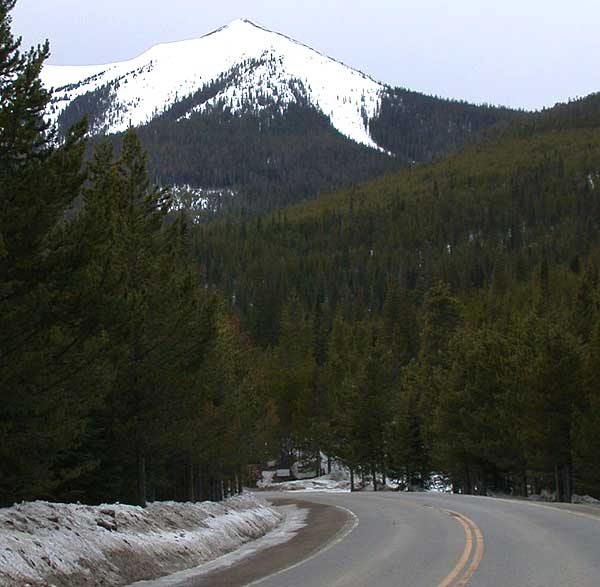
 Photo: cogdogblog, CC BY 2.0 (via Wikimedia Commons)
Parkview
~11 min drive
3.56-mile out-and-back trail in Colorado with 624 ft elevation gain.
Photo: cogdogblog, CC BY 2.0 (via Wikimedia Commons)PARKVIEW CREEK
~11 min drive
14.4-mile out-and-back trail at 9,839 ft elevation in Colorado
Arapaho Creek
~3 min drive
4.14-mile out-and-back trail in Colorado's Medicine Bow-Routt National Forest with 1,248 ft gain.
KAUFFMAN CREEK
~18 min drive
21.08-mile out-and-back trail in Colorado with 3,438 ft elevation gain and loss.
Wheatley Creek Cut Off
~24 min drive
0.64-mile out-and-back trail in Colorado with 316 ft elevation gain.
Photo: cogdogblog, CC BY 2.0 (via Wikimedia Commons)Willow Pass Trail
~12 min drive
1.84-mile out-and-back trail in Colorado with 373 ft elevation gain and loss.
Elk Mountain
~22 min drive
11.90-mile out-and-back trail in Colorado with 311 ft of elevation gain.
Paradise Creek
~14 min drive
5.16-mile out-and-back trail in Colorado's Medicine Bow-Routt National Forest with 1,161 ft gain.
LITTLE GRAVEL MOUNTAIN SPUR
~19 min drive
23.78-mile out-and-back trail in Colorado with 3,568 ft gain/loss.
 Photo: Thomas — CC BY-SA 2.0 (via Flickr)
Gilsonite Trail
~25 min drive
3.65-mile trail in Colorado with 800 ft of elevation gain.
Local operatorsoffering guided trips. You book directly with them — Roamze doesn’t take a cut.
Rancho Del Rio
Hiking business nearby (~39 mi away) — hasn't claimed their Roamze page yet
Alpine Lodge at Red Feather Lakes
Hiking business nearby (~44 mi away) — hasn't claimed their Roamze page yet
