Harlequin Lake Trail
At a glance
Harlequin Lake Trail is a short, easy out-and-back hike in Yellowstone National Park in Wyoming, managed by the National Park Service. The trail is about a mile long, with a total elevation gain of 118 feet, and it starts at the Harlequin Lake Trailhead. The route rises from a low point of about 6,798 feet to a high of about 6,927 feet. Summer is the most comfortable time to go. Typical averages from a nearby weather station show July highs around 80°F with lows near 39°F, while winter highs stay in the mid-20s. A fee is charged for the hike, and bikes are not allowed. The trail is open year-round, but expect cold conditions from November through April. Madison Junction is about 1.3 miles away, and the Purple Mountain Trail and Mount Haynes Fishing Platform are both within 2 miles. Firehole Canyon Swimming Area is about 2 miles off.
- round trip
- 1.0 mi
- climb
- 118 ft
- high point
- 6,927 ft
- route
- Out and back
- time
- About 30 minutes
- best months
- Late May–mid-Jul, early Aug–mid-Sep
Where it is: Yellowstone National Park
Near: West Yellowstone
Best weeks to go
Late May to mid-July and early August to mid-September are usually best for hiking here.
Typical highs of 62–80°F and lows of 30°F or warmer in those weeks.
Typical weather: NOAA 1991–2020 normals at W Yellowstone Gateway, MT, 10 mi away. Not a forecast.
Typical weather by monthBest time to visit Harlequin Lake Trail
Best months: June and August–September. Best months are the ones mostly made of the best weeks for hiking: typical temperatures in its comfortable range, few snowy days and not usually wet, judged with the same limits as our good-day forecasts.
Jan
27°
0°
Feb
31°
1°
Mar
40°
9°
Apr
48°
21°
May
59°
29°
Jun
68°
34°
Jul
80°
39°
Aug
78°
36°
Sep
68°
30°
Oct
51°
21°
Nov
36°
11°
Dec
26°
3°
Typical high / low (°F) and days with rain or snow, 1991–2020. Measured at W Yellowstone Gateway, MT, 10.1 mi away at 6,679 ft. This station doesn't record snowfall. Source: NOAA NCEI U.S. Climate Normals 1991–2020.
Been here? Tell people how it was.
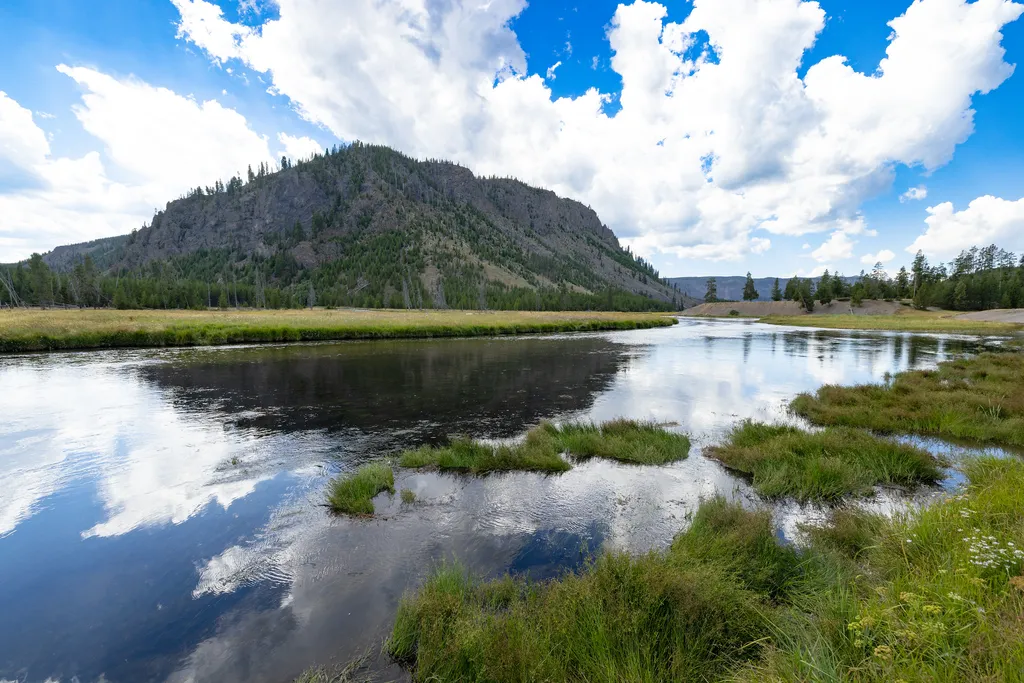 Madison JunctionHikingPhoto: NPS / public domain1.3 mi
- Purple Mountain TrailHiking1.6 mi
 Mount Haynes Fishing PlatformHikingPhoto: NPS / public domain1.8 mi
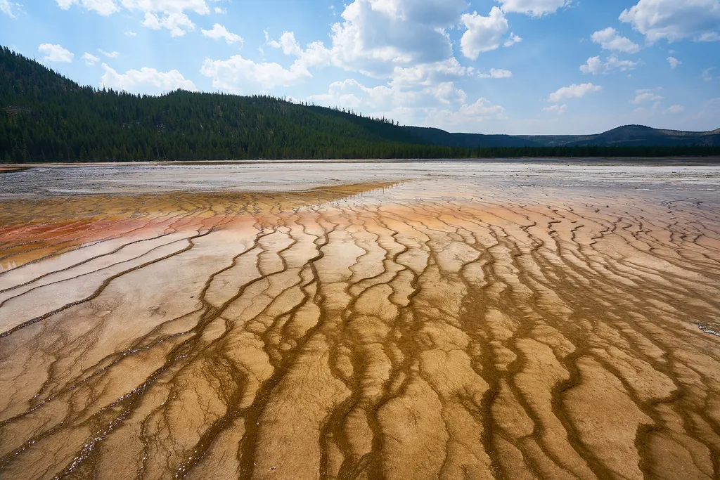 Firehole Canyon Swimming AreaHikingPhoto: Pedro Szekely from Los Angeles, USA — Wikimedia Commons (CC BY-SA 2.0)2 mi
- Cougar Cabin TrailHiking5.2 mi
 Imperial Meadows TrailHikingPhoto: R. Sieben, CC BY 3.0 (via Wikimedia Commons)5.6 mi
- Sentinel Meadows TrailHiking5.7 mi
- Cougar CreekCanoeing8.8 mi
- Madison JunctionHiking~2 min drive
- Imperial Meadows TrailHikingPhoto: R. Sieben, CC BY 3.0 (via Wikimedia Commons)~10 min drive
 Fairy Falls TrailHikingPhoto: Николай Максимович, CC BY 3.0 (via Wikimedia Commons)~15 min drive
 Fairy Creek TrailHikingPhoto: Domenico Salvagnin from Legnaro, Italy, CC BY 2.0 (via Wikimedia Commons)~18 min drive
- Mystic Falls TrailHikingPhoto: Domenico Salvagnin from Legnaro, Italy, CC BY 2.0 (via Wikimedia Commons)~18 min drive
- Firehole Canyon Swimming AreaHiking~4 min drive
 Fairy Falls TrailHikingPhoto: NASA's Earth Observatory, CC BY 2.0 (via Wikimedia Commons)~11 min drive
- MADISON ARM LOOP (SNOWMO)Hiking~18 min drive
- Monument Geyser Basin TrailHiking~12 min drive
- Red SpouterHiking~13 min drive
Also worth it near here
- Harlequin LakeLake fishingNext door
 National Park MountainSummitPhoto: Acroterion, CC BY-SA 4.0 (via Wikimedia Commons)~1 min drive
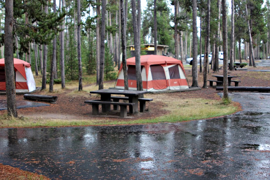 Madison CampgroundCampingPhoto: Yellowstone National Park from Yellowstone NP, USA, Public domain (via Wikimedia Commons)~2 min drive
 Gibbon FallsWaterfallPhoto: Daniel Mayer, CC BY-SA 3.0 (via Wikimedia Commons)~10 min drive
Conditions and forecast
Daily highs and lows, wind and the chance of precipitation at Start for the next 7 days, from the Open-Meteo model.
Ask about this place
Questions about Harlequin Lake Trail: conditions, access, timing. Answers say when something isn't known.
Map and trail data © OpenStreetMap contributors
