Trail Camp
Campground
1.3 mi from the trail
 Photo: Moo.The.Cow, CC BY 2.0 (via Flickr)
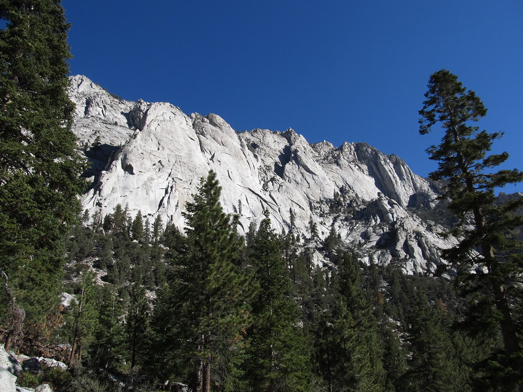
Mt. Whitney is a climbing area in California's John Muir Wilderness, within the Inyo National Forest. The land is managed by the Forest Service, and the surrounding peaks make it a natural base for exploring the high-country terrain of the area. The climbing here is alpine in style, with routes spread across the mountain's flanks. Ten routes are listed in total, and they range from about 5.5 to 5.11 on the YDS scale. The East Face was first climbed in 1931 by Underhill, Eichorn, Dawson and Clyde, and Hairline, a 5.10d, was first climbed by Bruce Bindner and Alex Schmauss in 1987. Left Wing Extremist, at 5.11, is the hardest of the listed routes. Mt. Russell lies less than a mile away, and Mt Carillon is about 1.3 miles off. The Mount Whitney hike is roughly 1.1 miles from the area, and Whitney Trailhead Walk In Campground is about 3 miles away for anyone planning to camp before a climb.
10 routes · 5.5 – 5.11 · Alpine
Where it is: John Muir Wilderness · Inyo National Forest
Near: Lone Pine
Been here? Tell people how it was.
 Mt. RussellRock climbingPhoto: Don Graham from Redlands, CA, USA - God bless it!, CC BY-SA 2.0 (via Wikimedia Commons)0.8 mi
 Mount WhitneyHikingPhoto: Ken Lund from Reno, Nevada, USA, CC BY-SA 2.0 (via Wikimedia Commons)1.1 mi
 Mt CarillonRock climbingPhoto: inkknife_2000 (7.5 million views +), CC BY-SA 2.0 (via Wikimedia Commons)1.3 mi
 Whitney & Surrounding PeaksRock climbingPhoto: GSEC, CC BY 2.0 (via Flickr)1.4 mi
 North Fork Lone Pine CreekHikingPhoto: Ken Lund — CC BY-SA 2.0 (via Flickr)2.4 mi
 Mount CarillonHikingPhoto: Seth Tisue, CC BY-SA 2.0 (via Flickr)2.9 mi
 Whitney Trailhead Walk In CampgroundCampingPhoto: Ken Lund — CC BY-SA 2.0 (via Flickr)3 miMt. RussellRock climbingPhoto: Don Graham from Redlands, CA, USA - God bless it!, CC BY-SA 2.0 (via Wikimedia Commons)~1 min driveMt CarillonRock climbingPhoto: inkknife_2000 (7.5 million views +), CC BY-SA 2.0 (via Wikimedia Commons)~2 min driveWhitney & Surrounding PeaksRock climbingPhoto: GSEC, CC BY 2.0 (via Flickr)~2 min drive
 The BeachRock climbingPhoto: GSEC, CC BY 2.0 (via Flickr)~4 min drive
 Whitney Portal ButtressRock climbingPhoto: Ken Lund, CC BY-SA 2.0 (via Flickr)~5 min driveWhitney PortalRock climbingPhoto: Ken Lund, CC BY-SA 2.0 (via Flickr)~6 min driveEl Segundo ButtressRock climbingPhoto: Ken Lund, CC BY-SA 2.0 (via Flickr)~6 min drive
 Premier ButtressRock climbingPhoto: GSEC, CC BY 2.0 (via Flickr)~6 min driveSolstice Celebration WallRock climbingPhoto: GSEC, CC BY 2.0 (via Flickr)~6 min driveRoadwork WallRock climbingPhoto: GSEC, CC BY 2.0 (via Flickr)~6 min drive
Also worth it near here
 Mount RussellSummitPhoto: Will Beback at en.wikipedia, CC BY-SA 3.0 (via Wikimedia Commons)~1 min driveMount WhitneyHikingPhoto: Ken Lund from Reno, Nevada, USA, CC BY-SA 2.0 (via Wikimedia Commons)~2 min driveWhitney Trailhead Walk In CampgroundCampingPhoto: Ken Lund — CC BY-SA 2.0 (via Flickr)~5 min drive
Daily highs and lows, wind and the chance of precipitation at Mt. Whitney for the next 7 days, from the Open-Meteo model.
Questions about Mt. Whitney: conditions, access, timing. Answers say when something isn't known.
Trail Camp
Campground
Whitney Portal Store
Restaurant
Kern Hot Spring
Hot spring
Places © OpenStreetMap contributors
More in Silver City