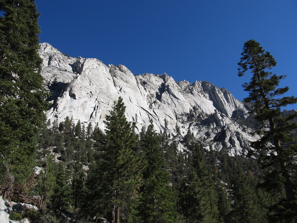
Whitney & Surrounding Peaks
Whitney & Surrounding Peaks has 48 climbing routes in California.
 Photo: GSEC, CC BY 2.0 (via Flickr)
- 48 routes
- 5.4 – 5.12-
- Alpine · Bouldering
Is Whitney & Surrounding Peaks open right now?
Alert in the area
The Forest Service lists 4 alerts for Inyo National Forest.
Stage 1 Fire Restrictions in Effect
Agency alert covering Inyo National Forest · Order 05-04-50-26-23 · USFS · Inyo National Forest
Help Halt Golden Mussel Invasion
Agency alert covering Inyo National Forest · USFS · Inyo National Forest
Ansel Adams and John Muir Wilderness Campfire Restrictions
Agency alert covering Inyo National Forest · Order 05-04-50-25-04 · USFS · Inyo National Forest
Golden Trout and Hoover Wilderness Campfire Restrictions
Agency alert covering Inyo National Forest · Order 05-04-50-25-05 · USFS · Inyo National Forest
As of · Source: USFS · Inyo National Forest. Agencies don't list every closure — check before you go.
Whitney & Surrounding Peaks is a climbing area in California's John Muir Wilderness, within the Mt. Whitney Ranger District of Inyo National Forest. The Forest Service manages the land, and the area sits about 1.4 miles from the Mt. Whitney climbing area and 1.7 miles from the North Fork Lone Pine Creek hike. The climbing here is alpine, with 48 routes in total, and the grade range runs from 5.4 to 5.12 on the YDS scale. The Diagonal Route is a 5.7, and Blood of the Monkey is the hardest at 5.12. Three boulder problems round out the mix. The Beach and Mt Carillon are other climbing areas within about 2 miles. For a base, Whitney Trailhead Walk In Campground is about 2.2 miles away, and Lone Pine Group Campground is about 2.5 miles away.
Routes (48)
Aiguille Extra(1)
Aiguille Junior (pk 14000+)(1)
Cirque Peak(1)
Cleaver, The(1)
Day Needle (aka Crooks Peak)(2)
Impala, The(3)
Keeler Needle(3)
Killer Pillar(1)
Lower Boy Scout Lake Boulders(3)
Mt Carl Heller and Tulainyo Tower(3)
Mt. Barnard East Peak (aka Peak 13,680 +)(2)
Mt. Chamberlin(3)
Mt. Irvine(1)
Peak 3986(2)
Pinnacle Ridge(3)
Springbok, The(2)
Thor Peak(2)
Tuttle Obelisk(1)
Upper Boy Scout Lake(1)
Keep exploring — more climbs worth the drive
 Photo: Moo.The.Cow, CC BY 2.0 (via Flickr)
Mt. Whitney
~2 min drive
Mt. Whitney in California has 10 climbing routes with 8 difficulty grades.
 Photo: inkknife_2000 (7.5 million views +), CC BY-SA 2.0 (via Wikimedia Commons)
Mt Carillon
~3 min drive
Mt Carillon in California has 6 climbing routes with 5 difficulty grades.
 Photo: GSEC, CC BY 2.0 (via Flickr)
The Beach
~3 min drive
The Beach in California has 16 trad climbing routes across 7 grades.
 Photo: Don Graham from Redlands, CA, USA - God bless it!, CC BY-SA 2.0 (via Wikimedia Commons)
Mt. Russell
~3 min drive
Mt. Russell is a climbing area in California with 9 routes.
 Photo: Ken Lund, CC BY-SA 2.0 (via Flickr)
Whitney Portal Buttress
~4 min drive
Whitney Portal Buttress in California has 8 mixed and trad climbing routes across 5 grades.
Photo: Ken Lund, CC BY-SA 2.0 (via Flickr)Whitney Portal
~4 min drive
Whitney Portal in California has 15 climbing routes across 11 difficulty grades.
 Photo: jfdervin, CC BY-SA 2.0 (via Flickr)
Lone Pine Peak
~4 min drive
Lone Pine Peak in California has 8 climbing routes with 5 difficulty grades.
Photo: Ken Lund, CC BY-SA 2.0 (via Flickr)El Segundo Buttress
~5 min drive
El Segundo Buttress in California has 8 climbing routes across 6 grades, offering sport and trad options.
 Photo: GSEC, CC BY 2.0 (via Flickr)
Solstice Celebration Wall
~5 min drive
Solstice Celebration Wall is a California climbing crag with 5 trad routes.
Photo: GSEC, CC BY 2.0 (via Flickr)Roadwork Wall
~5 min drive
Roadwork Wall in California has 10 climbing routes across 6 grades, offering sport and trad styles.