Mount Harwood
At a glance
Mount Harwood is a summit of 9,543 feet in the San Gabriel Mountains National Monument Ranger District of Angeles National Forest, about 4 miles from the town of Wrightwood, California. The Baldy Bowl Trail and the Rock Garden climbing area both sit about half a mile away, and Register Ridge is about a mile off. For an overnight base, Manker Flat campground is about 1.5 miles away.
- summit
- 9,543 ft
Where it is: San Gabriel Mountains National Monument Ranger District · Angeles National Forest
Near: Rancho Cucamonga
Been here? Tell people how it was.
We don't know of a mapped trail or route to the summit of Mount Harwood. Plan the approach with local maps, a guidebook or a local guide, and check conditions before you go.
- Mount San Antonio10,067 ft · California4 routes0.7 mi away
- Thunder Mountain8,565 ft · California1 route2.1 mi away
- Telegraph Peak8,980 ft · California2 routes2.6 mi away
- Ontario Peak8,694 ft · California1 route4.1 mi away
- Bighorn Peak8,441 ft · California1 route4.2 mi away
 Iron Mountain8,009 ft · California1 route4.6 mi awayPhoto: Self, CC BY 3.0 (via Wikimedia Commons)
 Baldy Bowl TrailHikingPhoto: feverblue, CC BY-SA 2.0 (via Flickr)0.5 mi
- Other RoutesRock climbing0.5 mi
- Rock GardenRock climbing0.5 mi
- Mount San Antonio (Mt. Baldy)Rock climbing0.8 mi
 Register RidgeHikingPhoto: inkknife_2000 (7.5 million views +), CC BY-SA 2.0 (via Wikimedia Commons)1.2 mi
- Manker FlatCamping1.5 mi
- LupineCamping3.5 mi
- Lytle Creek - Cajon Pass Recreation AreaRiver fishing9.5 mi
- Iron MountainSummitPhoto: Self, CC BY 3.0 (via Wikimedia Commons)~8 min drive
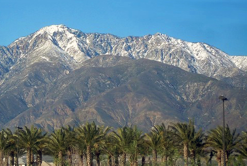 Cucamonga PeakSummitPhoto: Cliff Hutson; later cropping and color editing by Daniel Case., CC BY 2.0 (via Wikimedia Commons)~9 min drive
 Mount IslipSummitPhoto: Eeekster, CC BY 3.0 (via Wikimedia Commons)~21 min drive
 Mount JurupaSummitPhoto: Scottthezombie, CC BY-SA 4.0 (via Wikimedia Commons)~35 min drive
 Mount RubidouxSummitPhoto: No machine-readable author provided. Takwish assumed (based on copyright claims)., CC BY-SA 2.5 (via Wikimedia Commons)~43 min drive
 Timber MountainSummitPhoto: Mitch Barrie (simonov), CC BY-SA 2.0 (via Wikimedia Commons)~6 min drive
 Mount Baden-PowellSummitPhoto: The original uploader was Jakerome at English Wikipedia./ Simonov, CC BY-SA 2.0 (via Wikimedia Commons)~15 min drive
 Mount BurnhamSummitPhoto: Ctatkinson, Public domain (via Wikimedia Commons)~17 min drive
 Throop PeakSummitPhoto: Eeekster, CC BY 3.0 (via Wikimedia Commons)~18 min drive
 Slover MountainSummitPhoto: Unknown authorUnknown author, Public domain (via Wikimedia Commons)~39 min drive
Also worth it near here
- Baldy Bowl TrailHikingPhoto: feverblue, CC BY-SA 2.0 (via Flickr)Next door
- Rock GardenRock climbingNext door
 Chapman TrailMountain bikingPhoto: Bri Weldon, CC BY 2.0 (via Wikimedia Commons)~4 min drive
 Mountain HighDownhill skiingPhoto: Mtf612 at English Wikipedia, Public domain (via Wikimedia Commons)~11 min drive
Conditions and forecast
Daily highs and lows, wind and the chance of precipitation at the summit for the next 7 days, from the Open-Meteo model.
Questions about Mount Harwood
How tall is Mount Harwood?
9,543 ft (2,909 m).
Is there a trail to the top of Mount Harwood?
We don't know of a mapped trail or route to the summit. Plan the approach with local maps, a guidebook or a local guide.
Ask about this place
Questions about Mount Harwood: conditions, access, timing. Answers say when something isn't known.
