Lake Fork Mesa
At a glance
Lake Fork Mesa is an easy out-and-back hike in the Jemez Ranger District of Santa Fe National Forest in northern New Mexico. The trail is about 3.5 miles long, with a total elevation gain of 915 feet, and the high point sits at 8,435 feet. The route starts near 8,158 feet and ends at the same elevation, so it works as a short loop. The Forest Service manages the land. The most comfortable time to go is late spring or early fall. Typical averages from the Wolf Canyon weather station, about 6.6 miles away at a similar elevation, show May highs around 65°F and October highs near 59°F. Summer brings more wet days, with about 12 to 13 in July and August. The Lake Fork Mesa Loop is about 0.6 miles away. The Horseshoe Springs Trail is about 2.1 miles off, and San Antonio and Redondo campgrounds are both within 3.5 miles.
- round trip
- 1.7 mi
- climb
- 915 ft
- high point
- 8,435 ft
- route
- Out and back
- time
- About 1 hour
- best months
- May–Jul, Sep
Where it is: Jemez Ranger District · Santa Fe National Forest
Near: Los Alamos
Best time to visit LAKE FORK MESA
Best months: May–July and September. Best months have typical highs of 55–85 °F, lows of 30 °F or warmer (32 °F where the station doesn't record snow), at most one snowy day and no more than 12 wet days.
Jan
38°
9°
7 wet · 7 snow
Feb
40°
13°
6 wet · 6 snow
Mar
48°
19°
6 wet · 5 snow
Apr
56°
24°
5 wet · 3 snow
May
65°
30°
5 wet · 1 snow
Jun
75°
37°
5 wet
Jul
77°
44°
12 wet
Aug
75°
43°
13 wet
Sep
69°
36°
8 wet
Oct
59°
27°
6 wet · 1 snow
Nov
47°
18°
5 wet · 4 snow
Dec
38°
10°
7 wet · 7 snow
Typical high / low (°F) and days with rain or snow, 1991–2020. Measured at Wolf Canyon, NM, 6.6 mi away at 8,220 ft. Source: NOAA NCEI U.S. Climate Normals 1991–2020.
Been here? Tell people how it was.
 LAKE FORK MESA LOOPHikingPhoto: cogdogblog, CC0 (via Wikimedia Commons)0.6 mi
- Horseshoe Springs TrailHikingPhoto: cogdogblog, CC0 (via Wikimedia Commons)2.1 mi
- San AntonioCamping2.7 mi
- RedondoCamping3.4 mi
 Jemez Cave (a.k.a. Crystal Cave) - CLOSEDRock climbingPhoto: RuggyBearLA, CC BY 2.0 (via Flickr)5.1 mi
- Jemez Mountains and Jemez ValleyRock climbing5.3 mi
- Rio de las VacasCanoeing8.8 mi
 Rio GuadalupeCanoeingPhoto: John Fowler from Placitas, NM, USA, CC BY 2.0 (via Wikimedia Commons)9.5 mi
- LAKE FORK MESA LOOPHikingPhoto: cogdogblog, CC0 (via Wikimedia Commons)~1 min drive
 East ForkHikingPhoto: RuggyBearLA, CC BY 2.0 (via Flickr)~6 min drive
 Monastery TrailHikingPhoto: RuggyBearLA, CC BY-SA 2.0 (via Flickr)~10 min drive
- Saddle ShedHiking~16 min drive
- Backcountry Driving RouteHiking~15 min drive
- Horseshoe Springs TrailHikingPhoto: cogdogblog, CC0 (via Wikimedia Commons)~4 min drive
- Rio CebollaHiking~8 min drive
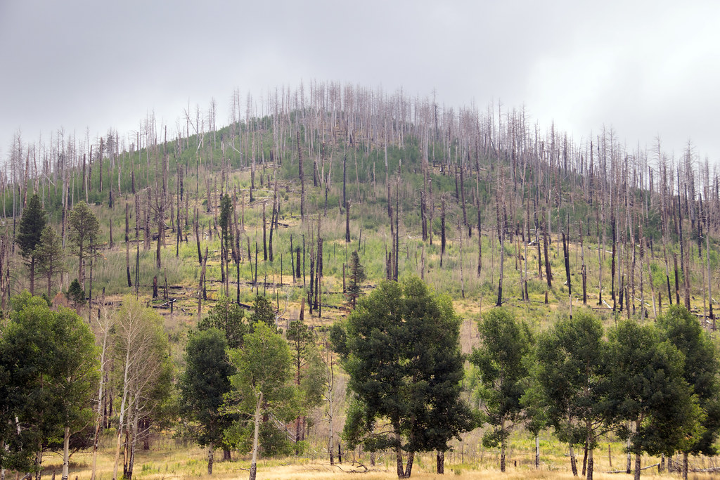 Coyote Call TrailHikingPhoto: Paul and Jill, CC BY 2.0 (via Flickr)~21 min drive
- Cerro La Jara Stop 6Hiking~18 min drive
- Abrigo TrailHiking~20 min drive
Conditions and forecast
Caution todayAgency alerts are in effect for this areaUSFS · checked 20 min agoDaily highs and lows, wind and the chance of precipitation at Start for the next 7 days, from the Open-Meteo model.

Ask about this place
Questions about Lake Fork Mesa: conditions, access, timing. Answers say when something isn't known.
