
Belle Fourche Campground
Campground
0.7 mi from the trail
 Photo: Ealdgyth, CC BY 3.0 (via Wikimedia Commons)
Devils Tower is a summit of 5,110 feet in Devils Tower National Monument in northeastern Wyoming, managed by the National Park Service. The nearest town is Hulett, about 9 miles away. Summer is the most comfortable time to visit. Typical averages from a nearby weather station show July and August highs around 85°F with lows in the mid-50s, while winter brings highs in the mid-30s and regular snow days. Several climbing areas and trails start right around the tower. The Durrance Approach, West Face and South and East Faces climbing areas are all about 0.1 mile away, and the Tower Trail is about 0.2 mile off.
Where it is: Devils Tower National Monument
Near: Sundance
Best months: May–October. Best months have typical highs of 55–85 °F, lows of 30 °F or warmer (32 °F where the station doesn't record snow), at most one snowy day and no more than 12 wet days.
Jan
34°
8°
8 wet · 7 snow
Feb
37°
11°
7 wet · 6 snow
Mar
47°
21°
7 wet · 5 snow
Apr
57°
29°
9 wet · 2 snow
May
66°
39°
11 wet
Jun
76°
49°
11 wet
Jul
85°
55°
9 wet
Aug
85°
52°
7 wet
Sep
75°
42°
6 wet
Oct
60°
30°
7 wet · 1 snow
Nov
45°
19°
6 wet · 4 snow
Dec
35°
9°
6 wet · 6 snow
Typical high / low (°F) and days with rain or snow, 1991–2020. Measured at Devils Twr #2, WY, 0.5 mi away at 3,862 ft. The station sits about 1,200 ft lower than this place, so expect it a little cooler here. Source: NOAA NCEI U.S. Climate Normals 1991–2020.
Been here? Tell people how it was.
We don't know of a mapped trail or route to the summit of Devils Tower. Plan the approach with local maps, a guidebook or a local guide, and check conditions before you go.


 Durrance ApproachRock climbingPhoto: w_lemay, CC BY-SA 2.0 (via Flickr)0.1 miWest FaceRock climbingPhoto: w_lemay, CC BY-SA 2.0 (via Flickr)0.1 mi
 South and East FacesRock climbingPhoto: w_lemay, CC BY-SA 2.0 (via Flickr)0.1 miEast and Northeast Buttress ApproachRock climbingPhoto: w_lemay, CC BY-SA 2.0 (via Flickr)0.1 mi
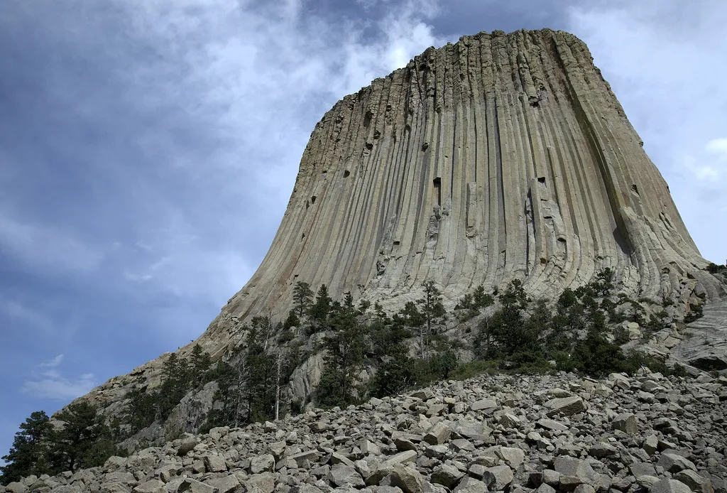 Devils Tower Boulder FieldHikingPhoto: Jim Bowen — Wikimedia Commons (CC BY 3.0)0.1 mi
 Missouri ButtesSummitPhoto: John Grabill, Public domain (via Wikimedia Commons)~6 min drive
 Sundance MountainSummitPhoto: James St. John, CC BY 2.0 (via Wikimedia Commons)~37 min drive
 Inyan Kara MountainSummitPhoto: User:Runner1928, CC0 (via Wikimedia Commons)~54 min drive
 Rawhide ButteSummitPhoto: Mr. Satterly, CC0 (via Wikimedia Commons)~1h 14m driveMount Theodore RooseveltSummitPhoto: U.S. Department of Agriculture, CC BY 2.0 (via Wikimedia Commons)~1h 24m drive
Daily highs and lows, wind and the chance of precipitation at the summit for the next 7 days, from the Open-Meteo model.
5,110 ft (1,558 m).
We don't know of a mapped trail or route to the summit. Plan the approach with local maps, a guidebook or a local guide.
Questions about Devils Tower: conditions, access, timing. Answers say when something isn't known.
Belle Fourche Campground
Campground
Places © OpenStreetMap contributors, Places © Overture Maps Foundation
More in Sundance