Bell
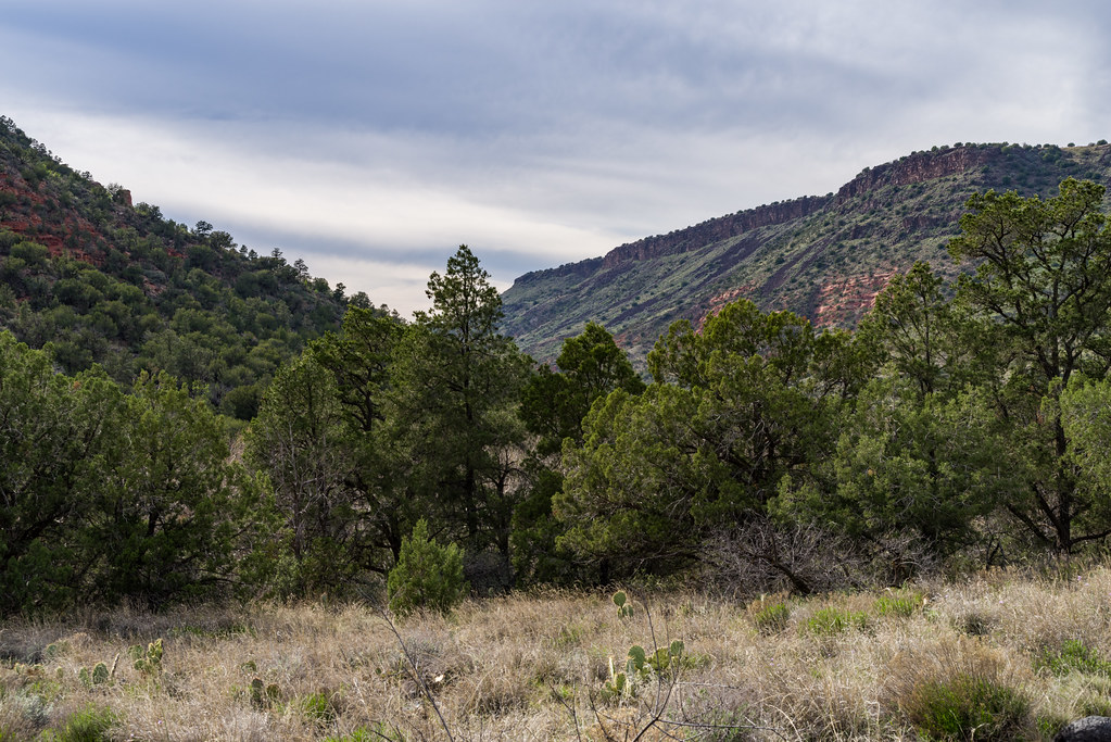
 Photo: Coconino National Forest, CC0 (via Wikimedia Commons)
At a glance
Bell is a mountain biking route in the Red Rock Ranger District of Coconino National Forest in Arizona, managed by the Forest Service. The ride covers about 2.3 miles, climbing from a low point of 4,051 feet to a high of 4,837 feet, with a total gain of 925 feet. The steepest stretch comes at about 1.4 miles in, where the grade reaches 26 percent. Spring and fall are the most comfortable times to ride. Typical averages from a nearby weather station in Sedona show October highs around 79°F with lows near 51°F, and April highs around 75°F. That station sits about 600 feet lower than the route's high point, so temperatures on the climb run a little cooler. The route sits close to several other outings. The Weir hike is about 0.2 miles away, and the Apache Maid mountain biking route is about 0.3 miles off. White Mesa is a hike about 0.4 miles away, and the Wet Beaver Crack climbing area is about 1.1 miles away.
- distance
- 2.3 mi
- climb
- 925 ft
- time
- About 2.5 hours
- best months
- Oct–May
Where it is: Red Rock Ranger District · Coconino National Forest
Near: Camp Verde
Best time to visit Bell
Best months: October–May. Best months have typical highs of 55–85 °F, lows of 30 °F or warmer (32 °F where the station doesn't record snow), at most one snowy day and no more than 12 wet days.
Jan
58°
34°
5 wet
Feb
61°
36°
6 wet
Mar
67°
40°
6 wet
Apr
75°
44°
3 wet
May
84°
53°
3 wet
Jun
94°
61°
2 wet
Jul
97°
68°
6 wet
Aug
94°
67°
9 wet
Sep
89°
61°
5 wet
Oct
79°
51°
3 wet
Nov
67°
41°
4 wet
Dec
58°
33°
4 wet
Typical high / low (°F) and days with rain or snow, 1991–2020. Measured at Sedona, AZ, 15.8 mi away at 4,220 ft. The station sits about 600 ft lower than this place, so expect it a little cooler here. This station doesn't record snowfall. Source: NOAA NCEI U.S. Climate Normals 1991–2020.
Been here? Tell people how it was.
 WeirHikingPhoto: Coconino NF Photography, Public Domain Dedication (CC0) (via Flickr)0.2 mi
- Apache MaidMountain bikingPhoto: Coconino National Forest, CC0 (via Wikimedia Commons)0.3 mi
 White MesaHikingPhoto: Coconino NF Photography, Public Domain Dedication (CC0) (via Flickr)0.4 mi
 Wet Beaver CrackRock climbingPhoto: Coconino National Forest, CC0 (via Wikimedia Commons)1.1 mi
- Wet Beaver CreekCanoeing2.8 mi
- Dry Beaver CreekCanoeing6.4 mi
 Oak Creek SpireRock climbingPhoto: Coconino National Forest, CC BY-SA 2.0 (via Wikimedia Commons)9 mi
- Tempeh WallRock climbing9.3 mi
 WeirMountain bikingPhoto: Coconino National Forest, CC0 (via Wikimedia Commons)Next door
- Hot LoopMountain biking~12 min drive
- Big Park LoopMountain biking~17 min drive
- Bell Rock PathwayMountain biking~17 min drive
 Bell Trail #13Mountain bikingPhoto: Coconino National Forest, CC0 (via Wikimedia Commons)~1 min drive
- Hot LoopMountain biking~13 min drive
- Big Park LoopMountain biking~17 min drive
- Bell Rock PathwayMountain biking~18 min drive
- Apache MaidMountain bikingPhoto: Coconino National Forest, CC0 (via Wikimedia Commons)~1 min drive
- Hot LoopMountain biking~13 min drive
Conditions and forecast
Caution todayAgency alerts are in effect for this areaUSFS · checked 18 min agoDaily highs and lows, wind and the chance of precipitation at Start for the next 7 days, from the Open-Meteo model.
Ask about this place
Questions about Bell: conditions, access, timing. Answers say when something isn't known.
Local outfitters
- Rancho Sedona RV Park14 mi away
- Village Camp41 mi away
Not on Roamze yet. Their page has how to reach them.
Map and trail data © OpenStreetMap contributors
