Wet Beaver Creek
- 20.9 mi
- distance
- 6,357 ft
- high point
- May–Jul, Sep
- best months
Is Wet Beaver Creek open right now?
Closure in the area
There's a closure order in Red Rock Ranger District. It doesn't name Wet Beaver Creek, so check the source for the area it covers (3 listed).
Beaver Creek Picnic Site temporarily closed
Agency closure covering Red Rock Ranger District · Order 03-04-06-26-05 · USFS · Red Rock Ranger District
Red Rock Ranger District affected by severe flooding; many closures in effect
Agency closure covering Red Rock Ranger District · USFS · Red Rock Ranger District
Banjo Bill Picnic Area Closure
Agency closure covering Red Rock Ranger District · Order 03-04-06-25-01 · USFS · Red Rock Ranger District
West Fork Temporary Area Closure - Extension to 2/27/27
Agency alert covering Coconino National Forest · Order 03-04-00-26-09 · USFS · Coconino National Forest
West Sedona Camping and Campfire Restrictions
Agency alert covering Red Rock Ranger District · Order 03-04-06-26-04 · USFS · Red Rock Ranger District
As of · Source: USFS · Red Rock Ranger District. Agencies don't list every closure — check before you go.
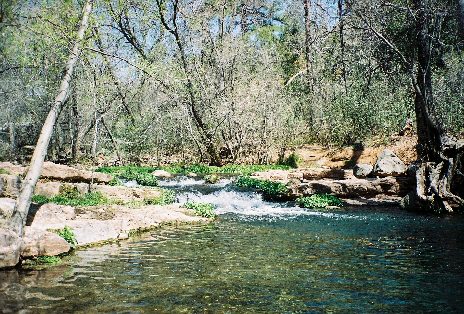
Wet Beaver Creek is a canoeing route in the Wet Beaver Wilderness, part of the Red Rock Ranger District of Coconino National Forest in northern Arizona. The Forest Service manages the surrounding land, and the creek lies within designated wilderness. For paddlers, the most comfortable stretch is late spring and early fall. Typical averages from a nearby weather station run highs around 69°F in May and 76°F in September, with summer bringing more frequent wet days, peaking at 13 in August. Several other outings sit close by. The Bell hike is about a mile away, and Wet Beaver Crack, a climbing area, is under 2 miles off. For another paddling option, West Clear Creek and Dry Beaver Creek are each roughly 9 miles away.
Local outfitters
- Verde Ranch RV Resort16 mi away
- Fort Tuthill Luke AFB Recreation Area32 mi away
Not on Roamze yet. Their page has how to reach them.
 BellHikingPhoto: Coconino NF Photography, Public Domain Dedication (CC0) (via Flickr)1.2 mi
 Wet Beaver CrackRock climbingPhoto: Coconino National Forest, CC0 (via Wikimedia Commons)1.8 mi
 Apache Maid SpurHikingPhoto: Coconino NF Photography, Public Domain Dedication (CC0) (via Flickr)2.1 mi
 Apache MaidHikingPhoto: Coconino NF Photography, Public Domain Dedication (CC0) (via Flickr)2.3 mi
 WeirMountain bikingPhoto: Coconino National Forest, CC0 (via Wikimedia Commons)2.4 mi
 Bell Trail #13Mountain bikingPhoto: Coconino National Forest, CC0 (via Wikimedia Commons)2.5 mi
- West Clear CreekCanoeing9 mi
- Dry Beaver CreekCanoeing9.3 mi
Source: Roamze catalog (indexable pages within 10 miles, PostGIS distance)
 Fossil CreekCanoeing · ~34 min drivePhoto: Gonzo fan2007, CC BY-SA 3.0 (via Wikimedia Commons)
- Kinnikinick Lake Boating SiteBoat launch · ~41 min drive
 Verde RiverCanoeing · ~50 min drivePhoto: Jennifer Horn, Public domain (via Wikimedia Commons)
- Ashurst Lake Boat LaunchBoat launch · ~46 min drive
 East Verde RiverCanoeing · ~50 min drivePhoto: Richard N Horne, CC BY-SA 4.0 (via Wikimedia Commons)
- Lake Mary Narrows Boat Launch and Picnic AreaBoat launch · ~48 min drive
 Walnut CreekCanoeing · ~58 min drivePhoto: Llrice1240, CC BY-SA 3.0 (via Wikimedia Commons)
- Narrows Boat RampBoat launch · ~48 min drive
 Tonto CreekCanoeing · ~1h 21m drivePhoto: Richard N Horne, CC BY-SA 4.0 (via Wikimedia Commons)
- Knoll Lake Boating SiteBoat launch · ~1h drive
Best time to visit Wet Beaver Creek
Best months: May–July and September. Best months have typical highs of 55–85 °F, lows of 30 °F or warmer (32 °F where the station doesn't record snow), at most one snowy day and no more than 12 wet days.
Jan
46° / 17°
7 wet
Feb
47° / 19°
7 wet
Mar
53° / 23°
7 wet
Apr
60° / 27°
4 wet
May
69° / 34°
3 wet
Jun
79° / 40°
3 wet
Jul
83° / 49°
9 wet
Aug
81° / 50°
13 wet
Sep
76° / 41°
8 wet
Oct
66° / 31°
5 wet
Nov
54° / 22°
5 wet
Dec
46° / 16°
7 wet
Typical high / low (°F) and days with rain or snow, 1991–2020. Measured at Mund'S Park, AZ, 18.1 mi away at 6,470 ft. This station doesn't record snowfall. Source: NOAA NCEI U.S. Climate Normals 1991–2020.
