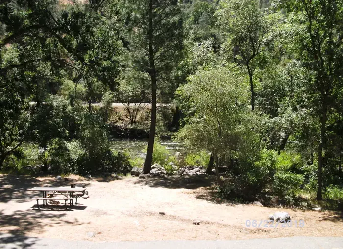
McCabe Flat Campground
Campground
Campground · 2.1 mi from the trail
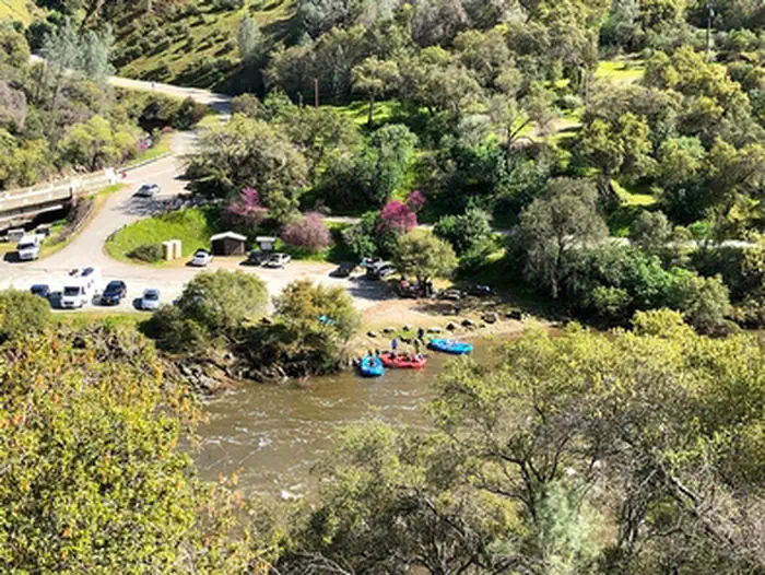
Remember your OUTDOOR ETHICS when enjoying your public lands. Please RECREATE RESPONSIBLY. OverviewAt the entrance to the BLM, Merced River Recreation Management Area (RMA) is the Briceburg Put-In. This Day-Use Area and Boat Launch is located 12 miles east of Mariposa where Highway 140 meets the Wild & Scenic Merced River. Just below the Briceburg Visitor Center is a parking area, restrooms, picnic area, and boat launch for whitewater river access. This gravel parking area serves as a meeting place for river trips, and a rest stop for Yosemite motorists. There is a great view of the Briceburg Suspension Bridge which was installed in 1926 and provides access to the north side of the Merced River and the BLM campgrounds downstream. Popular activities here are gold panning/prospecting, fishing, picnicking, rafting take-out or put-in. It is a good place to meet and carpool downstream to other swimming holes in the BLM, Merced River RMA. Facilities: This site has a picnic table, raised barbeque grill, vault toilet, information kiosk, trash and recycling containers. What You Need To Know:Camping and campfires are not allowed anytime. Charcoal BBQ's are allowed in the provided raised metal grill during winter and spring until fire restrictions go into effect. It is best to bring your own propane BBQ or stove for cooking any time of year. Pay Attention: No lifeguard on duty. Swimming is dangerous any time of year, but especially during spring and early summer. The Merced River is un-damned and the flow changes dramatically from year to year and season to season. Please wear a life jacket. SWIMMING IS ONLY RECOMMENDED BELOW 700 CFS. Helpful Links: River flow is posted on-line at: www.dreamflows.com Back To: Merced River Recreation Management Area Visit: Briceburg Visitor Center Return To: BLM, Mother Lode Field Office
McCabe Flat Campground
Campground
Canyon Bar & Grill
Restaurant
Roosevelt Point
Viewpoint
Scenic viewpoint in Yosemite National Park
Places © OpenStreetMap contributors
More in Yosemite Valley Jenkins HillHikingPhoto: stevelyon, CC BY-SA 2.0 (via Flickr)4.4 mi
 Hite CoveHikingPhoto: Ken Lund, CC BY-SA 2.0 (via Flickr)5.5 mi
 Dirt FlatCampingPhoto: Recreation.gov (RIDB) / public domain8.2 mi
Source: Roamze catalog (indexable pages within 10 miles, PostGIS distance)
Best months: October–June. Best months have typical highs of 55–85 °F, lows of 30 °F or warmer (32 °F where the station doesn't record snow), at most one snowy day and no more than 12 wet days.
Jan
56° / 33°
10 wet
Feb
58° / 34°
10 wet
Mar
62° / 37°
10 wet
Apr
67° / 40°
6 wet
May
76° / 45°
4 wet
Jun
85° / 51°
1 wet
Jul
93° / 57°
0 wet
Aug
92° / 56°
0 wet
Sep
87° / 51°
1 wet
Oct
76° / 43°
4 wet
Nov
63° / 36°
7 wet
Dec
55° / 32°
10 wet
Typical high / low (°F) and days with rain or snow, 1991–2020. Measured at Sonora, CA, 34 mi away at 1,675 ft. The station sits about 500 ft higher than this place, so expect it a little warmer here. Source: NOAA NCEI U.S. Climate Normals 1991–2020.