Montgomery Gulch
Campground
Campground · 3.4 mi from the trail
Caution today
Agency alerts are in effect for this area; weather is good · USFS, OpenWeather · checked 7 h ago
Closure in the area
There's a closure order in Stanislaus National Forest. It doesn't name Texas Hill Mine, so check the source for the area it covers (2 listed).
Stanislaus National Forest extends seasonal MVUM closure for two high elevation roads
Agency closure covering Stanislaus National Forest · USFS · Stanislaus National Forest
Extension of Seasonal Road Closures
Agency closure covering Stanislaus National Forest · USFS · Stanislaus National Forest
As of · Source: USFS · Stanislaus National Forest. Agencies don't list every closure — check before you go.
Texas Hill Mine is a 3.9-mile out-and-back hike in the Groveland Ranger District of Stanislaus National Forest in California. It rises from a low point of 2,522 feet to a high of 3,200 feet, with an elevation gain of 675 feet, and is rated moderate. The trail is on natural surface, and it is open to both horses and bikes, according to Forest Service records. It lies within Stanislaus National Forest, and the Forest Service manages the land. The most comfortable months for a visit are typically May and September, when typical averages from a nearby weather station in Groveland run to highs around 73°F and 85°F with only a few wet days. That station sits about 400 feet below the trail's high point, so expect temperatures on the summit to run a bit cooler. The hike is open year-round. Other options close by include the Bandarita H2o Tanks hike about 1.3 miles away and the North Fork Merced River, a canoeing route about 1.5 miles away. Paddlers can also head to Bull Creek, about 4.7 miles off, and the Jenkins Hill hike is about 4.1 miles away.
Montgomery Gulch
Campground
Canyon Bar & Grill
Restaurant
Roosevelt Point
Viewpoint
Scenic viewpoint in Yosemite National Park
Places © OpenStreetMap contributors
More in Yosemite Valley Jenkins HillHikingPhoto: stevelyon, CC BY-SA 2.0 (via Flickr)4.1 mi
Source: Roamze catalog (indexable pages within 10 miles, PostGIS distance)
 Hite CoveHiking · ~12 min drivePhoto: Ken Lund, CC BY-SA 2.0 (via Flickr)
 Pilot RidgeHiking · ~15 min drivePhoto: paulinkenbrandt, CC BY-SA 2.0 (via Flickr)
 Railroad, South Fork TuolumneHiking · ~16 min drivePhoto: Eeekster, CC BY 3.0 (via Wikimedia Commons)
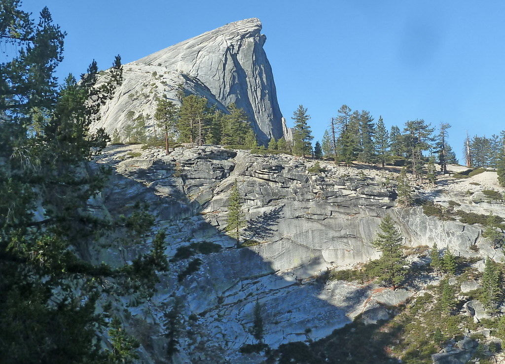 Pinoch RidgeHiking · ~17 min drivePhoto: scorpio-tiger, CC BY-SA 2.0 (via Flickr)
 L.G.C.F. Falls Interperative THiking · ~17 min drivePhoto: stevelyon, CC BY-SA 2.0 (via Flickr)Golden Forest Interp. TrailHiking · ~18 min drivePhoto: stevelyon, CC BY-SA 2.0 (via Flickr)
 Moss Canyon Truck TrailHiking · ~17 min drivePhoto: epredator, CC BY 2.0 (via Flickr)Golden Stairs to Cherry Oil RdHiking · ~18 min drivePhoto: Eeekster, CC BY 3.0 (via Wikimedia Commons)Jenkins HillHiking · ~7 min drivePhoto: stevelyon, CC BY-SA 2.0 (via Flickr)
 Tuolumne CanyonHiking · ~19 min drivePhoto: Nerds For Nature, CC BY-SA 2.0 (via Flickr)
Best months: February–June and September–November. Best months have typical highs of 55–85 °F, lows of 30 °F or warmer (32 °F where the station doesn't record snow), at most one snowy day and no more than 12 wet days.
Jan
53° / 31°
10 wet
Feb
55° / 32°
9 wet
Mar
60° / 35°
10 wet
Apr
65° / 38°
7 wet
May
73° / 44°
4 wet
Jun
83° / 51°
1 wet
Jul
91° / 56°
0 wet
Aug
91° / 55°
1 wet
Sep
85° / 50°
2 wet
Oct
74° / 42°
4 wet
Nov
60° / 35°
8 wet
Dec
52° / 31°
10 wet
Typical high / low (°F) and days with rain or snow, 1991–2020. Measured at Groveland 2, CA, 16 mi away at 2,800 ft. This station doesn't record snowfall. Source: NOAA NCEI U.S. Climate Normals 1991–2020.
