Big M
- Mar–Jun, Sep–Nov
- best months
Caution today
Agency alerts are in effect for this area; weather is good · USFS, OpenWeather · checked 9 h ago
Is Big M open right now?
Alert in the area
The Forest Service lists 12 alerts for Mark Twain National Forest.
Crane Lake Dam
Agency alert covering Mark Twain National Forest · USFS · Mark Twain National Forest
Delays on Forest Road 557
Agency alert covering Mark Twain National Forest · USFS · Mark Twain National Forest
Forest Order - Trail 119 Closure Extended (Chadwick Motorized Trail System)
Agency alert covering Mark Twain National Forest · USFS · Mark Twain National Forest
Forest Order - Trail 119 Closure (Chadwick Motorized Trail System)
Agency alert covering Ava/Cassville/Willow Springs Ranger District · Order 09-05-21-26-06 · USFS · Ava/Cassville/Willow Springs Ranger District
Forest Order 09-05-21-26-03 National Forest System Road 566 Closure
Agency alert covering Ava/Cassville/Willow Springs Ranger District · Order 09-05-21-26-03 · USFS · Ava/Cassville/Willow Springs Ranger District
As of · Source: USFS · Mark Twain National Forest. Agencies don't list every closure — check before you go.
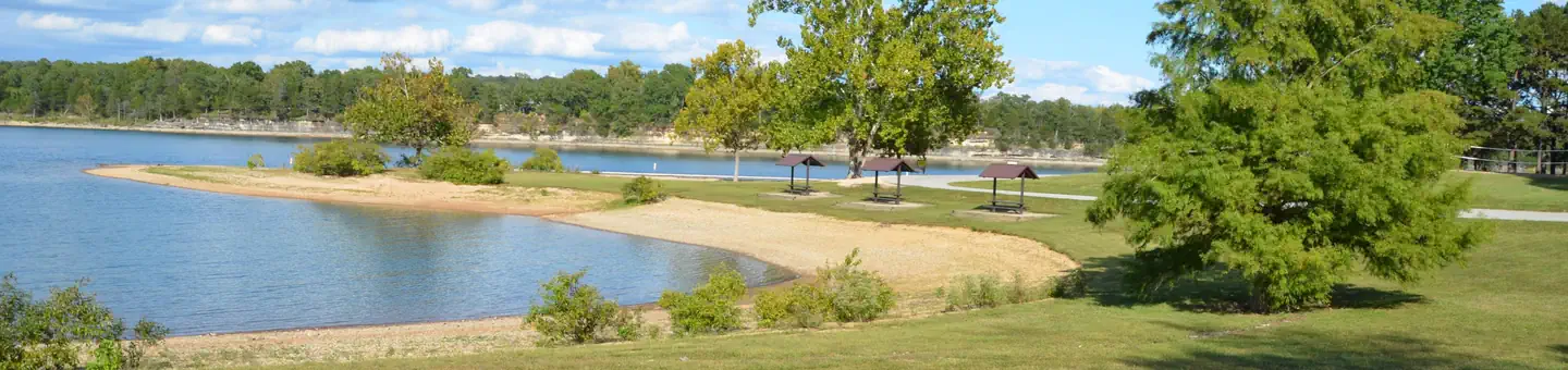
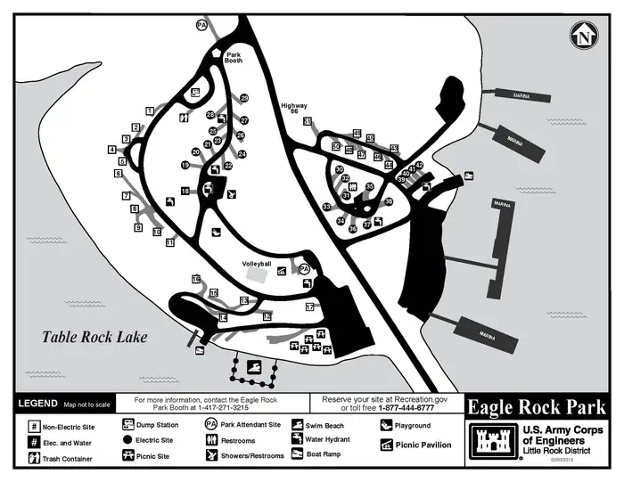
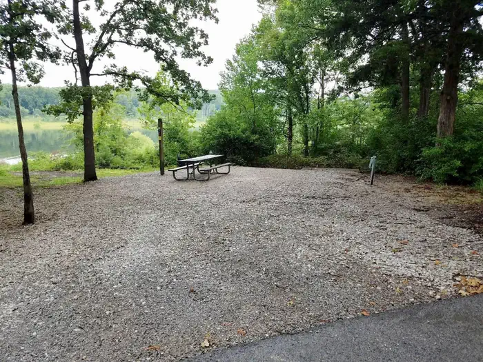
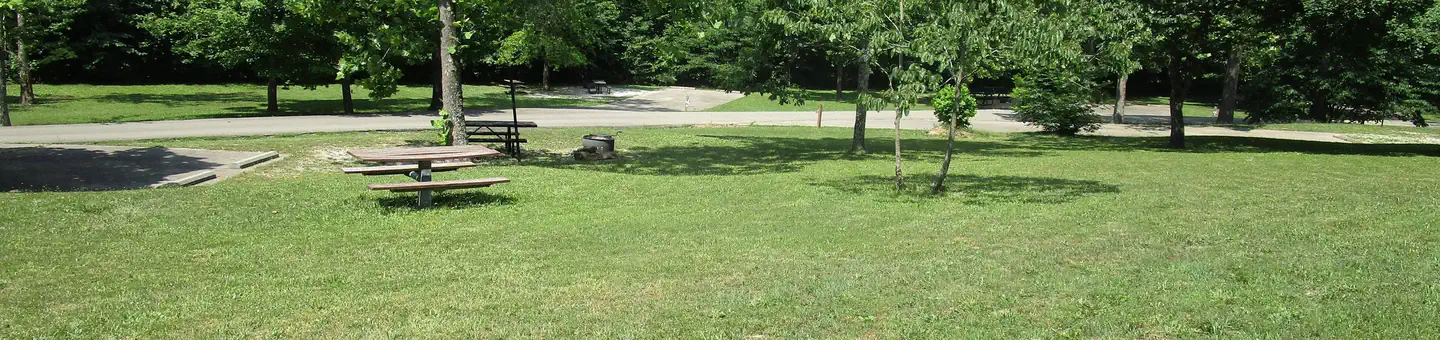
Overview Big M is a spacious and grassy campground that sits along the White River Arm of Table Rock Lake in the Missouri countryside. Big M provides plenty of sites with a panoramic view of the beautiful Table Rock Lake, surrounded by the scenic foothills of the Ozark Mountains.Recreation Whether on water or land, Big M Campground offers visitors countless recreational activities. Picnicking, swimming, scuba diving, boating, fishing, hiking and wildlife viewing are all popular pastimes at the park. With a large marina located just a short walking distance from the campsites, boating and fishing enthusiasts will find they have everything they need to enjoy the deep, clear waters of Table Rock Lake. While the lake boasts an abundance of crappie, catfish, and bluegill, Table Rock is most famous for bass, and is acclaimed as one of the best bass fishing lakes in this hemisphere. Multiple fishing tournaments are hosted yearly and anglers will there is no shortage of Largemouth, Smallmouth, White or Spotted bass. For visitors interested in staying near shore, a designated swimming beach near the campground's volleyball court, offers a convenient way to cool off during warm summer months. Table Rock Lakeshore Trail, about 2 miles long, runs from the Dewey Short Visitor Center to the Table Rock State Park Marina. During the spring hikers will see dogwood, serviceberry and redbud trees in bloom as well as many wildflower species. During the autumn months, visitors are treated to nature's colorful fall foliage. The trail also offers beautiful views of Table Rock Lake. Other hiking and mountain biking opportunities are available at the Mark Twain National Forest, parts of which are easily accessible from the campground. Click here for more information.Facilities Big M Campground offers 61 reservable sites. Amenities like hot showers, drinking water, a dump station and electric hookups create a comfortable camping experience. A swim area, marina, boat ramp, playground and volleyball court make the campground perfect for family trips.Natural Features Table Rock Lake is a beautiful body of water surrounded by a forest of oak and hickory trees. Its waters wind down through the valleys and hollows of the Ozark Mountains, from Branson, Missouri to Eureka Springs, Arkansas. More than five million visitors per year take advantage of this recreational oasis. Originally built for flood control, the Table Rock Dam has created a lake that boasts 779 miles of shoreline for the public to enjoy. Nearby Attractions The Dewey Short Visitors Center is located at the south end of Table Rock Dam. It offers three educational films focused on the history of the dam, the story of Lewis and Clark and the history of eagles and their endangerment in the state of Missouri. The visitor center also contains exhibits on the natural history of the area.
Local outfitters
- Float Eureka12 mi away
- Kings River Outfitters17 mi away
Not on Roamze yet. Their page has how to reach them.
Best time to go · Mar–Jun, Sep–Nov
Best time to visit Big M
Best months: March–June and September–November. Best months have typical highs of 55–85 °F, lows of 30 °F or warmer (32 °F where the station doesn't record snow), at most one snowy day and no more than 12 wet days.
Jan
44° / 23°
Feb
49° / 26°
Mar
58° / 35°
Apr
67° / 44°
May
75° / 54°
Jun
83° / 62°
Jul
87° / 66°
Aug
87° / 65°
Sep
80° / 56°
Oct
70° / 46°
Nov
57° / 35°
Dec
47° / 27°
Typical high / low (°F) and days with rain or snow, 1991–2020. Measured at Cassville, MO, 14 mi away at 1,376 ft. This station doesn't record snowfall. Source: NOAA NCEI U.S. Climate Normals 1991–2020.


Similar waters
Like this spot? Try:
Keep exploring — more waters worth the drive
SEE
Eagle Rock
~6 min drive
SEE
Shell Knob Rec Site Pavilion
~10 min drive
SEE
Table Rock Lake
~27 min drive
Table Rock Lake is a 39,232-acre reservoir in Missouri.
SEE
Buffalo River
~1h 10m drive
Buffalo River is a river in Arkansas.
SEE
Campbell Point
~13 min drive
SEE
Baxter
~17 min drive
SEE
Roaring River
~16 min drive
Roaring River is a river in Missouri.
SEE
Cape Fair
~24 min drive
SEE
Mill Creek
~23 min drive
SEE
White River
~23 min drive
White River is a river in Arkansas.

