Shadow Lower 8
Campground
Campground · 2.5 mi from the trail
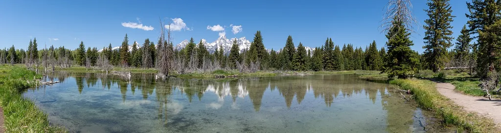 Photo: Hansueli Krapf — Wikimedia Commons (CC BY-SA 4.0)
Alert in the area
The National Park Service lists 2 alerts for Grand Teton National Park.
Construction in the South End of the Park
Park alert covering Grand Teton National Park · NPS · Grand Teton National Park
Construction on HWY 26/89/191
Park alert covering Grand Teton National Park · NPS · Grand Teton National Park
As of · Source: NPS · Grand Teton National Park. Agencies don't list every closure — check before you go.
Schwabacher Landing is a scenic stop along the Snake River in Grand Teton National Park in Wyoming, managed by the National Park Service. The river here is winding and braided, with one channel flowing toward the landing. The shallow, crystal-clear water reflects the Teton Range on calm mornings, and the riparian habitat draws moose and beavers. Evidence of beavers is all around, including gnawed tree stumps. The landing is a place to pause and take in the views. Sunrise and sunset are especially striking, but any time of day brings awe-inspiring scenery. Summer is the most comfortable time to visit. Typical averages from a nearby weather station show July highs around 79°F with lows near 43°F, and August is similar with fewer wet days. Restrooms are available at the landing. A fee is charged for the visit. Teton Point Turnout is about 0.7 miles away, and Glacier View Turnout is about 1.4 miles away. Climbers can head to Blacktail Butte, about 3.6 miles off, and Toppings Spread 4 campground is about 6.7 miles away.
Shadow Lower 8
Campground
Kelly Warm Springs
Hot spring
Places © OpenStreetMap contributors
More in JacksonNot on Roamze yet. Their page has how to reach them.
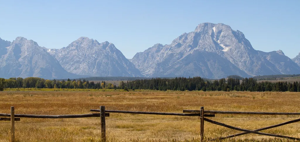 Teton Point TurnoutHikingPhoto: Tony Hisgett from Birmingham, UK — Wikimedia Commons (CC BY 2.0)0.7 mi
 Glacier View TurnoutHikingPhoto: Hansueli Krapf — Wikimedia Commons (CC BY-SA 4.0)1.4 mi
 Approaching the Bar BCHikingPhoto: Matt Lavin from Bozeman, Montana, USA — Wikimedia Commons (CC BY-SA 2.0)1.6 mi
Source: Roamze catalog (indexable pages within 10 miles, PostGIS distance)
 Blacktail Butte TrailHiking · ~6 min drivePhoto: inkknife_2000 (7.5 million views +), CC BY-SA 2.0 (via Wikimedia Commons)
 S Jenny Lake Parking WalkwaysHiking · ~6 min drivePhoto: inkknife_2000 (7.5 million views +), CC BY-SA 2.0 (via Wikimedia Commons)
Also worth it near here
 Jenny Lake CampgroundCamping · ~7 min drivePhoto: LikeGrantTookRichmond, CC BY-SA 3.0 (via Wikimedia Commons)
 Cutfinger RockRock climbing · ~7 min drivePhoto: Michael Kirsh, CC BY-SA 2.0 (via Flickr)
Best months: June–September. Best months have typical highs of 55–85 °F, lows of 30 °F or warmer (32 °F where the station doesn't record snow), at most one snowy day and no more than 12 wet days.
Jan
24° / 2°
17 wet
Feb
28° / 7°
16 wet
Mar
38° / 15°
15 wet
Apr
47° / 24°
14 wet
May
60° / 32°
14 wet
Jun
69° / 37°
11 wet
Jul
79° / 43°
10 wet
Aug
78° / 41°
8 wet
Sep
68° / 35°
9 wet
Oct
53° / 25°
11 wet
Nov
36° / 15°
13 wet
Dec
25° / 3°
17 wet
Typical high / low (°F) and days with rain or snow, 1991–2020. Measured at Moose 1 Nne, WY, 4 mi away at 6,466 ft. This station doesn't record snowfall. Source: NOAA NCEI U.S. Climate Normals 1991–2020.
