Lower Paintbrush Camping Zone
Campground
Campground · 2.0 mi from the trail
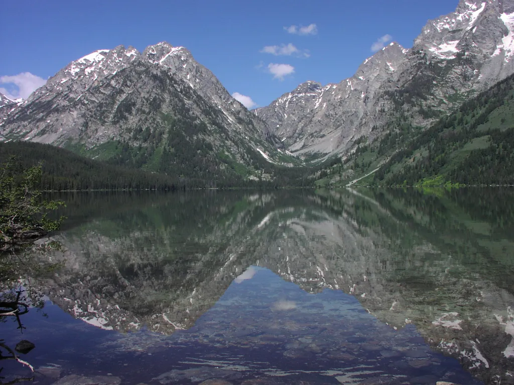 Photo: NPS / public domain
Closure in the area
There's a closure order in Grand Teton National Park. It doesn't name Leigh Lake Trailhead, so check the source for the area it covers.
Death Canyon Trailhead Construction Closure
Park closure covering Grand Teton National Park · NPS · Grand Teton National Park
Construction in the South End of the Park
Park alert covering Grand Teton National Park · NPS · Grand Teton National Park
Construction on HWY 26/89/191
Park alert covering Grand Teton National Park · NPS · Grand Teton National Park
As of · Source: NPS · Grand Teton National Park. Agencies don't list every closure — check before you go.
Leigh Lake Trailhead provides hikers a wide variety of options from easy level trails to access to mountain passes. Some may opt for the relatively level trail that begins along the east shore of String Lake and extends north to Leigh, Bearpaw and Trapper lakes. Others may enjoy a loop around String Lake with views of the Jackson Hole valley. For those looking for a longer hike, venture up Cascade or Paintbrush canyons to reach the alpine lakes such as Lake Solitude or Holly Lake. Suggested Hikes Leigh Lake 1.8 miles RT, 1 hour, 40 ft total climbing, Easy. Hike along the east shore of String Lake, pass the bridge across a stream and climb to Leigh Lake. Trapper Lake 9.2 miles RT, 5 hours, 400 ft total climbing, Easy-Moderate. From String Lake, follow forested shore of Leigh Lake to smaller lakes with views of Mount Moran. Holly Lake 13.0 miles RT, 9 hours, 2600 ft total climbing, Strenuous. Follow Paintbrush Canyon trail through forests and wildflowers meadows to an alpine lake. Location Access the Leigh Lake Trailhead from the Jenny Lake scenic loop drive. Turn west at North Jenny Lake Junction, bend north where the road splits and choose from a series of parking lots. The first parking lot is the String Lake Trailhead. The second lot serves as a boat launch for String Lake. The third lot provides access to the Leigh Lake Trailhead and the String Lake Picnic Area. Check the parking page for additonal information. Note, the Teton Park Road is seasonally closed to this destination from November 1-April 30. Things to Know This area is popular for picnicking and water sports. Parking is often congested mid-day especially on weekends. Restrooms are located near the Leigh Lake trailhead. Remember to bring water with you. Bears may be active any place and at any time-travel in groups, make noise and carry bear spray. Backcountry camping requires a permit-pick one up at a backcountry permits office. Overnight parking is only allowed with a backcountry permit, no camping in parking lot. Name Origin Richard "Beaver Dick" Leigh was a British expatriate who moved to the Teton area in 1863 as a fur trapper. He married Jenny a Shoshone Indian and they had five children. Jenny and Beaver Dick assisted the 1872 Hayden expedition - he as their guide, she with camp logistics. The Hayden Expedition named Jenny and Leigh lakes in their honor.
Lower Paintbrush Camping Zone
Campground
Kelly Warm Springs
Hot spring
Places © OpenStreetMap contributors
More in JacksonNot on Roamze yet. Their page has how to reach them.
Best months: June–September. Best months have typical highs of 55–85 °F, lows of 30 °F or warmer (32 °F where the station doesn't record snow), at most one snowy day and no more than 12 wet days.
Jan
24° / 1°
14 wet · 14 snow
Feb
30° / 4°
12 wet · 11 snow
Mar
39° / 12°
12 wet · 9 snow
Apr
46° / 21°
12 wet · 6 snow
May
56° / 31°
12 wet · 2 snow
Jun
67° / 37°
10 wet
Jul
77° / 42°
8 wet
Aug
76° / 40°
8 wet
Sep
66° / 34°
8 wet
Oct
51° / 25°
9 wet · 3 snow
Nov
35° / 14°
12 wet · 9 snow
Dec
24° / 4°
15 wet · 14 snow
Typical high / low (°F) and days with rain or snow, 1991–2020. Measured at Moran 5wnw, WY, 8.5 mi away at 6,805 ft. Source: NOAA NCEI U.S. Climate Normals 1991–2020.
HIKE
String Lake Launch
Next door
Location: The String Lake Canoe launch is the middle of three parking lots in the String Lake area. Access String Lake from the Jenny Lake Scenic Drive. The farthest parking lot provides access to the String Lake picnic area and the Leigh Lake Trailhead. Notes: This area is…
 Photo: Bas van Oorschot, CC BY-SA 3.0 (via Wikimedia Commons)
Teton Crest Trail
Next door
71.28-mile out-and-back trail in Wyoming with 4,558 ft elevation gain.
 Photo: Cal Wolfe, CC BY-SA 3.0 (via Wikimedia Commons)
Laurel Hill Climb Trail
Next door
1.38-mile out-and-back climb in Wyoming with 965 ft gain
HIKE
Cathedral Group Turnout
~2 min drive
The Cathedral Group refers to three peaks: Teewinot Mountain, the Grand Teton and Mount Owen. These spires tower above Cascade Canyon casting long shadows during a summer sunset. Looking west, the Teton fault breaks the lower slope on Rockchuck Peak recording the last…
HIKE
Apex Trail
~6 min drive
4.84-mile out-and-back hike in Wyoming with 3,787 ft elevation gain and loss.
HIKE
String Lake Trailhead
Next door
Location: Access the String Lake Trailhead from the Jenny Lake scenic loop drive. Turn west at North Jenny Lake Junction, bend north where the road splits and choose from a series of parking lots. The first parking lot is the String Lake Trailhead. The second lot serves as a…
HIKE
Lake of the Crags Trail
~2 min drive
4.24-mile out-and-back hike in Wyoming with 3,291 ft gain and 9,596 ft max elevation.
HIKE
Cascade Canyon Turnout
~3 min drive
Most visitors find it challenging to reach the alpine community in the park, but the view from Cascade Canyon turnout provides a glimpse. The canyon climbs through the forest community where many conifers thrive-lodgepole pine, Engelmann spruce, Douglas fir and subalpine…
HIKE
Mountain View Turnout
~3 min drive
The Teton Range appears unchanging, but the opposite is true. The rocks found in the mountains formed hundreds of millions to billions of years ago. Movement on the Teton fault generated earthquakes that began to lift the mountains less than 10 million years ago. Ice age…
Photo: Bas van Oorschot, CC BY-SA 3.0 (via Wikimedia Commons)String Lake Trail
Next door
3.13-mile out-and-back hike to String Lake in Wyoming with 266 ft of elevation gain.


