Cascade Canyon Turnout
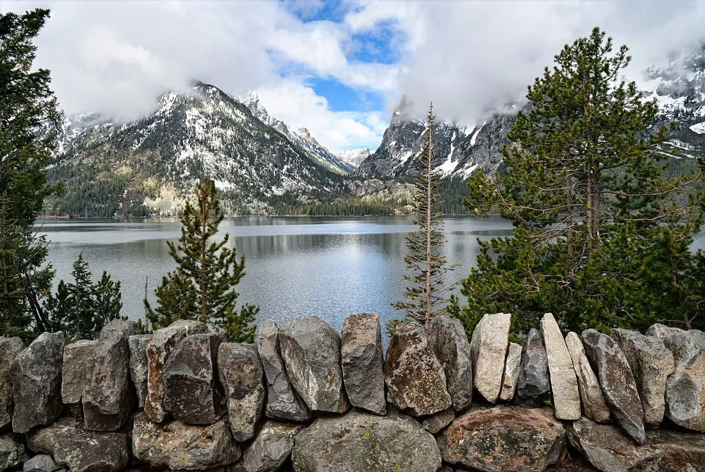 Photo: Eric Kilby — Wikimedia Commons (CC BY-SA 4.0)
- 3.2 mi
- round trip
- 425 ft
- climb
- 7,745 ft
- high point
- Out and back
- route
- Jun–Sep
- best months
Cascade Canyon Turnout is a moderate hike in Grand Teton National Park in Wyoming, managed by the National Park Service. The trail begins at a turnout on the way to the alpine community, which is hard to reach for most visitors. The canyon passes through forested areas dominated by lodgepole pine, Engelmann spruce, Douglas fir and subalpine fir, with Cascade Creek running close by and creating wetland islands along the way. The route is an out-and-back about 6.4 miles long, with a one-way climb of about 425 feet from a low point of 7,317 feet to a high of 7,745 feet. The upper canyon leads into the alpine zone, a harsh environment where snow typically covers the ground most of the year. The canyon itself was once a U-shaped glacial valley, and the creek that flows down it into Jenny Lake was originally named Glacier Creek in 1872 before being renamed Cascade Creek in 1931. Summer is the most comfortable time to go. Typical averages from a nearby weather station run about 90 to 100°F in July and August, while winter brings highs in the 20s and regular snow. The turnout sits about a mile from Jenny Lake Lodge, and the String Lake Trail and Teton Crest Trail are each about a mile away. Climbers can find Red Cross Rock about 1.2 miles off.
 Jenny Lake LodgeHikingPhoto: Cal Wolfe, CC BY-SA 3.0 (via Wikimedia Commons)1 mi
 String Lake TrailHikingPhoto: Bas van Oorschot, CC BY-SA 3.0 (via Wikimedia Commons)1.1 mi
- Teton Crest TrailHikingPhoto: Bas van Oorschot, CC BY-SA 3.0 (via Wikimedia Commons)1.1 mi
- Red Cross RockRock climbing1.2 mi
- Shoreline BouldersRock climbing1.3 mi
 Cutfinger RockRock climbingPhoto: Michael Kirsh, CC BY-SA 2.0 (via Flickr)1.3 mi
- Toppings Spread 2aCamping7.8 mi
- Toppings Spread 4Camping7.9 mi
Source: Roamze catalog (indexable pages within 10 miles, PostGIS distance)
- Jenny Lake OverlookHiking · Next door
- Teton Crest TrailHiking · ~2 min drivePhoto: Bas van Oorschot, CC BY-SA 3.0 (via Wikimedia Commons)
- Cathedral Group TurnoutHiking · ~2 min drive
- Laurel Hill Climb TrailHiking · ~2 min drivePhoto: Cal Wolfe, CC BY-SA 3.0 (via Wikimedia Commons)
- Apex TrailHiking · ~5 min drive
- Jenny Lake LodgeHiking · ~2 min drivePhoto: Cal Wolfe, CC BY-SA 3.0 (via Wikimedia Commons)
- Lake of the Crags TrailHiking · ~3 min drive
 Backcountry Trip PlanningHiking · ~2 min drivePhoto: inkknife_2000 (7.5 million views +), CC BY-SA 2.0 (via Wikimedia Commons)
- Jenny Lake LoopHiking · ~3 min drive
- String Lake TrailHiking · ~2 min drivePhoto: Cal Wolfe, CC BY-SA 3.0 (via Wikimedia Commons)
Also worth it near here
Best time to visit Cascade Canyon Turnout
Best months: June–September. Best months have typical highs of 55–85 °F, lows of 30 °F or warmer (32 °F where the station doesn't record snow), at most one snowy day and no more than 12 wet days.
Jan
24° / 1°
14 wet · 14 snow
Feb
30° / 4°
12 wet · 11 snow
Mar
39° / 12°
12 wet · 9 snow
Apr
46° / 21°
12 wet · 6 snow
May
56° / 31°
12 wet · 2 snow
Jun
67° / 37°
10 wet
Jul
77° / 42°
8 wet
Aug
76° / 40°
8 wet
Sep
66° / 34°
8 wet
Oct
51° / 25°
9 wet · 3 snow
Nov
35° / 14°
12 wet · 9 snow
Dec
24° / 4°
15 wet · 14 snow
Typical high / low (°F) and days with rain or snow, 1991–2020. Measured at Moran 5wnw, WY, 8.4 mi away at 6,805 ft. The station sits about 900 ft lower than this place, so expect it a little cooler here. Source: NOAA NCEI U.S. Climate Normals 1991–2020.

