Lower Paintbrush Camping Zone
Campground
Campground · 2.1 mi from the trail
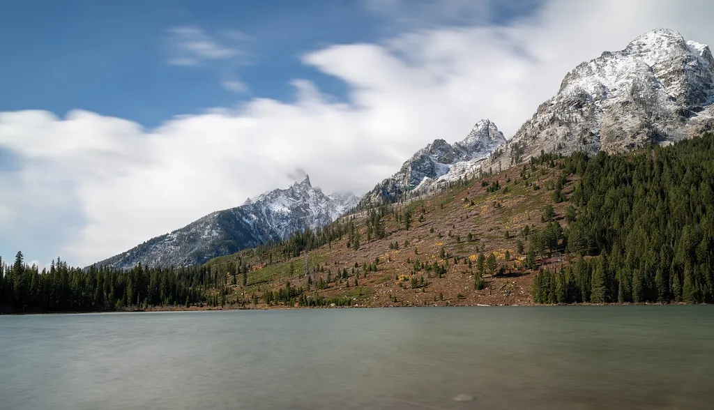 Photo: Eric Kilby — Wikimedia Commons (CC BY-SA 2.0)
Closure in the area
There's a closure order in Grand Teton National Park. It doesn't name String Lake Launch, so check the source for the area it covers.
Death Canyon Trailhead Construction Closure
Park closure covering Grand Teton National Park · NPS · Grand Teton National Park
Construction in the South End of the Park
Park alert covering Grand Teton National Park · NPS · Grand Teton National Park
Construction on HWY 26/89/191
Park alert covering Grand Teton National Park · NPS · Grand Teton National Park
As of · Source: NPS · Grand Teton National Park. Agencies don't list every closure — check before you go.
Location: The String Lake Canoe launch is the middle of three parking lots in the String Lake area. Access String Lake from the Jenny Lake Scenic Drive. The farthest parking lot provides access to the String Lake picnic area and the Leigh Lake Trailhead. Notes: This area is very congested during summer especially from late morning through afternoon. Please obey all regulations. There is no boat ramp at this location. Visitors must carry their watercraft to the lake. No motors are allowed on String Lake. Water, restrooms, picnic area and additional parking is available at the String Lake picnic area. Regulations All boats including paddleboards launched in Grand Teton National Park must have a park permit. Purchase permits at the permits desk in the Craig Thomas Discovery & Visitor Center in Moose or the Colter Bay permits office. More information on park boat regulations. Boat inspections required for all boats entering Wyoming between March 1 and November 30 for Aquatic Invasive Species (AIS). AIS inspection stations near Moose and Moran. Boat owners must buy a decal to support this program. More information on state boat regulations . Name Origin The shallow lake between Leigh and Jenny lakes was named Beaver Dick Lake in 1931 after Richard "Beaver Dick" Leigh who guided the 1872 Hayden Survey. The name changed back to String Lake sometime later in the 1930s.
Lower Paintbrush Camping Zone
Campground
Kelly Warm Springs
Hot spring
Places © OpenStreetMap contributors
More in JacksonNot on Roamze yet. Their page has how to reach them.
Best months: June–September. Best months have typical highs of 55–85 °F, lows of 30 °F or warmer (32 °F where the station doesn't record snow), at most one snowy day and no more than 12 wet days.
Jan
24° / 1°
14 wet · 14 snow
Feb
30° / 4°
12 wet · 11 snow
Mar
39° / 12°
12 wet · 9 snow
Apr
46° / 21°
12 wet · 6 snow
May
56° / 31°
12 wet · 2 snow
Jun
67° / 37°
10 wet
Jul
77° / 42°
8 wet
Aug
76° / 40°
8 wet
Sep
66° / 34°
8 wet
Oct
51° / 25°
9 wet · 3 snow
Nov
35° / 14°
12 wet · 9 snow
Dec
24° / 4°
15 wet · 14 snow
Typical high / low (°F) and days with rain or snow, 1991–2020. Measured at Moran 5wnw, WY, 8.6 mi away at 6,805 ft. Source: NOAA NCEI U.S. Climate Normals 1991–2020.
 Photo: Bas van Oorschot, CC BY-SA 3.0 (via Wikimedia Commons)
Teton Crest Trail
Next door
71.28-mile out-and-back trail in Wyoming with 4,558 ft elevation gain.
HIKE
String Lake Trailhead
Next door
Location: Access the String Lake Trailhead from the Jenny Lake scenic loop drive. Turn west at North Jenny Lake Junction, bend north where the road splits and choose from a series of parking lots. The first parking lot is the String Lake Trailhead. The second lot serves as a…
 Photo: Cal Wolfe, CC BY-SA 3.0 (via Wikimedia Commons)
Laurel Hill Climb Trail
Next door
1.38-mile out-and-back climb in Wyoming with 965 ft gain
HIKE
Cathedral Group Turnout
~2 min drive
The Cathedral Group refers to three peaks: Teewinot Mountain, the Grand Teton and Mount Owen. These spires tower above Cascade Canyon casting long shadows during a summer sunset. Looking west, the Teton fault breaks the lower slope on Rockchuck Peak recording the last…
HIKE
Apex Trail
~6 min drive
4.84-mile out-and-back hike in Wyoming with 3,787 ft elevation gain and loss.
HIKE
Lake of the Crags Trail
~2 min drive
4.24-mile out-and-back hike in Wyoming with 3,291 ft gain and 9,596 ft max elevation.
Photo: Bas van Oorschot, CC BY-SA 3.0 (via Wikimedia Commons)String Lake Trail
Next door
3.13-mile out-and-back hike to String Lake in Wyoming with 266 ft of elevation gain.
HIKE
Cascade Canyon Turnout
~2 min drive
Most visitors find it challenging to reach the alpine community in the park, but the view from Cascade Canyon turnout provides a glimpse. The canyon climbs through the forest community where many conifers thrive-lodgepole pine, Engelmann spruce, Douglas fir and subalpine…
HIKE
Talus Slope
~3 min drive
A talus slope is a geologic term for large, sometimes even house-sized boulders that have accumulated on a hillside from higher up cliffs. This is different than a scree field, which tend to be made up of much smaller rocks. Talus slopes are more than just a geologic feature…
HIKE
Paintbrush Canyon Trail
~6 min drive
Scenic out-and-back alpine canyon hike with mountain views.


