Green River
Near Dutch John
- 7.7 mi
- distance
- 8,566 ft
- high point
Is Green River open right now?
No closures listed
The Forest Service lists no closures for Bridger-Teton National Forest.
As of · Source: USFS · Bridger-Teton National Forest. Agencies don't list every closure — check before you go.
Best time to visit Green River
Best months: June–August. Best months have typical highs of 55–85 °F, lows of 30 °F or warmer (32 °F where the station doesn't record snow), at most one snowy day and no more than 12 wet days.
Jan
26° / -6°
9 wet
Feb
29° / -4°
9 wet
Mar
36° / 5°
10 wet
Apr
43° / 16°
10 wet
May
54° / 26°
11 wet
Jun
64° / 32°
10 wet
Jul
72° / 35°
8 wet
Aug
71° / 34°
9 wet
Sep
62° / 28°
8 wet
Oct
48° / 19°
8 wet
Nov
35° / 6°
9 wet
Dec
25° / -5°
10 wet
Typical high / low (°F) and days with rain or snow, 1991–2020. Measured at Darwin Rch, WY, 25.8 mi away at 8,190 ft. This station doesn't record snowfall. Source: NOAA NCEI U.S. Climate Normals 1991–2020.
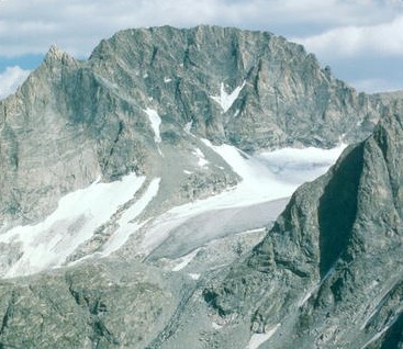
Green River is a 7.7-mile paddling stretch near Dutch John, Utah. It is intermittent and may run dry in some seasons. USGS models an average flow of about 1,465 cfs and a gradient of about 77.2 feet per mile. Land along it is managed by the U.S. Forest Service.
Keep exploring — more water worth the drive
Fremont Creek
~14 min drive
Fremont Creek is a 6.9-mile paddling stretch near Cora, Wyoming. It is intermittent and may run dry in some seasons. USGS models an average flow of about 44 cfs and a gradient of about 428.9 feet per mile. Land along it is managed by the U.S. Forest Service.
New Fork Lake Boating Site
~18 min drive
Bridger Creek
~14 min drive
Bridger Creek is a 3.1-mile paddling stretch near Cora, Wyoming. It flows year-round. USGS models an average flow of about 50 cfs and a gradient of about 713.1 feet per mile. Land along it is managed by the U.S. Forest Service.
Green River Lake Boating Site
~19 min drive
Downs Fork
~21 min drive
Downs Fork is a 4.7-mile paddling stretch near Dubois, Wyoming. It flows year-round. USGS models an average flow of about 31 cfs and a gradient of about 312.4 feet per mile. Land along it is managed by the U.S. Forest Service.
Willow Lake Bs Boating Site
~23 min drive
Pine Creek
~22 min drive
Pine Creek is a 17-mile paddling stretch near Pinedale, Wyoming. It flows year-round. USGS models an average flow of about 174 cfs and a gradient of about 191.2 feet per mile. Land along it is managed by the U.S. Forest Service.
Upper Fremont Lake Boating Site
~26 min drive
New Fork River
~22 min drive
New Fork River is a 36-mile paddling stretch near Pinedale, Wyoming. It is intermittent and may run dry in some seasons. USGS models an average flow of about 84 cfs and a gradient of about 88.4 feet per mile.
Green River Access Site 8 Boat Launch
~26 min drive