Fire Just Is
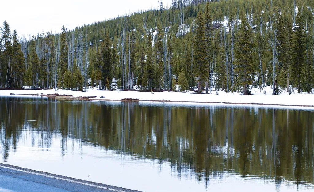 Photo: Thank You (25 Millions ) views — Wikimedia Commons (CC BY 4.0)
- Jun–Aug
- best months
Is Fire Just Is open right now?
No closures listed
The National Park Service lists no closures for John D. Rockefeller, Jr., Memorial Parkway.
As of · Source: NPS · John D. Rockefeller, Jr., Memorial Parkway. Agencies don't list every closure — check before you go.
Fire Just Is is a stop at the Flagg Canyon Picnic Area along the John D. Rockefeller, Jr., Memorial Parkway in Wyoming, managed by the National Park Service. It is Stop 8, and its name comes from the message on display: "Fire isn't good or bad—it just is." The stop invites visitors to reflect on the past 50 years of fire management with insights from park and forest fire managers from Grand Teton National Park and Bridger-Teton National Forest, and to consider what that means for the future. Summer is the most comfortable time to visit. Typical averages from a nearby weather station show July highs around 77°F with lows near 38°F, while winter highs stay in the mid-20s. Flagg Canyon Launch is about 0.1 mile away, and the John D. Rockefeller, Jr. Memorial Parkway North Turnout is about 0.3 mile away. The Snake River Backcountry Office is about half a mile off, and Sheffield Campground is about 2.2 miles away.
Local outfitters
- Swift Creek Outfitters17 mi away
- The Virginian RV Park46 mi away
Not on Roamze yet. Their page has how to reach them.
Best time to go · Jun–Aug
Best time to visit Fire Just Is
Best months: June–August. Best months have typical highs of 55–85 °F, lows of 30 °F or warmer (32 °F where the station doesn't record snow), at most one snowy day and no more than 12 wet days.
Jan
26° / 1°
18 wet
Feb
30° / 3°
15 wet
Mar
39° / 11°
15 wet
Apr
45° / 20°
14 wet
May
56° / 28°
13 wet
Jun
66° / 34°
12 wet
Jul
77° / 38°
10 wet
Aug
76° / 35°
9 wet
Sep
66° / 28°
9 wet
Oct
51° / 21°
10 wet
Nov
35° / 11°
15 wet
Dec
25° / 2°
19 wet
Typical high / low (°F) and days with rain or snow, 1991–2020. Measured at Snake Rvr, WY, 0.5 mi away at 6,882 ft. This station doesn't record snowfall. Source: NOAA NCEI U.S. Climate Normals 1991–2020.
Keep exploring — more trails worth the drive
HIKE
Flagg Canyon Launch
Next door
Location: Access from US 89/191/287 just south of the Yellowstone South Gate. A steep dirt road leads from the picnic area down to the boat ramp. The ramp is a log slide that provides access to the river bottom. Except during high water, visitors will need to carry their…
 Photo: W. Bulach, CC BY-SA 4.0 (via Wikimedia Commons)
Pitchstone Plateau Trail
~15 min drive
Remote 17-mile out-and-back across Wyoming's volcanic Pitchstone Plateau.
Photo: W. Bulach, CC BY-SA 4.0 (via Wikimedia Commons)Cascade Creek-Falls River Cutoff Trail
~16 min drive
Brief out-and-back walk to Cascade Creek Falls in Wyoming.
 Photo: Don Graham from Redlands, CA, USA - God bless it!, CC BY-SA 2.0 (via Wikimedia Commons)
Webb Canyon Trail
~16 min drive
Moderate 7.71-mile out-and-back canyon hike in Wyoming.
HIKE
Snake River Cutoff Trail
~13 min drive
Accessible out-and-back trail along Wyoming's Snake River corridor.
HIKE
John D. Rockefeller, Jr. Memorial Parkway North Turnout
Next door
The north boundary of the John D. Rockefeller, Jr. Memorial Parkway abuts Yellowstone National Park. The headwaters of the adjacent Snake River are east along the Yellowstone, Teton Wilderness Boundary. Lodgepole pines regenerated after the 1988 Yellowstone fires cover the…
HIKE
South Boundary Trail: Grassy Lake-South Entrance
~11 min drive
Moderate out-and-back hike along Wyoming's South Boundary Trail.
HIKE
Headwaters Cabins Walkways
~3 min drive
Easy out-and-back walk through Headwaters Cabins area in Wyoming.
HIKE
Sheffield
~4 min drive
Sheffield is a 14.24-mile out-and-back trail in Wyoming with 2,193 feet of elevation gain.
HIKE
Colter / Wolverine Trailhead (8K8)
~13 min drive
This is a remote trailhead at the southern boundary of the park that is not accessible by road. From this trailhead, you can embark on the following trails within the park: Colter / Wolverine Trail South Boundary Trail: South Entrance–Harebell Snake River Canyon Trail Snake…

