

The Virginian RV Park
Hiking business nearby (~21 mi away) — hasn't claimed their Roamze page yet
Deadmans Bar
Free — you'll pick up right here.
Watch this trail
Sign up to watch it — saving subscribes you to gate, closure and report changes.
Wyoming
We won't guess. Here is exactly what we do and don't know.
What we do know
Inside Grand Teton National Park
National Park unit boundary is mapped — agency alerts for it feed this page automatically.
Boundary data
What's missing
No access route mapped
We don't yet know which road reaches this trailhead, so we can't tell you if it's gated.
Nobody's filed a report here yet — be the first.
Deadmans Bar
AI-suggested draft · review before you go
No elevation data on file for this trail.
The Snake River winds through the valley floor carrying snowmelt from the mountains westward toward the Pacific Ocean. This river is an artery of the park that offers stunning views of the Tetons. Many species of wildlife use the river, from the browsing moose to the industrious beaver. Whether you are fishing, viewing wildlife, or enjoying the scenery, floating on this river is an unforgettable experience. Jackson Lake Dam is the primary starting point for Snake River boating and floating trips in the park. The course this river follows is not straightforward. It travels in and out of numerous channels that change every year. This is a powerful river that requires reading and navigation skills. Before you float, know what skills you need to float the river, where you are going, and what things you need. Informational panels on river safety are located at the launch area for you and your group to review. You will find resources like a map, things to do before going on the water, things to bring, and things to know. For a complete overview of boating rules, regulations, and permit requirements, please review our webpage on boating and floating before getting out on the water. Additional information about floating the Snake River, including an interactive map, is available too. Permits and Regulations To meet the permit requirements for Grand Teton National Park you must: Have a Grand Teton Boat Permit Have a valid Wyoming AIS Decal Complete an AIS inspection Grand Teton Boat Permit All boats are required to have a Grand Teton Boat Permit before launching on any of the park’s waters. Permits are required for all motorized and non-motorized boats, including stand-up paddleboards (SUPs) and windsurfing boards. Privately owned vessels must register each year with Grand Teton National Park.Permits may be purchased on Recreation.gov or at the visitor centers in Moose or Colter Bay during summer operations. Boaters can also have their permit mailed directly to them within two weeks. Wyoming AIS Decal PREVENT THE SPREAD OF PATHOGENS - CLEAN. DRAIN. DRY. All watercraft using Wyoming waters are required to display a Wyoming Aquatic Invasive Species decal.The decal can be purchased online at the Wyoming Game and Fish Department website or from a variety of local vendors. Additionally, all boats entering the park must stop for an Aquatic Invasive Species (AIS) inspection. By law, boats coming from out of state must be inspected or have valid proof of inspection before they launch on waters in Wyoming, including waters in the park. This includes motorized boats, rafts, drift boats, canoes, kayaks, stand-up paddle boards, and all watercraft 10 feet and longer. Aquatic Invasive Species, such as whirling disease and zebra or quagga mussels, are a serious ecological and economic threat to the Greater Yellowstone Ecosystem. Boats, waders, and anything else that comes in contact with a body of water has the potential to spread non-native plants, pathogens, and other invasive species among water bodies. Make sure to clean, drain, dry, all boating and fishing equipment after use.Learn more about preventing the spread of AIS. Note: Non-motorized inflatable watercraft 10 feet or less in length, all solid and inflatable paddleboards regardless of length, and all devices defined as water sport toys are exempt from the Wyoming State AIS Decal requirement. Stretches of River Beginner Jackson Lake Dam to Pacific Creek 5 miles This stretch features scenic views, calmer water and few obstructions. At Pacific Creek landing the water is swift, boaters should scout this landing prior to launching. Intermediate Pacific Creek to Deadmans Bar 10 miles his section drops significantly creating swift water and braided channels requiring careful route-finding. Flagg Ranch to Lizard Creek Campground 10 miles The braided channels make route-finding a challenge. The river winds for 6 miles before reaching Jackson Lake. Depending on the lake level, the trip is another 4 miles to Lizard Creek Campground. Strenuous rowing or paddling may be required. Afternoon thunderstorms and winds produce waves that may swamp canoes. Motors may be used on Jackson Lake. Advanced Deadman’s Bar to Moose Landing 10 miles This is the most challenging stretch of river in the park, many accidents occur here. The river drops more steeply and the current increases. Complex braiding may obscure the main channel and strong currents can sweep boaters into side channels blocked by logjams. Moose to Wilson 14 miles This section of the river is as difficult as the preceding section. Advanced boating skills are required due to fast current, braided channels and logjams. The park extends 5 miles downstream from Moose on the west bank and 2 miles downstream on the east bank. There is no take out or access to the river at the park boundary. The next take-out is at the Snake River Bridge east of Wilson, WY, 14 miles downstream from Moose. Use our advanced Snake River Map on our website for more route details. Name Origin Named after John Tonner's three mining companions were found dead along the river in 1886. There were no witnesses to the crime and although Tonner was arrested, he was freed on the grounds of self-defense.
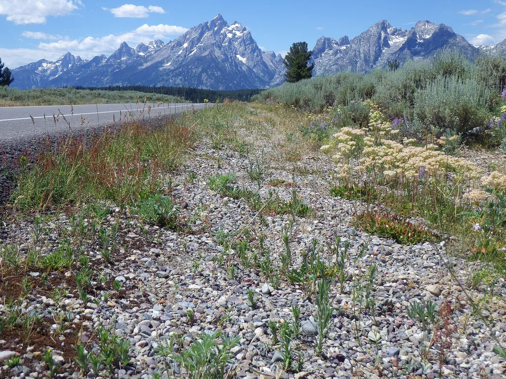
Mount Moran Turnout
~5 min drive
<p>Mount Moran, named for the famous landscape painter Thomas Moran, is the dominant peak of the northern Teton Range. The mountain also reflects all the geologic forces that formed the Teton Range. Ancient igneous and metamorphic rocks comprise the mountain core, sedimentary…
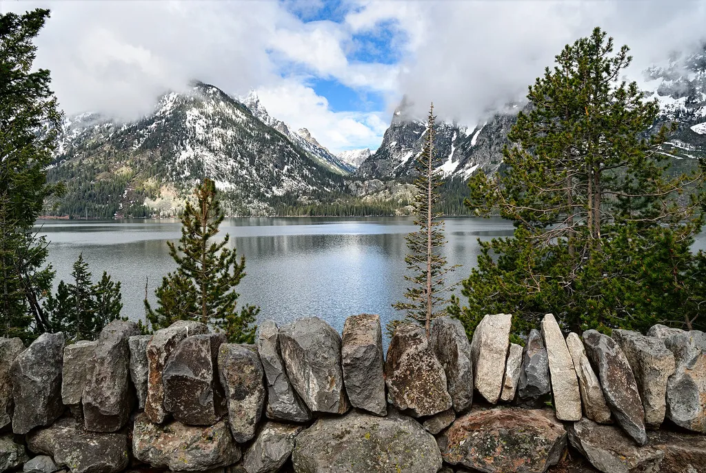
Cascade Canyon Turnout
~7 min drive
<p>Most visitors find it challenging to reach the alpine community in the park, but the view from Cascade Canyon turnout provides a glimpse. The canyon climbs through the forest community where many conifers thrive-lodgepole pine, Engelmann spruce, Douglas fir and subalpine fi…
Jenny Lake Overlook
~8 min drive
<p>Jenny Lake is the most popular destination in the park. The view across the lake toward Cascade Canyon is stunning. Pleistocene glaciers carved the U-shaped canyon and the basin filled by the lake today. Many people have visited in the past-American Indians, fur trappers, s…

Teton Crest Trail
~9 min drive
71 mi · Hard

Potholes Turnout
~5 min drive
<p>This odd stand of conifer trees took root in a depression within the sagebrush flats. Locals called these depressions "potholes" while other regions of the country call these features "kettles." As ice-age glaciers retreated, blocks of ice dropped from the glacier's face on…
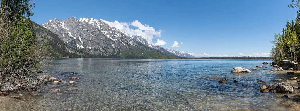
Jenny Lake East Shore Boat Dock
~9 min drive
<p>The Jenny Lake East Shore Boat Dock is where you can purchase tickets and board the shuttle boat to the western side of Jenny Lake. Scenic cruises also depart from this location and require a reservation. Canoes and kayaks are available for rent. <br /> <br /> The shuttle b…
Middle Fork Ditch Creek
~8 min drive
13 mi · Hard
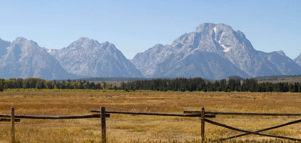
Teton Point Turnout
~6 min drive
<p>Pleistocene Ice Age glaciers advanced across this valley many times. Each time the glaciers melted, a raging torrent of meltwater flowed across the valley floor. The powerful flow carved terraces that step down to the modern Snake River. Today, conifer and cottonwood trees…
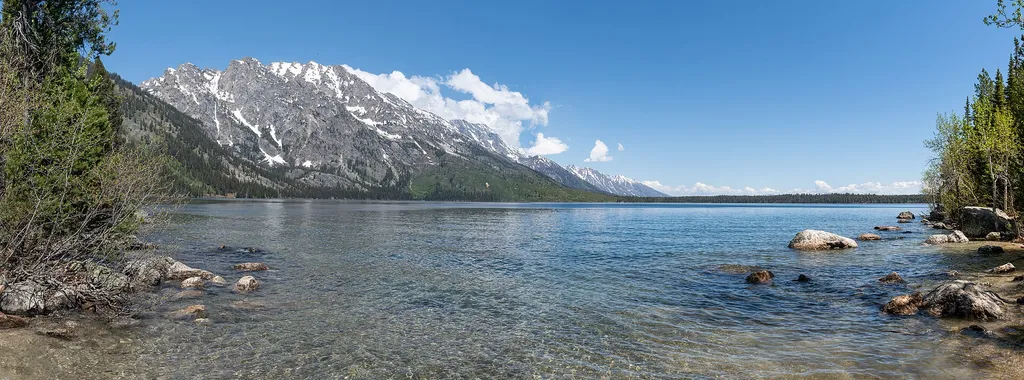
Jenny Lake Boat Launch
~9 min drive
<h3><span style="color:null;">Notice: </span>The Jenny Lake Boat Launch will be closed for construction for the 2025 season. Jenny Lake Boating, including shuttle boats and scenic cruises, will not be affected.</h3> <p><br /> Jenny Lake Boat Launch is accessible by vehicle fro…
Slate Creek
~10 min drive
22 mi · Hard
Local operatorsoffering guided trips. You book directly with them — Roamze doesn’t take a cut.
The Virginian RV Park
Hiking business nearby (~21 mi away) — hasn't claimed their Roamze page yet
Greys River Cove
Hiking business nearby (~46 mi away) — hasn't claimed their Roamze page yet