Sheep Mountain
 Photo: Aaron, CC BY 2.0 (via Wikimedia Commons)
- 8,276 ft
- summit
- Forest Service
- managed by
Is Sheep Mountain open right now?
Closure in the area
There's a closure order in Okanogan-Wenatchee National Forest. It doesn't name Sheep Mountain, so check the source for the area it covers (3 listed).
Little Giant Fire Closure Superseding
Agency closure covering Okanogan-Wenatchee National Forest · Order 06-17-07-2026-48 · USFS · Okanogan-Wenatchee National Forest
Railroad and Preston Creek Road Closure
Agency closure covering Okanogan-Wenatchee National Forest · Order 06-17-05-26-04 · USFS · Okanogan-Wenatchee National Forest
MVRD Storm Damaged Roads
Agency closure covering Methow Valley Ranger District · Order 06-17-04-26-09 · USFS · Methow Valley Ranger District
Cle Elum River Restoration Area Closure on the Cle Elum Ranger District
Agency alert covering Okanogan-Wenatchee National Forest · USFS · Okanogan-Wenatchee National Forest
Storm Damaged Roads Closure on Methow Valley District
Agency alert covering Methow Valley Ranger District · Order 06-17-04-26-18 · USFS · Methow Valley Ranger District
As of · Source: USFS · Okanogan-Wenatchee National Forest. Agencies don't list every closure — check before you go.
Sheep Mountain is a summit of about 8,276 feet in Okanogan County, Washington, inside the Pasayten Wilderness. The peak lies within the Methow Valley Ranger District of the Okanogan-Wenatchee National Forest, which the Forest Service manages. The nearest town is Barron, about 21.5 miles away. Two trails start close by: Sheep Lake Trail is about 0.6 miles away and Sheep Mountain Trail about 0.9 miles. Farther afield, Boundary Trail and Quartz Lake Trail are each about 1.6 miles off.
Conditions and forecast
Daily highs and lows, wind and the chance of precipitation at the summit for the next 7 days, from the Open-Meteo model.
- Summit elevation
- 8,276 ft
- Land manager
- Forest Service
Elevation from USGS 3D Elevation Program terrain data (about 10 m resolution).
We don't know of a mapped trail or route to the summit of Sheep Mountain. Plan the approach with local maps, a guidebook or a local guide, and check conditions before you go.
Questions about Sheep Mountain
How tall is Sheep Mountain?
8,276 ft (2,523 m).
Is there a trail to the top of Sheep Mountain?
We don't know of a mapped trail or route to the summit. Plan the approach with local maps, a guidebook or a local guide.
- Dollar Watch Mountain7,681 ft · Washington1 route5.7 mi away
- Burch Mountain7,784 ft · Washington4 routes13 mi away
- Reed Peak7,520 ft · Washington1 route16 mi away
- Topaz Mountain7,782 ft · Washington1 route18 mi away
- Doe Mountain7,157 ft · Washington1 route20 mi away
 Slate Peak7,445 ft · Washington1 route21 mi awayPhoto: Eli Duke, CC BY-SA 2.0 (via Wikimedia Commons)
- Sheep Lake TrailHiking0.6 mi
- Sheep Mountain TrailHiking0.9 mi
- Boundary TrailHiking1.6 mi
- Quartz Lake TrailHiking1.6 mi
- Larch Creek TrailHiking3.1 mi
- CORRAL LAKEHiking3.5 mi
 Amphitheatre MountainRock climbingPhoto: caffeinated_zeitgeist, CC BY 2.0 (via Flickr)8.9 mi
- Cathedral PeakRock climbing9.1 mi
Source: Roamze catalog (indexable pages within 10 miles, PostGIS distance)
 Amphitheater MountainSummit · ~15 min drivePhoto: Maurice King, CC BY 2.0 (via Wikimedia Commons)
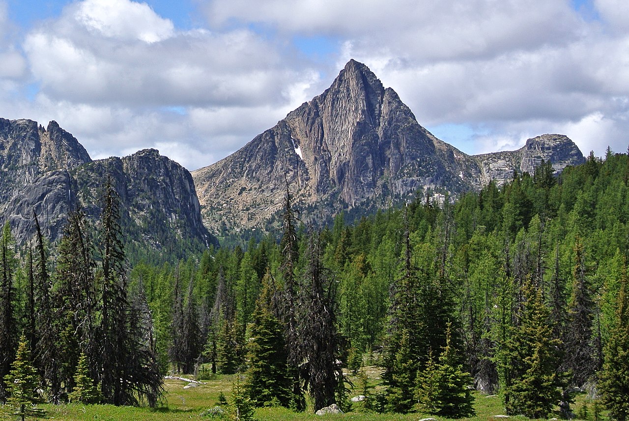 Cathedral PeakSummit · ~16 min drivePhoto: Maurice King, CC BY 2.0 (via Wikimedia Commons)
 Remmel MountainSummit · ~16 min drivePhoto: Maurice King, CC BY 2.0 (via Wikimedia Commons)
 Apex MountainSummit · ~19 min drivePhoto: Maurice King, CC BY 2.0 (via Wikimedia Commons)
 Mount LagoSummit · ~21 min drivePhoto: Eggbones, CC BY-SA 4.0 (via Wikimedia Commons)
 Monument PeakSummit · ~25 min drivePhoto: Martin Bravenboer, CC BY 2.0 (via Wikimedia Commons)
 Blackwall PeakSummit · ~33 min drivePhoto: Kay Röllig, CC BY 3.0 (via Wikimedia Commons)
 Windy PeakSummit · ~33 min drivePhoto: Maurice King, CC BY 2.0 (via Wikimedia Commons)
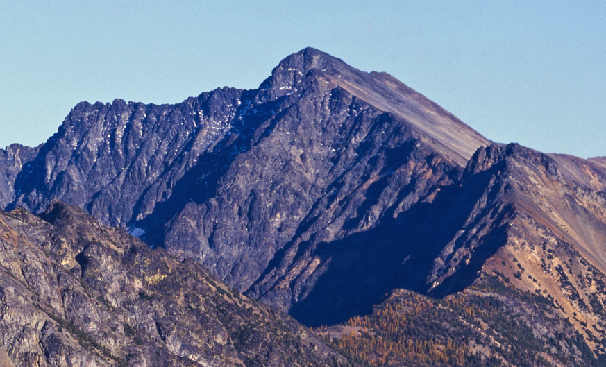 Robinson MountainSummit · ~33 min drivePhoto: Eggbones, CC BY-SA 4.0 (via Wikimedia Commons)
- Sheep N3Summit · ~4 min drive
Also worth it near here
- Quartz Lake CampgroundCamping · ~3 min drive
- Similkameen Cabin Emergency ShelterHut camping · ~7 min drive
- Middle Hidden LakeLake fishing · ~11 min drive
 Chewuch TrailHiking · ~13 min drivePhoto: Aaron, CC BY 2.0 (via Wikimedia Commons)
- Amphitheatre MountainRock climbing · ~15 min drivePhoto: caffeinated_zeitgeist, CC BY 2.0 (via Flickr)
