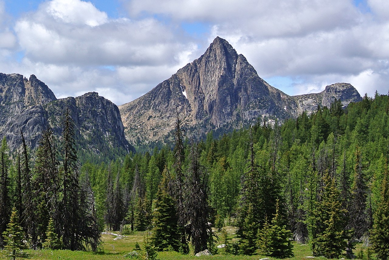
Remmel Mountain
 Photo: Maurice King, CC BY 2.0 (via Wikimedia Commons)
- 8,678 ft
- summit
- Forest Service
- managed by
Is Remmel Mountain open right now?
Closure in the area
There's a closure order in Okanogan-Wenatchee National Forest. It doesn't name Remmel Mountain, so check the source for the area it covers (3 listed).
Little Giant Fire Closure Superseding
Agency closure covering Okanogan-Wenatchee National Forest · Order 06-17-07-2026-48 · USFS · Okanogan-Wenatchee National Forest
Railroad and Preston Creek Road Closure
Agency closure covering Okanogan-Wenatchee National Forest · Order 06-17-05-26-04 · USFS · Okanogan-Wenatchee National Forest
MVRD Storm Damaged Roads
Agency closure covering Methow Valley Ranger District · Order 06-17-04-26-09 · USFS · Methow Valley Ranger District
Cle Elum River Restoration Area Closure on the Cle Elum Ranger District
Agency alert covering Okanogan-Wenatchee National Forest · USFS · Okanogan-Wenatchee National Forest
Storm Damaged Roads Closure on Methow Valley District
Agency alert covering Methow Valley Ranger District · Order 06-17-04-26-18 · USFS · Methow Valley Ranger District
As of · Source: USFS · Okanogan-Wenatchee National Forest. Agencies don't list every closure — check before you go.
Remmel Mountain is a summit of about 8,678 feet in Okanogan County, Washington, within the Pasayten Wilderness. The peak lies in the Methow Valley Ranger District of the Okanogan-Wenatchee National Forest, which the Forest Service manages, and the nearest town is Vanderpool Crossing, about 19 miles away. Peepsight Trail and Coleman Ridge Trail both start within about a mile of the mountain. Amphitheatre Mountain and Cathedral Peak, two climbing areas, sit roughly 4 to 5 miles away.
Conditions and forecast
Daily highs and lows, wind and the chance of precipitation at the summit for the next 7 days, from the Open-Meteo model.
- Summit elevation
- 8,678 ft
- Land manager
- Forest Service
Elevation from USGS 3D Elevation Program terrain data (about 10 m resolution).
We don't know of a mapped trail or route to the summit of Remmel Mountain. Plan the approach with local maps, a guidebook or a local guide, and check conditions before you go.
Questions about Remmel Mountain
How tall is Remmel Mountain?
8,678 ft (2,645 m).
Is there a trail to the top of Remmel Mountain?
We don't know of a mapped trail or route to the summit. Plan the approach with local maps, a guidebook or a local guide.
- Reed Peak7,520 ft · Washington1 route6.6 mi away
- Topaz Mountain7,782 ft · Washington1 route9.5 mi away
- Dollar Watch Mountain7,681 ft · Washington1 route9.8 mi away
- Burch Mountain7,784 ft · Washington4 routes10 mi away
- North Twentymile Peak7,440 ft · Washington1 route13 mi away
- Doe Mountain7,157 ft · Washington1 route14 mi away
- Peepsight TrailHiking1 mi
- Coleman Ridge TrailHiking1.2 mi
- SPOTTED CREEKHiking2.5 mi
 Old Lesamiz Trail (abandoned)HikingPhoto: Aaron, CC BY 2.0 (via Wikimedia Commons)2.5 mi
 Amphitheatre MountainRock climbingPhoto: caffeinated_zeitgeist, CC BY 2.0 (via Flickr)3.7 mi
- Cathedral PeakRock climbing4.6 mi
- Chewuch RiverCanoeing7.4 mi
- Pasayten WildernessRock climbing9.3 mi
Source: Roamze catalog (indexable pages within 10 miles, PostGIS distance)
 Apex MountainSummit · ~6 min drivePhoto: Maurice King, CC BY 2.0 (via Wikimedia Commons)
 Amphitheater MountainSummit · ~6 min drivePhoto: Maurice King, CC BY 2.0 (via Wikimedia Commons)
 Cathedral PeakSummit · ~8 min drivePhoto: Maurice King, CC BY 2.0 (via Wikimedia Commons)
 Sheep MountainSummit · ~16 min drivePhoto: Aaron, CC BY 2.0 (via Wikimedia Commons)
 Windy PeakSummit · ~18 min drivePhoto: Maurice King, CC BY 2.0 (via Wikimedia Commons)
 Horseshoe MountainSummit · ~22 min drivePhoto: Djs417, CC BY-SA 4.0 (via Wikimedia Commons)
 Mount LagoSummit · ~29 min drivePhoto: Eggbones, CC BY-SA 4.0 (via Wikimedia Commons)
 Monument PeakSummit · ~31 min drivePhoto: Martin Bravenboer, CC BY 2.0 (via Wikimedia Commons)
- The PopeSummit · ~9 min drive
- The DeaconSummit · ~10 min drive
Also worth it near here
- Andrew Pass backcountry camp areaCamping · ~2 min drive
- Old Lesamiz Trail (abandoned)Hiking · ~4 min drivePhoto: Aaron, CC BY 2.0 (via Wikimedia Commons)
- Amphitheatre MountainRock climbing · ~6 min drivePhoto: caffeinated_zeitgeist, CC BY 2.0 (via Flickr)
- Tungsten LakeLake fishing · ~7 min drive
- Chewack FallsWaterfall · ~15 min drive
