Robinson Mountain
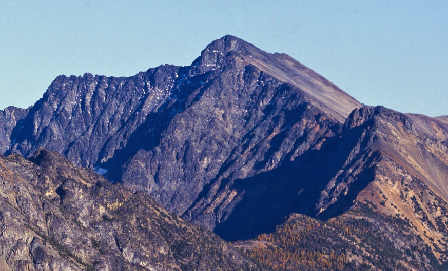 Photo: Eggbones, CC BY-SA 4.0 (via Wikimedia Commons)
- 8,721 ft
- summit
- Forest Service
- managed by
Is Robinson Mountain open right now?
Closure in the area
There's a closure order in Okanogan-Wenatchee National Forest. It doesn't name Robinson Mountain, so check the source for the area it covers (3 listed).
Little Giant Fire Closure Superseding
Agency closure covering Okanogan-Wenatchee National Forest · Order 06-17-07-2026-48 · USFS · Okanogan-Wenatchee National Forest
Railroad and Preston Creek Road Closure
Agency closure covering Okanogan-Wenatchee National Forest · Order 06-17-05-26-04 · USFS · Okanogan-Wenatchee National Forest
MVRD Storm Damaged Roads
Agency closure covering Methow Valley Ranger District · Order 06-17-04-26-09 · USFS · Methow Valley Ranger District
Cle Elum River Restoration Area Closure on the Cle Elum Ranger District
Agency alert covering Okanogan-Wenatchee National Forest · USFS · Okanogan-Wenatchee National Forest
Storm Damaged Roads Closure on Methow Valley District
Agency alert covering Methow Valley Ranger District · Order 06-17-04-26-18 · USFS · Methow Valley Ranger District
As of · Source: USFS · Okanogan-Wenatchee National Forest. Agencies don't list every closure — check before you go.
Robinson Mountain is a summit of about 8,721 feet in Okanogan County, Washington, inside the Pasayten Wilderness. It lies within the Methow Valley Ranger District of the Okanogan-Wenatchee National Forest, which the Forest Service manages, and the nearest town is Barron, about 7 miles away. The closest trails are Beauty Creek, about 1.4 miles away, and Robinson Creek Trail, about 1.8 miles away. For an overnight base, Harts Pass Campground and Meadows Campground are both within about 5 miles.
Conditions and forecast
Daily highs and lows, wind and the chance of precipitation at the summit for the next 7 days, from the Open-Meteo model.
- Summit elevation
- 8,721 ft
- Land manager
- Forest Service
Elevation from USGS 3D Elevation Program terrain data (about 10 m resolution).
We don't know of a mapped trail or route to the summit of Robinson Mountain. Plan the approach with local maps, a guidebook or a local guide, and check conditions before you go.
Questions about Robinson Mountain
How tall is Robinson Mountain?
8,721 ft (2,658 m).
Is there a trail to the top of Robinson Mountain?
We don't know of a mapped trail or route to the summit. Plan the approach with local maps, a guidebook or a local guide.
 Slate Peak7,445 ft · Washington1 route5.0 mi awayPhoto: Eli Duke, CC BY-SA 2.0 (via Wikimedia Commons)
 Goat Peak6,998 ft · Washington2 routes10 mi awayPhoto: Curt Smith from Bellevue, WA, USA, CC BY 2.0 (via Wikimedia Commons)
- Burch Mountain7,784 ft · Washington4 routes13 mi away
- Dollar Watch Mountain7,681 ft · Washington1 route14 mi away
- Crater Mountain8,138 ft · Washington1 route16 mi away
- Doe Mountain7,157 ft · Washington1 route18 mi away
- BEAUTY CREEKHiking1.4 mi
- Robinson Creek TrailHiking1.8 mi
- Harts Pass CampgroundCamping4.4 mi
- Meadows CampgroundCamping4.7 mi
- Nugget WallRock climbing4.9 mi
- Recess WallRock climbing4.9 mi
 Methow RiverCanoeingPhoto: Benjamin Cody, CC BY-SA 3.0 (via Wikimedia Commons)6.3 mi
- Lost RiverCanoeing7 mi
Source: Roamze catalog (indexable pages within 10 miles, PostGIS distance)
 Monument PeakSummit · ~8 min drivePhoto: Martin Bravenboer, CC BY 2.0 (via Wikimedia Commons)
- Slate PeakSummit · ~8 min drivePhoto: Eli Duke, CC BY-SA 2.0 (via Wikimedia Commons)
 Mount LagoSummit · ~12 min drivePhoto: Eggbones, CC BY-SA 4.0 (via Wikimedia Commons)
 Mount BallardSummit · ~15 min drivePhoto: Martin Bravenboer, CC BY 2.0 (via Wikimedia Commons)
- Goat PeakSummit · ~17 min drivePhoto: Curt Smith from Bellevue, WA, USA, CC BY 2.0 (via Wikimedia Commons)
 Golden HornSummit · ~19 min drivePhoto: Ron Clausen, CC BY-SA 4.0 (via Wikimedia Commons)
 Tower MountainSummit · ~19 min drivePhoto: Ron Clausen, CC BY-SA 4.0 (via Wikimedia Commons)
 Silver Star MountainSummit · ~21 min drivePhoto: Josh Lewis, CC BY-SA 3.0 (via Wikimedia Commons)
 North Gardner MountainSummit · ~26 min drivePhoto: Ron Clausen, CC BY-SA 4.0 (via Wikimedia Commons)
 Liberty Bell MountainSummit · ~26 min drivePhoto: Jsayre64, CC BY-SA 3.0 (via Wikimedia Commons)
