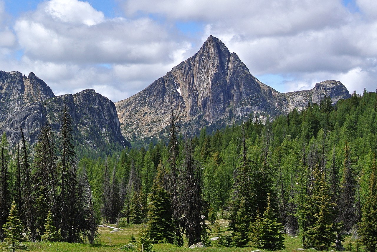
Cathedral Peak
About
Cathedral Peak is a summit of about 8,582 feet in Okanogan County, Washington, inside the Pasayten Wilderness. It lies within the Methow Valley Ranger District of the Okanogan-Wenatchee National Forest, managed by the Forest Service, and the nearest town is Chopaka, about 21 miles away. As part of a designated wilderness, the peak falls under wilderness rules for the Pasayten. Several area alerts were posted for the Methow Valley Ranger District as of October 2026, including the Ptarmigan Fire Closure and a motorized use restriction on East Chewuch Road 5010. These apply across the district rather than to this summit alone and can change, so confirm their status before heading out. The peak sits close to a cluster of trails and climbing terrain. Amphitheatre Mountain, a climbing area, is under a mile away, while the Lower Cathedral Lake Cutoff trail and Cathedral Lakes Trail #545 lie within about a mile and a half. The Chewuch Trail is roughly 2 miles off.
Summit Facts
Summit elevation
8,582 ft
Land manager
Forest Service
Elevation from USGS 3D Elevation Program terrain data (about 10 m resolution).
Location
Cathedral Peak
Washington
Name and location: U.S. Geological Survey, Geographic Names Information System (GNIS). Elevation: USGS 3D Elevation Program. View the GNIS record.
Facts about this place
Where it is
- Pasayten Wilderness · Wilderness
- Methow Valley Ranger District · Ranger district
- Okanogan-Wenatchee National Forest · National forest
- Nearest town
- Chopaka, Washington · 21 mi
- Managed by
- Forest Service
Source: Wilderness.net boundaries; USFS EDW boundaries; USGS PAD-US 4.1; USGS GNIS populated places
Conditions
Active alerts for Methow Valley Ranger District as of Oct 9, 2026:
Ptarmigan Fire Closure on the Methow Valley Ranger District
fire-restriction · posted Sep 9, 2026
Motorized Use Restriction on East Chewuch Road 5010 on the Methow Valley Ranger District
information · posted Aug 24, 2026
Scenic Highway 20 Corridor Mining Closure on the Methow Valley Ranger District
information · posted Aug 24, 2026
Volstead Road Closure on the Methow Valley Ranger District
information · posted Aug 24, 2026
Storm Damaged Roads Closure on Methow Valley District
caution · posted Aug 24, 2026
Paving Closure along Highway 20 Campgrounds and Trailheads - Methow Valley Ranger District
caution · posted Aug 24, 2026
Source: USFS forest alerts
Nearby
- Amphitheatre MountainRock climbing0.9 mi
- Lower Cathedral Lake Cutoff trailHiking1.3 mi
- Cathedral Lakes Trail #545Hiking1.4 mi
- Lesamiz TrailHiking1.8 mi
- Old Lesamiz Trail (abandoned)Hiking2.1 mi
- Chewuch TrailHiking2.1 mi
- Remmel Cutoff TrailHiking2.7 mi
- Pasayten WildernessRock climbing9.4 mi
Source: Roamze catalog (indexable pages within 10 miles, PostGIS distance)
