Canyon Creek Road
- 0.7 mi
- round trip
- 291 ft
- climb
- 2,644 ft
- high point
- Out and back
- route
Is Canyon Creek Road open right now?
Closure in the area
There's a closure order in Mt. Baker-Snoqualmie National Forest. It doesn't name Canyon Creek Road, so check the source for the area it covers (2 listed).
Grand Park 2 Fire Closure Update
Agency closure covering Mt. Baker-Snoqualmie National Forest · Order 06-05-26-16 · USFS · Mt. Baker-Snoqualmie National Forest
Bell Creek Bridge Damaged
Agency closure covering Mt. Baker-Snoqualmie National Forest · USFS · Mt. Baker-Snoqualmie National Forest
Rescission of Shooting Restrictions
Agency alert covering Mt. Baker-Snoqualmie National Forest · USFS · Mt. Baker-Snoqualmie National Forest
Electric Fire Closure Order
Agency alert covering Mt. Baker-Snoqualmie National Forest · Order 06-05-26-19 · USFS · Mt. Baker-Snoqualmie National Forest
Mountain Goats Have Been Present on Yellow Aster Butte
Agency alert covering Mt. Baker-Snoqualmie National Forest · USFS · Mt. Baker-Snoqualmie National Forest
As of · Source: USFS · Mt. Baker-Snoqualmie National Forest. Agencies don't list every closure — check before you go.
Canyon Creek Road is a short, easy cross-country ski route in the Mt. Baker Ranger District of Mt. Baker-Snoqualmie National Forest in Washington, managed by the Forest Service. The out-and-back trip covers about 1.4 miles, with a total elevation gain of 291 feet from a low point of 2,540 feet to a high of 2,644 feet. The climb is gentle, and the route is rated easy. The road makes a straightforward addition to a day spent exploring the surrounding area. Canyon Creek, a canoeing spot, lies about 1.5 miles away, and Church Lake Trail, a cross-country ski route, and Church Lake, a hike, are both about 2.7 miles off. Douglas Fir Campground, roughly 4.4 miles away, offers a place to stay overnight.
Local outfitters
- Guided Exposure6 mi away
- WHATCOM MEADOWS28 mi away
Not on Roamze yet. Their page has how to reach them.
- Canyon CreekCanoeing1.5 mi
- Church Lake TrailCross-country skiing2.7 mi
- Church LakeHiking2.7 mi
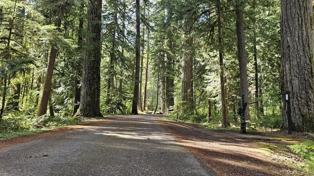 Douglas Fir CampgroundCampingPhoto: Recreation.gov (RIDB) / public domain4.4 mi
- Boulder CreekCanoeing4.9 mi
- The PumphouseRock climbing5.6 mi
 Excelsior Group CampCampingPhoto: Recreation.gov (RIDB) / public domain5.6 mi
- Cobblestone WallRock climbing9.4 mi
Source: Roamze catalog (indexable pages within 10 miles, PostGIS distance)
- Canyon Creek RoadCross-country skiing · ~1 min drive
- Forest Road 3071Cross-country skiing · ~18 min drive
- Mom'sCross-country skiing · ~18 min drive
- Forest Road 3160Cross-country skiing · ~2 min drive
- Forest Road 3071Cross-country skiing · ~18 min drive
- River TrailCross-country skiing · ~19 min drive
- Canyon Creek RoadCross-country skiing · ~2 min drive
- Cougar LoopCross-country skiing · ~21 min drive
- Forest Road 3140Cross-country skiing · ~3 min drive
- Canyon Creek RoadCross-country skiing · ~3 min drive

Map and trail data © OpenStreetMap contributors
