Church Mountain
 Photo: Danust, CC BY-SA 4.0 (via Wikimedia Commons)
- 6,298 ft
- summit
- Forest Service
- managed by
Is Church Mountain open right now?
Closure in the area
There's a closure order in Mt. Baker-Snoqualmie National Forest. It doesn't name Church Mountain, so check the source for the area it covers (2 listed).
Grand Park 2 Fire Closure Update
Agency closure covering Mt. Baker-Snoqualmie National Forest · Order 06-05-26-16 · USFS · Mt. Baker-Snoqualmie National Forest
Bell Creek Bridge Damaged
Agency closure covering Mt. Baker-Snoqualmie National Forest · USFS · Mt. Baker-Snoqualmie National Forest
Rescission of Shooting Restrictions
Agency alert covering Mt. Baker-Snoqualmie National Forest · USFS · Mt. Baker-Snoqualmie National Forest
Electric Fire Closure Order
Agency alert covering Mt. Baker-Snoqualmie National Forest · Order 06-05-26-19 · USFS · Mt. Baker-Snoqualmie National Forest
Mountain Goats Have Been Present on Yellow Aster Butte
Agency alert covering Mt. Baker-Snoqualmie National Forest · USFS · Mt. Baker-Snoqualmie National Forest
As of · Source: USFS · Mt. Baker-Snoqualmie National Forest. Agencies don't list every closure — check before you go.
Church Mountain is a summit in Whatcom County, Washington, on Forest Service land within the Mt. Baker Ranger District of Mt. Baker-Snoqualmie National Forest. The nearest town is Glacier, about 3.4 miles away. The Church Mountain Trail lies about 1.6 miles away. Canyon Creek, a canoeing spot, is about 1.5 miles off. For an overnight stay, Douglas Fir Campground is about 2.2 miles away, and the Horseshoe Bend Trail is at a similar distance.
Conditions and forecast
Daily highs and lows, wind and the chance of precipitation at the summit for the next 7 days, from the Open-Meteo model.
- Summit elevation
- 6,298 ft
- Land manager
- Forest Service
Elevation from USGS 3D Elevation Program terrain data (about 10 m resolution).
We don't know of a mapped trail or route to the summit of Church Mountain. Plan the approach with local maps, a guidebook or a local guide, and check conditions before you go.
Questions about Church Mountain
How tall is Church Mountain?
6,298 ft (1,920 m).
Is there a trail to the top of Church Mountain?
We don't know of a mapped trail or route to the summit. Plan the approach with local maps, a guidebook or a local guide.
- Excelsior Peak5,702 ft · Washington2 routes4.2 mi away
 Table Mountain5,740 ft · Washington3 routes9.5 mi awayPhoto: Ron Clausen, CC BY-SA 4.0 (via Wikimedia Commons)
- Panorama Dome5,041 ft · Washington1 route11 mi away
- Grant Peak10,777 ft · Washington2 routes11 mi away
- Winchester Mountain6,507 ft · Washington1 route11 mi away
- Park Butte5,453 ft · Washington1 route15 mi away
- Canyon CreekCanoeing1.5 mi
- Church Mountain TrailHiking1.6 mi
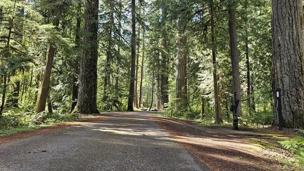 Douglas Fir CampgroundCampingPhoto: Recreation.gov (RIDB) / public domain2.2 mi
- Horseshoe Bend TrailHiking2.2 mi
- The PumphouseRock climbing2.9 mi
 Excelsior Group CampCampingPhoto: Recreation.gov (RIDB) / public domain3.1 mi
- Glacier CreekCanoeing5.4 mi
- Cobblestone WallRock climbing7.4 mi
Source: Roamze catalog (indexable pages within 10 miles, PostGIS distance)
 Tomyhoi PeakSummit · ~15 min drivePhoto: Ron Clausen, CC BY-SA 4.0 (via Wikimedia Commons)
 Canadian Border PeakSummit · ~18 min drivePhoto: 潘世博, CC BY-SA 2.0 (via Wikimedia Commons)
 American Border PeakSummit · ~19 min drivePhoto: Nwcamera1, CC BY-SA 3.0 (via Wikimedia Commons)
 Goat MountainSummit · ~20 min drivePhoto: Ron Clausen, CC BY-SA 4.0 (via Wikimedia Commons)
 Elk MountainSummit · ~23 min drivePhoto: Boreal11, CC0 (via Wikimedia Commons)
 Mount ShuksanSummit · ~25 min drivePhoto: Frank Kovalchek from Anchorage, Alaska, USA, CC BY 2.0 (via Wikimedia Commons)
 Slesse MountainSummit · ~25 min drivePhoto: Jonhall (talk), CC BY 3.0 (via Wikimedia Commons)
 Nooksack TowerSummit · ~26 min drivePhoto: Ron Clausen, CC BY-SA 4.0 (via Wikimedia Commons)
- Table MountainSummit · ~16 min drivePhoto: Ron Clausen, CC BY-SA 4.0 (via Wikimedia Commons)
- American Border PeakSummit · ~19 min drivePhoto: Nwcamera1, CC BY-SA 3.0 (via Wikimedia Commons)
