Albion Basin
Campground
Campground · 0.8 mi from the trail
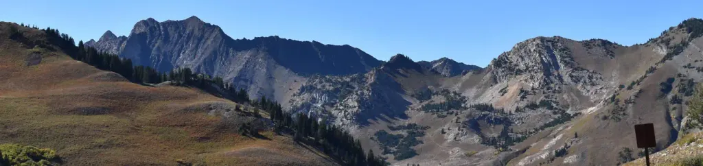
 Photo: Brian Lauer, CC BY 2.0 (via Wikimedia Commons)
No closures listed
The Forest Service lists no closures for Uinta-Wasatch-Cache National Forest.
As of · Source: USFS · Uinta-Wasatch-Cache National Forest. Agencies don't list every closure — check before you go.
Mount Tuscarora is a summit of about 10,647 feet in Salt Lake County, Utah, within the Salt Lake Ranger District of the Uinta-Wasatch-Cache National Forest. The Forest Service manages the land, and the nearest town is Alta, about a mile away. The Mount Millicent Trail and Sunset Peak Trail both start within a quarter mile of the summit. Lake Catherine and Lake Martha are about 0.4 miles away, and Albion Basin campground sits roughly 0.8 miles off.
Albion Basin
Campground
Alf's Restaurant
Restaurant
 If it rainsSaalebaer, CC0 · Wikimedia Commons
Park City Museum
Museum
Places © OpenStreetMap contributors · Photos: Saalebaer, CC0 (commons)
More in HeberDaily highs and lows, wind and the chance of precipitation at the summit and route start for the next 7 days, from the Open-Meteo model.
Elevation from USGS 3D Elevation Program terrain data (about 10 m resolution).
| Mount Millicent Trail | Mount Wolverine Trail | |
|---|---|---|
| Climbing | About 628 ft | About 1,677 ft |
| Round trip | 1.0 mi | 2.9 mi |
| Difficulty | Hard | Hard |
| Terrain | Scramble | Scramble |
10,647 ft (3,245 m).
2: Mount Millicent Trail and Mount Wolverine Trail.
Mount Millicent Trail, about 1.0 mi round trip.

 Tahoe SimulatorRock climbingPhoto: marcomorahuizar, CC0 (via Flickr)0.7 miBrighton's Frighton WallRock climbingPhoto: marcomorahuizar, CC0 (via Flickr)0.8 mi
 Albion BasinCampingPhoto: Recreation.gov (RIDB) / public domain0.8 mi
Source: Roamze catalog (indexable pages within 10 miles, PostGIS distance)
 Clayton PeakSummit · ~4 min drivePhoto: drdanielweir, CC BY 3.0 (via Wikimedia Commons)
 Mount BaldySummit · ~4 min drivePhoto: michaelwm25, CC BY 3.0 (via Wikimedia Commons)
 Hidden PeakSummit · ~5 min drivePhoto: VeggieGarden, CC BY-SA 4.0 (via Wikimedia Commons)
 Superior PeakSummit · ~7 min drivePhoto: Derrellwilliams, CC BY-SA 4.0 (via Wikimedia Commons)
 Kesler PeakSummit · ~8 min drivePhoto: Derrellwilliams, CC BY-SA 4.0 (via Wikimedia Commons)
 Bald MountainSummit · ~11 min drivePhoto: An Errant Knight, CC BY-SA 4.0 (via Wikimedia Commons)
 The PfeifferhornSummit · ~11 min drivePhoto: Itineranttrader, Public domain (via Wikimedia Commons)
 Gobblers KnobSummit · ~13 min drivePhoto: Derrellwilliams, CC BY-SA 4.0 (via Wikimedia Commons)
 Mount RaymondSummit · ~13 min drivePhoto: Derrellwilliams, CC BY-SA 4.0 (via Wikimedia Commons)
 Lone PeakSummit · ~16 min drivePhoto: Climbjm at English Wikipedia, Public domain (via Wikimedia Commons)

