Mountain · 1 route
Mount Millicent
10,449 ft · Utah
- Summit
- 10,449 ft
- Routes
- 1 way up
Route up Mount Millicent
About Mount Millicent
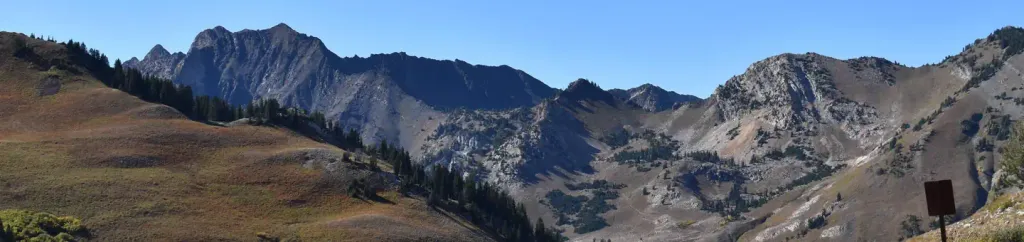
Mount Millicent is a summit in the Salt Lake Ranger District of the Uinta-Wasatch-Cache National Forest, about 1.3 miles from the town of Alta, Utah. The Mount Millicent Trail lies about 0.4 miles away and serves as the natural starting point for anyone heading toward the peak. Close by are Lake Mary and the Brighton Lakes Trail, both within half a mile, along with the climbing at the Brighton Area. Overnight options include Albion Basin campground at about 1.2 miles and Redman Campground at about 1.8 miles.
Forecast on Mount Millicent
Daily highs and lows, wind and the chance of precipitation at the summit and route start for the next 7 days, from the Open-Meteo model.
Questions about Mount Millicent
How tall is Mount Millicent?
10,449 ft (3,185 m).
How many routes go to the summit of Mount Millicent?
One: Mount Millicent Trail.
Mountains nearby
 Mount Tuscarora10,647 ft · Utah2 routes0.4 mi awayPhoto: Brian Lauer, CC BY 2.0 (via Wikimedia Commons)
- Mount Wolverine10,788 ft · Utah2 routes0.5 mi away
- Pioneer Peak10,456 ft · Utah1 route0.8 mi away
 Sunset Peak10,644 ft · Utah2 routes0.9 mi awayPhoto: Andrey Zharkikh, CC BY 2.0 (via Wikimedia Commons)
- Davenport Hill10,131 ft · Utah1 route1.4 mi away
 Clayton Peak10,717 ft · Utah1 route2.0 mi awayPhoto: drdanielweir, CC BY 3.0 (via Wikimedia Commons)
Facts about this place
Where it is
- Salt Lake Ranger District · Ranger district
- Uinta-Wasatch-Cache National Forest · National forest
- Nearest town
- Alta, Utah · 1.3 mi
Conditions
Active alerts for Salt Lake Ranger District as of Oct 9, 2026:
Portions of Bonneville Shoreline Trail closure, Salt Lake Ranger District
information · posted Aug 29, 2026
information · posted Aug 24, 2026
information · posted Aug 24, 2026
Camping Fire Restrictions Mill Creek, Little and Big Cottonwood Canyons
information · posted Aug 24, 2026
Swimming Camping Animal in Watersheds
information · posted Aug 24, 2026
Source: USFS forest alerts
Nearby
- Mount Millicent TrailHiking0.4 mi
- Brighton AreaRock climbing0.4 mi
- Lake MaryLake fishing0.4 mi
- Lake MarthaLake fishing0.5 mi
- Brighton Lakes TrailHiking0.5 mi
 Brighton's Frighton WallRock climbingPhoto: marcomorahuizar, CC0 (via Flickr)0.5 mi
 Albion BasinCampingPhoto: Recreation.gov (RIDB) / public domain1.2 mi
- Redman CgCamping1.8 mi
Source: Roamze catalog (indexable pages within 10 miles, PostGIS distance)
Is Mount Millicent open right now?
No closures listed
The Forest Service lists no closures for Uinta-Wasatch-Cache National Forest.
As of · Source: USFS · Uinta-Wasatch-Cache National Forest. Agencies don't list every closure — check before you go.
