Tr 327
- 1.2 mi
- distance
- 826 ft
- climb
- May–Jun, Sep–Oct
- best months
Is Tr 327 open right now?
Alert in the area
The Forest Service lists 2 alerts for Fishlake National Forest.
PST 66 Rock Canyon Trail Temporarily Closed
Agency alert covering Fishlake National Forest · USFS · Fishlake National Forest
TERMINATION OF STAGE 1 FIRE RESTRICTION ORDER
Agency alert covering Fishlake National Forest · Order 0408-26-10 · USFS · Fishlake National Forest
As of · Source: USFS · Fishlake National Forest. Agencies don't list every closure — check before you go.
Tr 327 is a mountain biking route in the Fillmore Ranger District of Fishlake National Forest in Utah, managed by the Forest Service. The trail is about 1.2 miles long, with a total elevation gain of 826 feet from a low point of 5,888 feet to a high of 6,628 feet. The most comfortable months for riding are typically late spring and early fall. Typical averages from the nearby Fillmore weather station, which sits about 1,500 feet lower, show May highs around 72°F and September highs around 78°F, with July peaking near 88°F. Several other routes and trails lie close by. Trail 1440 and Trail 1433 are both within about a mile, and the Shingle Mill hike is about 1.1 miles away. Climbers can find the Fishlake National Forest climbing area roughly 4.9 miles off.
Local outfitters
- Big Rock Candy Mountain29 mi away
- Big Rock Adventure29 mi away
Not on Roamze yet. Their page has how to reach them.
- Trail 1440Mountain biking0.9 mi
- Trail 1433Mountain biking1 mi
- Shingle MillHiking1.1 mi
- White Sage Flat - ShinglemillHiking1.1 mi
- North Fork Chalk CreekHiking1.1 mi
- Horse Hollow - CopleysMountain biking1.1 mi
- Fishlake National ForestRock climbing4.9 mi
- Meadow Rappel RockRock climbing4.9 mi
Source: Roamze catalog (indexable pages within 10 miles, PostGIS distance)
 Pharo-Willow Creek Peak SpurMountain biking · ~13 min drivePhoto: QKC, CC BY-SA 3.0 (via Wikimedia Commons)
- Pole Creek TrailMountain biking · ~44 min drive
- PharoMountain biking · ~16 min drivePhoto: QKC, CC BY-SA 3.0 (via Wikimedia Commons)
- North Maple GroveMountain biking · ~18 min drivePhoto: QKC, CC BY-SA 3.0 (via Wikimedia Commons)
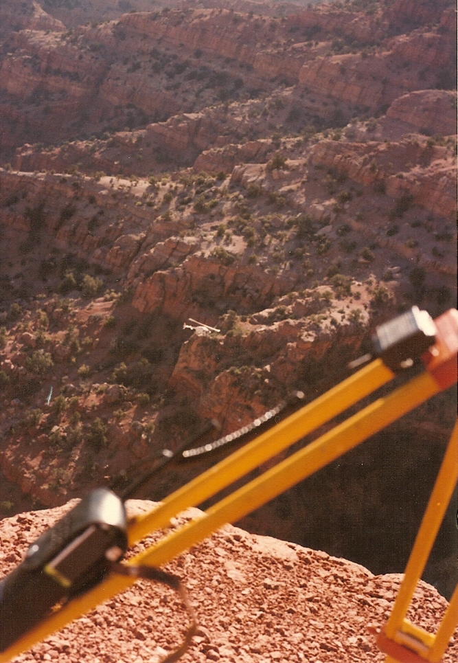 Crazy HollowMountain biking · ~19 min drivePhoto: Lorne Kelly, CC BY-SA 3.0 (via Wikimedia Commons)
- Trail 1440Mountain biking · ~2 min drive
- Trail 1433Mountain biking · ~2 min drive
- Horse Hollow - CopleysMountain biking · ~2 min drive
- Copleys CanyonMountain biking · ~3 min drive
- White Sage Flat - ShinglemillMountain biking · ~3 min drive
Best time to visit Tr 327
Best months: May–June and September–October. Best months have typical highs of 55–85 °F, lows of 30 °F or warmer (32 °F where the station doesn't record snow), at most one snowy day and no more than 12 wet days.
Jan
38° / 21°
7 wet · 5 snow
Feb
45° / 25°
8 wet · 5 snow
Mar
55° / 32°
8 wet · 4 snow
Apr
62° / 37°
8 wet · 3 snow
May
72° / 45°
7 wet
Jun
82° / 53°
4 wet
Jul
88° / 60°
4 wet
Aug
86° / 60°
5 wet
Sep
78° / 51°
5 wet
Oct
64° / 39°
5 wet · 1 snow
Nov
50° / 29°
6 wet · 3 snow
Dec
38° / 21°
7 wet · 5 snow
Typical high / low (°F) and days with rain or snow, 1991–2020. Measured at Fillmore, UT, 4 mi away at 5,127 ft. The station sits about 1,500 ft lower than this place, so expect it a little cooler here. Source: NOAA NCEI U.S. Climate Normals 1991–2020.

Map and trail data © OpenStreetMap contributors
