Upper Jump
- 5,621 ft
- elevation
- National Park Service
- managed by
- Mar–May, Sep–Oct
- best months
Is Upper Jump open right now?
Alert in the area
The National Park Service lists an alert for Canyonlands National Park.
Mineral Bottom and White Rim Road Remain Muddy in Parts, Not Recommended
Park alert covering Canyonlands National Park · NPS · Canyonlands National Park
As of · Source: NPS · Canyonlands National Park. Agencies don't list every closure — check before you go.
Upper Jump is a waterfall in Canyonlands National Park in Utah, managed by the National Park Service. It sits at about 5,620 feet, roughly 26 miles from the town of Monticello. Spring and fall are the most comfortable times to visit. Typical averages from a nearby weather station at The Needles show May highs around 77°F and October highs around 70°F, while July averages about 95°F and winter highs hover near 42°F. Several other spots lie close by. Angel Arch is about a mile away, and the Fortress Arch Trail and Castle Arch Trail are each a little over 2 miles off. For an overnight stay, Canyonlands National Park Needles District Campground is about 9 miles away.
- Elevation
- 5,621 ft
- Land manager
- National Park Service
Elevation from USGS 3D Elevation Program terrain data (about 10 m resolution).
 Angel ArchHikingPhoto: Ken Lund from Reno, Nevada, USA, CC BY-SA 2.0 (via Wikimedia Commons)1 mi
- Fortress Arch TrailHiking2.2 mi
- Castle Arch TrailHiking2.3 mi
- Eastwood CragRock climbing7.6 mi
 South SixshooterRock climbingPhoto: katsrcool, CC BY 2.0 (via Wikimedia Commons)8.2 mi
- Vitamin D WallRock climbing8.4 mi
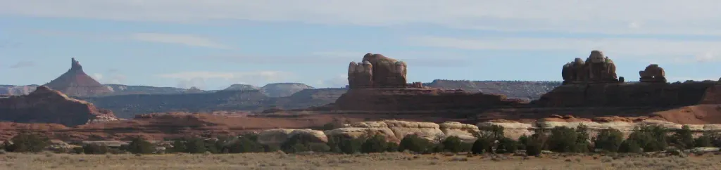 Canyonlands National Park Needles District CampgroundCampingPhoto: Recreation.gov (RIDB) / public domain8.8 mi
- Indian CreekCanoeing8.9 mi
Source: Roamze catalog (indexable pages within 10 miles, PostGIS distance)
Also worth it near here
- Angel ArchHiking · ~2 min drivePhoto: Ken Lund from Reno, Nevada, USA, CC BY-SA 2.0 (via Wikimedia Commons)
 Druid ArchNatural arch · ~8 min drivePhoto: J. Benjamin Wildeboer (talk · contribs), Ben W on flickr, CC BY-SA 2.0 (via Wikimedia Commons)
- Boundary ButteMountain biking · ~13 min drive
- South SixshooterRock climbing · ~14 min drivePhoto: katsrcool, CC BY 2.0 (via Wikimedia Commons)
Best time to visit Upper Jump
Best months: March–May and September–October. Best months have typical highs of 55–85 °F, lows of 30 °F or warmer (32 °F where the station doesn't record snow), at most one snowy day and no more than 12 wet days.
Jan
42° / 17°
4 wet · 2 snow
Feb
49° / 23°
4 wet · 1 snow
Mar
59° / 30°
5 wet · 1 snow
Apr
67° / 36°
5 wet
May
77° / 46°
4 wet
Jun
89° / 56°
3 wet
Jul
95° / 63°
5 wet
Aug
92° / 61°
6 wet
Sep
84° / 51°
5 wet
Oct
70° / 38°
5 wet
Nov
55° / 26°
4 wet · 1 snow
Dec
42° / 18°
4 wet · 2 snow
Typical high / low (°F) and days with rain or snow, 1991–2020. Measured at Canyonlands-The Needles, UT, 8.7 mi away at 4,906 ft. The station sits about 700 ft lower than this place, so expect it a little cooler here. Source: NOAA NCEI U.S. Climate Normals 1991–2020.
