Zion Canyon Campground and RV Resort
Campground
Campground · 0.6 mi from the trail
Clear at last check
Weather is good · OpenWeather · checked 21 h ago
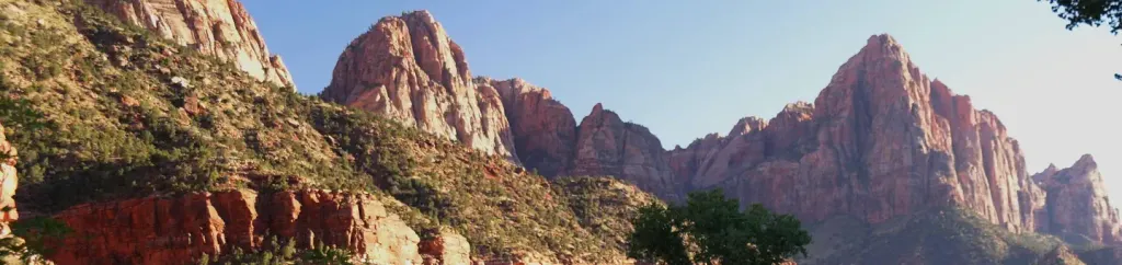
Town Trail is a short, easy out-and-back hike on Bureau of Land Management land in Utah's St. George Field Office, about a mile from the start. It is a low-key outing, with a total round-trip distance of about 2.2 miles and a total elevation gain of about 396 feet. The trail reaches a high point of about 4,011 feet and returns to a low point of about 3,909 feet, so the climb is modest, with the steepest stretch coming around half a mile into the route. Spring and fall are the most comfortable times to go. Typical averages from a nearby weather station show April highs around 73°F and October highs around 78°F, while July highs average about 100°F. The hike takes about an hour, and the trail is close to several other places to pair with it. Watchman Trail is less than a mile away, and the Visitor Center Area Pathways and Watchman Campground are each about a mile off. Climbers can find The Watchman about 1.4 miles from the trail.
Zion Canyon Campground and RV Resort
Campground
 If it rainsDon Graham from Redlands, CA, USA - God bless it!, CC BY-SA 2.0 · Wikimedia Commons
Places © OpenStreetMap contributors · Photos: Don Graham from Redlands, CA, USA - God bless it!, CC BY-SA 2.0 (commons)
More in HurricaneNot on Roamze yet. Their page has how to reach them.
 Watchman CampgroundCampingPhoto: Recreation.gov (RIDB) / public domain1 mi
 The WatchmanRock climbingPhoto: Christopher Michel, CC BY 2.0 (via Wikimedia Commons)1.4 mi
 Zion BoulderingRock climbingPhoto: Don Graham from Redlands, CA, USA - God bless it!, CC BY-SA 2.0 (via Wikimedia Commons)1.4 mi
 Drilled Pocket BoulderRock climbingPhoto: © Pierre André, CC BY-SA 4.0 (via Wikimedia Commons)1.4 mi
Source: Roamze catalog (indexable pages within 10 miles, PostGIS distance)
 Nung’wu Poa (Paiute) Trail - Phase 2Hiking · ~2 min drivePhoto: Ken Lund, CC BY-SA 2.0 (via Wikimedia Commons)
 Scoggins Wash TrailHiking · ~7 min drivePhoto: Fredlyfish4, CC BY-SA 4.0 (via Wikimedia Commons)
 Many Pools HikeHiking · ~9 min drivePhoto: Ken Lund from Reno, Nevada, USA, CC BY-SA 2.0 (via Wikimedia Commons)
 Watchman TrailHiking · ~3 min drivePhoto: yashima — CC BY-SA 2.0 (via Flickr)
 Wire Mesa Loop TrailHiking · ~10 min drivePhoto: Don Graham from Redlands, CA, USA - God bless it!, CC BY-SA 2.0 (via Wikimedia Commons)
 Pa'rus TrailHiking · ~4 min drivePhoto: Ken Lund from Reno, Nevada, USA, CC BY-SA 2.0 (via Wikimedia Commons)
Best months: February–May and October–November. Best months have typical highs of 55–85 °F, lows of 30 °F or warmer (32 °F where the station doesn't record snow), at most one snowy day and no more than 12 wet days.
Jan
54° / 30°
7 wet
Feb
58° / 34°
8 wet
Mar
66° / 39°
8 wet
Apr
73° / 44°
6 wet
May
83° / 53°
4 wet
Jun
95° / 62°
3 wet
Jul
100° / 70°
5 wet
Aug
98° / 69°
6 wet
Sep
91° / 61°
5 wet
Oct
78° / 49°
5 wet
Nov
64° / 37°
5 wet
Dec
53° / 29°
6 wet · 1 snow
Typical high / low (°F) and days with rain or snow, 1991–2020. Measured at Zion Np, UT, 1.6 mi away at 4,038 ft. Source: NOAA NCEI U.S. Climate Normals 1991–2020.
Map and trail data © OpenStreetMap contributors

