Zion Canyon Campground and RV Resort
Campground
Campground · 2.7 mi from the trail
Chinle Trail is a 16.04-mile out-and-back hike in Utah with 1,809 feet of elevation gain and loss. The trail reaches a maximum elevation of 4,401 feet.
Zion Canyon Campground and RV Resort
Campground
 If it rainsDon Graham from Redlands, CA, USA - God bless it!, CC BY-SA 2.0 · Wikimedia Commons
Places © OpenStreetMap contributors · Photos: Don Graham from Redlands, CA, USA - God bless it!, CC BY-SA 2.0 (commons)
More in HurricaneNot on Roamze yet. Their page has how to reach them.
 Nung’wu Poa (Paiute) Trail - Phase 2HikingPhoto: Ken Lund, CC BY-SA 2.0 (via Wikimedia Commons)1 mi
 The WatchmanRock climbingPhoto: Christopher Michel, CC BY 2.0 (via Wikimedia Commons)2.7 mi
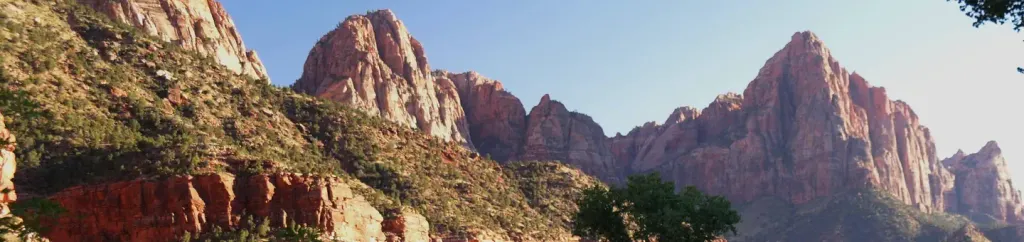 Watchman CampgroundCampingPhoto: Recreation.gov (RIDB) / public domain3.2 mi
 Drilled Pocket BoulderRock climbingPhoto: © Pierre André, CC BY-SA 4.0 (via Wikimedia Commons)3.7 mi
 Zion BoulderingRock climbingPhoto: Don Graham from Redlands, CA, USA - God bless it!, CC BY-SA 2.0 (via Wikimedia Commons)3.7 mi
Source: Roamze catalog (indexable pages within 10 miles, PostGIS distance)
Nung’wu Poa (Paiute) Trail - Phase 2Hiking · ~2 min drivePhoto: Ken Lund, CC BY-SA 2.0 (via Wikimedia Commons) Wire Mesa Loop TrailHiking · ~6 min drivePhoto: Don Graham from Redlands, CA, USA - God bless it!, CC BY-SA 2.0 (via Wikimedia Commons)
 Scoggins Wash TrailHiking · ~7 min drivePhoto: Fredlyfish4, CC BY-SA 4.0 (via Wikimedia Commons)
 Huber Wash TrailHiking · ~4 min drivePhoto: Fredlyfish4, CC BY-SA 4.0 (via Wikimedia Commons)
 Many Pools HikeHiking · ~12 min drivePhoto: Ken Lund from Reno, Nevada, USA, CC BY-SA 2.0 (via Wikimedia Commons)
 Canaan Mountain TrailHiking · ~12 min drivePhoto: BLMUtah, Public domain (via Wikimedia Commons)
 Watchman TrailHiking · ~6 min drivePhoto: yashima — CC BY-SA 2.0 (via Flickr)
Also worth it near here
 Johnson MountainSummit · ~3 min drivePhoto: Doc Searls, CC BY-SA 2.0 (via Wikimedia Commons)The WatchmanRock climbing · ~5 min drivePhoto: Christopher Michel, CC BY 2.0 (via Wikimedia Commons)
 Gander TrailMountain biking · ~11 min drivePhoto: Don Graham from Redlands, CA, USA - God bless it!, CC BY-SA 2.0 (via Wikimedia Commons)
Best months: February–May and October–November. Best months have typical highs of 55–85 °F, lows of 30 °F or warmer (32 °F where the station doesn't record snow), at most one snowy day and no more than 12 wet days.
Jan
54° / 30°
7 wet
Feb
58° / 34°
8 wet
Mar
66° / 39°
8 wet
Apr
73° / 44°
6 wet
May
83° / 53°
4 wet
Jun
95° / 62°
3 wet
Jul
100° / 70°
5 wet
Aug
98° / 69°
6 wet
Sep
91° / 61°
5 wet
Oct
78° / 49°
5 wet
Nov
64° / 37°
5 wet
Dec
53° / 29°
6 wet · 1 snow
Typical high / low (°F) and days with rain or snow, 1991–2020. Measured at Zion Np, UT, 3.9 mi away at 4,038 ft. Source: NOAA NCEI U.S. Climate Normals 1991–2020.
Map and trail data © OpenStreetMap contributors
