South Campground
Campground
Campground · 0.2 mi from the trail
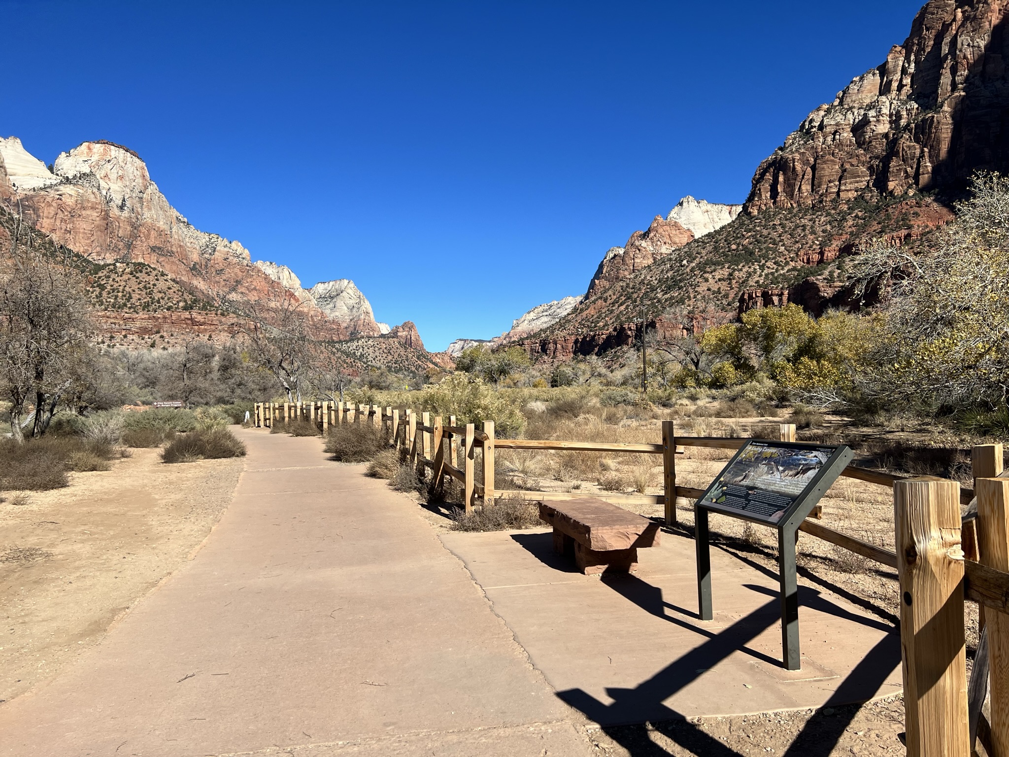 Photo: NPS/Abi Farish
Closure in the area
There's a closure order in Zion National Park. It doesn't name Pa'rus - A Living Canyon, so check the source for the area it covers (2 listed).
Narrows and All Slot Canyons in Zion National Park Closed
Park closure covering Zion National Park · NPS · Zion National Park
Watchman Trail closed
Park closure covering Zion National Park · NPS · Zion National Park
Toxic cyanobacteria in rivers, streams, and pools
Park alert covering Zion National Park · NPS · Zion National Park
Large vehicle restrictions on Zion-Mt. Carmel Highway
Park alert covering Zion National Park · NPS · Zion National Park
As of · Source: NPS · Zion National Park. Agencies don't list every closure — check before you go.
A Living Canyon Learn Zion's diverse topography leads to a diversity of habitats and species. Along the Virgin River, the riparian area is home to plants and animals that require an abundant supply of water. Fremont cottonwood trees (Populus fremontii) require a constant source of water and thrive along the Virgin River. When Fremont cottonwoods have access to reliable water, they can grow between 10–20 feet per year. These trees can also be helpful for streambank protection and are able to withstand low levels of flooding. The riparian area is also the perfect habitat for the American beaver. You may not immediately think of the American beaver when in the Southwest, but the Virgin River provides a welcome habitat for this river specialist. Sightings are rare, but evidence of the beaver's activity can be seen on many of the park's Fremont cottonwood trees. They do most of their tree-chewing during the night when the cover of darkness helps them to avoid predators. Look Have you seen any evidence of wildlife along the trail? The tall shrubs and plants along the trail like Utah Juniper and Rabbitbrush provide food and shelter for a variety of mammals, birds, and reptiles. Along the trail keep an eye out for wildlife like mule deer, road runner, and western scrub jays. Connect Zion Canyon would be inhospitable for plants and wildlife without water. How would our experience as visitors change if there were no water present in Zion Canyon?
South Campground
Campground
 If it rainsDon Graham from Redlands, CA, USA - God bless it!, CC BY-SA 2.0 · Wikimedia Commons
Places © OpenStreetMap contributors · Photos: Don Graham from Redlands, CA, USA - God bless it!, CC BY-SA 2.0 (commons)
More in HurricaneNot on Roamze yet. Their page has how to reach them.
Best months: February–May and October–November. Best months have typical highs of 55–85 °F, lows of 30 °F or warmer (32 °F where the station doesn't record snow), at most one snowy day and no more than 12 wet days.
Jan
54° / 30°
7 wet
Feb
58° / 34°
8 wet
Mar
66° / 39°
8 wet
Apr
73° / 44°
6 wet
May
83° / 53°
4 wet
Jun
95° / 62°
3 wet
Jul
100° / 70°
5 wet
Aug
98° / 69°
6 wet
Sep
91° / 61°
5 wet
Oct
78° / 49°
5 wet
Nov
64° / 37°
5 wet
Dec
53° / 29°
6 wet · 1 snow
Typical high / low (°F) and days with rain or snow, 1991–2020. Measured at Zion Np, UT, 0.4 mi away at 4,038 ft. Source: NOAA NCEI U.S. Climate Normals 1991–2020.
HIKE
Pa'rus - Footprints in Time
Next door
Footprints in Time Learn The Museum Collections and Archives at Zion National Park include archival documents, artifacts, photos, and ethnographic objects that help us understand how humans survived and adapted in the Zion area. Natural history specimens such as Zion’s…
 Photo: yashima — CC BY-SA 2.0 (via Flickr)
Watchman Trail
Next door
1.77-mile loop trail in Utah with 654 ft gain.
 Photo: Ken Lund from Reno, Nevada, USA, CC BY-SA 2.0 (via Wikimedia Commons)
Many Pools Hike
~7 min drive
2.08-mile out-and-back hike in Utah with 858 ft gain and 6,141 ft max elevation.
 Photo: Fredlyfish4, CC BY-SA 4.0 (via Wikimedia Commons)
Scoggins Wash Trail
~9 min drive
2.80-mile out-and-back trail in Utah with 964 ft elevation gain.
HIKE
Chinle Trail
~6 min drive
16.04-mile out-and-back hike in Utah with 1,809 ft gain/loss.
HIKE
Pa'rus - Creation from Destruction
Next door
Creation From Destruction Learn The Virgin River is the primary agent of erosion that continues to carve and shape Zion. The North Fork of the Virgin River begins north of Zion at Cascade Falls, where it drains out of Navajo Lake at 9,000 feet above sea level. It empties…
 Photo: Ken Lund from Reno, Nevada, USA, CC BY-SA 2.0 (via Wikimedia Commons)
Pa'rus Trail
~2 min drive
1.58-mile out-and-back trail in Utah with 65 ft of elevation gain.
HIKE
Nung’wu Poa (Paiute) Trail
~4 min drive
2.18-mile out-and-back trail in Utah with 890 ft gain and loss.
HIKE
Sand Bench Trail
~4 min drive
8.26-mile out-and-back hike in Utah with 1,915 ft elevation gain/loss.
HIKE
Pa'rus - Changing Landscapes
Next door
Changing Landscapes Learn Rock layers of Zion Canyon are arranged in a way that allows water to travel through them. The desert sand dunes that formed the Navajo Sandstone layer contain wind-blown sand particles that have space in-between them. The ancient floodplain that…


