Salvation Knoll
- 0.2 mi
- distance
- 7,241 ft
- high point
- Lollipop
- route
- Easy
- difficulty
- Apr–Jun, Aug–Oct
- best months
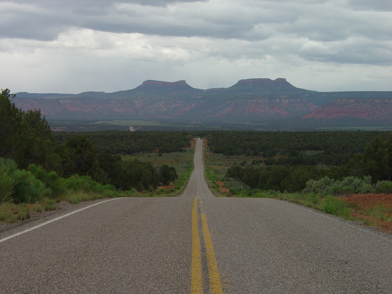
Salvation Knoll is a short, easy hike on Bureau of Land Management land within the Monticello Field Office in Utah, about 0.22 miles long and climbing from about 7,109 to 7,241 feet. The route sits on natural ground, and the land office doesn't allow horses or bikes. The most comfortable months are late spring and early fall. Typical averages from a nearby weather station at Natural Bridges show May highs around 71°F and September highs around 77°F, with July peaking near 89°F and winter lows near 20°F. That station sits about 700 feet lower than the knoll, so temperatures up high run cooler. Several trails lie within a few miles. Salvation Knoll Trail (475) is about 1.5 miles away, and Mule Canyonn Trail, West Rim Texas Canyon and Lyman Canyon are all within about 2.5 miles.
Local outfitters
- Coral Sands RV Park24 mi away
- Sacred Monument Tours43 mi away
Not on Roamze yet. Their page has how to reach them.
 Salvation Knoll Trail (475)HikingPhoto: Ken Lund from Reno, Nevada, USA, CC BY-SA 2.0 (via Wikimedia Commons)1.5 mi
- Mule Canyonn TrailHiking2.2 mi
- West Rim Texas CanyonHikingPhoto: Ken Lund from Reno, Nevada, USA, CC BY-SA 2.0 (via Wikimedia Commons)2.4 mi
- Lyman CanyonHiking2.5 mi
- Texas TrailHikingPhoto: Ken Lund from Reno, Nevada, USA, CC BY-SA 2.0 (via Wikimedia Commons)3.2 mi
 Lyman Canyon OverlookMountain bikingPhoto: brewbooks from near Seattle, USA, CC BY-SA 2.0 (via Wikimedia Commons)3.8 mi
 Short Point TrailMountain bikingPhoto: brewbooks from near Seattle, USA, CC BY-SA 2.0 (via Wikimedia Commons)4.2 mi
- Arch CanyonHiking4.3 mi
Source: Roamze catalog (indexable pages within 10 miles, PostGIS distance)
- Salvation Knoll Trail (475)Hiking · ~3 min drivePhoto: Ken Lund from Reno, Nevada, USA, CC BY-SA 2.0 (via Wikimedia Commons)
- West Rim Texas CanyonHiking · ~4 min drivePhoto: Ken Lund from Reno, Nevada, USA, CC BY-SA 2.0 (via Wikimedia Commons)
 Grand Gulch TrailHiking · ~16 min drivePhoto: Greg Willis, CC BY-SA 3.0 (via Wikimedia Commons)
 Cream Pots (Sz)Hiking · ~18 min drivePhoto: Ken Lund from Reno, Nevada, USA, CC BY-SA 2.0 (via Wikimedia Commons)
 Kane Gulch TrailHiking · ~11 min drivePhoto: Greg Willis, CC BY-SA 3.0 (via Wikimedia Commons)
- Texas TrailHiking · ~5 min drivePhoto: Ken Lund from Reno, Nevada, USA, CC BY-SA 2.0 (via Wikimedia Commons)
- Woodenshoe RoadHiking · ~11 min drive
- Mule Canyon TrailHiking · ~7 min drive
- Grand Gulch TrailHiking · ~11 min drivePhoto: Greg Willis, CC BY-SA 3.0 (via Wikimedia Commons)
- Arch CanyonHiking · ~7 min drive
Also worth it near here
Best time to visit Salvation Knoll
Best months: April–June and August–October. Best months have typical highs of 55–85 °F, lows of 30 °F or warmer (32 °F where the station doesn't record snow), at most one snowy day and no more than 12 wet days.
Jan
39° / 20°
6 wet · 4 snow
Feb
43° / 24°
6 wet · 3 snow
Mar
53° / 30°
5 wet · 2 snow
Apr
60° / 35°
5 wet · 1 snow
May
71° / 44°
5 wet
Jun
83° / 54°
3 wet
Jul
89° / 60°
7 wet
Aug
85° / 58°
8 wet
Sep
77° / 51°
6 wet
Oct
63° / 39°
5 wet
Nov
50° / 29°
4 wet · 2 snow
Dec
39° / 20°
6 wet · 4 snow
Typical high / low (°F) and days with rain or snow, 1991–2020. Measured at Natural Bridges Nm, UT, 9.2 mi away at 6,508 ft. The station sits about 700 ft lower than this place, so expect it a little cooler here. Source: NOAA NCEI U.S. Climate Normals 1991–2020.
Route details
- Distance
- 0.2 mi
- Summit
- 7,241 ft
- Difficulty
- Easy
- Time
- About 0 hours
Questions about this route
How long is the Salvation Knoll on Salvation Knoll?
About 0.2 mi.
How hard is the Salvation Knoll?
It is rated easy.
How long does the Salvation Knoll take?
About 0 hours round trip.
Conditions and forecast on Salvation Knoll
Daily highs and lows, wind and the chance of precipitation at the summit and route start for the next 7 days, from the Open-Meteo model.
