Short Point Trail
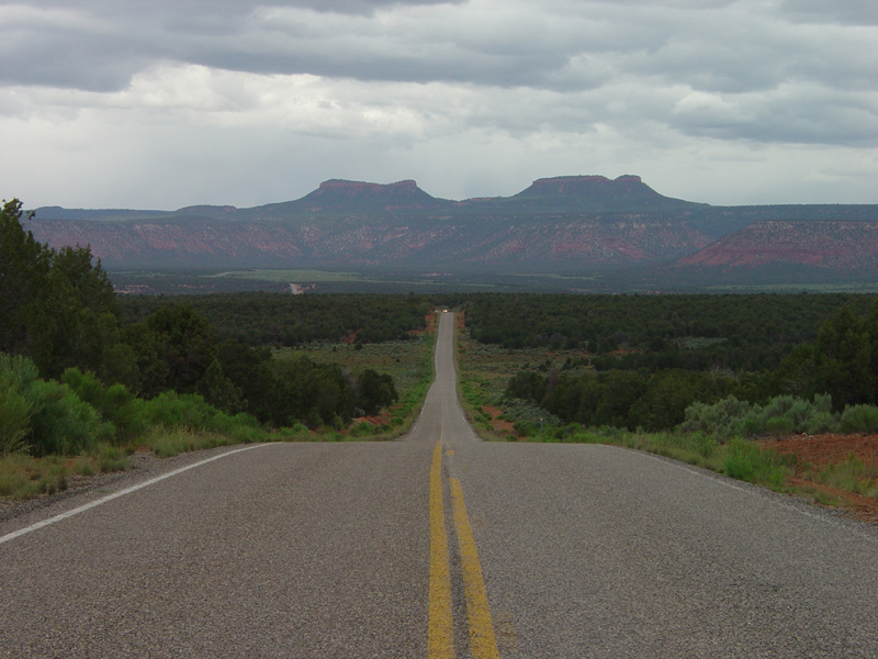
 Photo: brewbooks from near Seattle, USA, CC BY-SA 2.0 (via Wikimedia Commons)
- 0.8 mi
- distance
- 89 ft
- climb
- Apr–Jun, Aug–Oct
- best months
Caution at last check
Agency alerts are in effect for this area; weather is marginal · USFS, OpenWeather · checked 18 h ago
Is Short Point Trail open right now?
No closures listed
The Forest Service lists no closures for Manti-La Sal National Forest.
As of · Source: USFS · Manti-La Sal National Forest. Agencies don't list every closure — check before you go.
Short Point Trail is a mountain biking route in the Monticello Ranger District of Manti-La Sal National Forest in Utah, managed by the Forest Service. The trail is about 0.75 miles long and rises roughly 90 feet from its low point of about 7,960 feet to a high of about 8,066 feet. Late spring and early fall are the most comfortable times to ride. Typical averages from a nearby weather station show May highs around 71°F and September highs around 77°F, while July peaks near 89°F. That station sits about 1,600 feet below the trail, so temperatures on the route run cooler. Bears Ears Loop is about 0.7 miles away, and Lyman Canyon Overlook is about 1.3 miles off. Lyman Canyon and West Rim Texas Canyon are both within about 2.6 miles.
Best time to go · Apr–Jun, Aug–Oct
Best time to visit Short Point Trail
Best months: April–June and August–October. Best months have typical highs of 55–85 °F, lows of 30 °F or warmer (32 °F where the station doesn't record snow), at most one snowy day and no more than 12 wet days.
Jan
39° / 20°
6 wet · 4 snow
Feb
43° / 24°
6 wet · 3 snow
Mar
53° / 30°
5 wet · 2 snow
Apr
60° / 35°
5 wet · 1 snow
May
71° / 44°
5 wet
Jun
83° / 54°
3 wet
Jul
89° / 60°
7 wet
Aug
85° / 58°
8 wet
Sep
77° / 51°
6 wet
Oct
63° / 39°
5 wet
Nov
50° / 29°
4 wet · 2 snow
Dec
39° / 20°
6 wet · 4 snow
Typical high / low (°F) and days with rain or snow, 1991–2020. Measured at Natural Bridges Nm, UT, 6 mi away at 6,508 ft. The station sits about 1,600 ft lower than this place, so expect it a little cooler here. Source: NOAA NCEI U.S. Climate Normals 1991–2020.
Keep exploring — more rides worth the drive
Photo: brewbooks from near Seattle, USA, CC BY-SA 2.0 (via Wikimedia Commons)Bears Ears Loop
~2 min drive
2.47-mile trail in Utah's Posey Spring trail system with 898 ft of elevation gain.
RIDE
Squaw Canyon Spur
~1h 14m drive
1.40-mile easy singletrack in Utah with 221 ft elevation gain.
 Photo: brewbooks from near Seattle, USA, CC BY-SA 2.0 (via Wikimedia Commons)
Lyman Canyon Overlook
~2 min drive
1.39-mile point-to-point trail in Utah's Posey Spring system with 72 ft of elevation gain.
RIDE
East Texas Rim
~6 min drive
East Texas Rim is a 2.13-mile trail at Posey Spring, Utah with 841 ft of elevation gain.
RIDE
Texas Trail
~8 min drive
2.18-mile trail in Utah's Posey Spring trail system with 484 ft elevation gain.
RIDE
Arch Canyon
~9 min drive
Arch Canyon is a 4.89-mile trail in Utah with 1,792 ft of elevation gain.
RIDE
Butts Canyon
~10 min drive
0.80-mile trail in Utah's Posey Spring trail system with 114 ft of elevation gain.
RIDE
Lost Scout Trail
~35 min drive
0.79-mile out-and-back trail in Utah with 124 ft elevation gain.
RIDE
Skyline
~36 min drive
Skyline is a 0.60-mile trail in Mule Canyon, Utah with 672 ft of elevation gain.
RIDE
Trough Canyon Trail
~37 min drive
0.99-mile trail in Mule Canyon, Utah with 115 ft elevation gain

Map and trail data © OpenStreetMap contributors
