South Campground
Campground
Campground · 0.6 mi from the trail
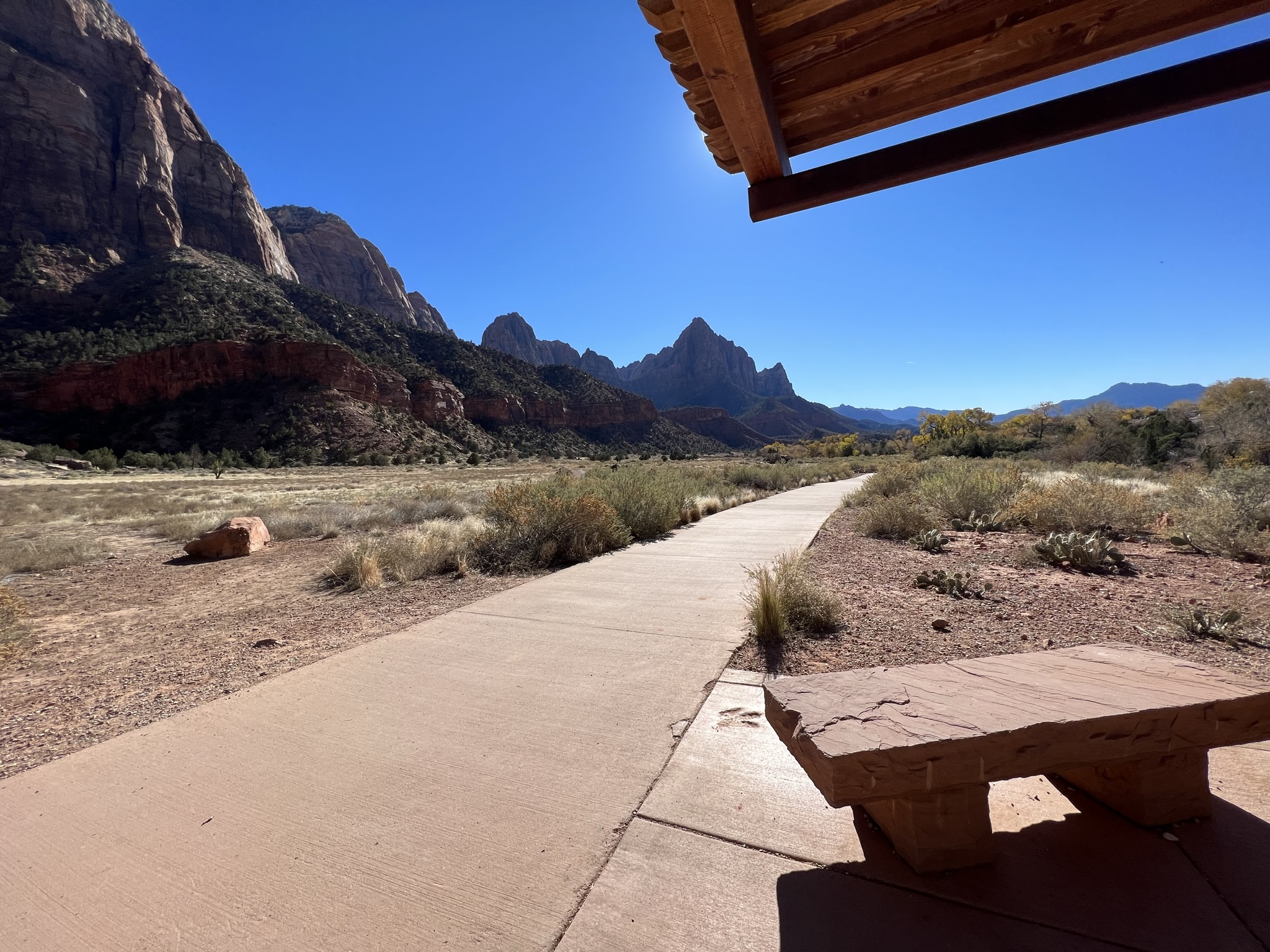 Photo: NPS/Abi Farish
Clear at last check
Weather is good · OpenWeather · checked 21 h ago
Closure in the area
There's a closure order in Zion National Park. It doesn't name Pa'rus - Changing Landscapes, so check the source for the area it covers.
Watchman Trail closed
Park closure covering Zion National Park · NPS · Zion National Park
Toxic cyanobacteria in rivers, streams, and pools
Park alert covering Zion National Park · NPS · Zion National Park
Large vehicle restrictions on Zion-Mt. Carmel Highway
Park alert covering Zion National Park · NPS · Zion National Park
As of · Source: NPS · Zion National Park. Agencies don't list every closure — check before you go.
Changing Landscapes Learn Rock layers of Zion Canyon are arranged in a way that allows water to travel through them. The desert sand dunes that formed the Navajo Sandstone layer contain wind-blown sand particles that have space in-between them. The ancient floodplain that formed the Kayenta layer is a mudstone that has tightly packed together particles. Water that is absorbed at the highest points of the canyon can travel through the Navajo Sandstone, but is not able to travel through the tightly packed mudstone particles of the Kayenta layer. Where these two rock layers meet, water is forced to travel sideways until it comes out of the rock face in the form of seeps and springs. Look Do you see any evidence of seeps and springs at the boundary of the Navajo Sandstone and Kayenta layer? Cottonwood trees and other water-loving plants are a good indication of a nearby water source. Connect Zion National Park is located along the edge of a region known as the Colorado Plateau. Here, the rock layers have been uplifted, tilted, and eroded, forming a feature called the Grand Staircase, a series of colorful cliffs stretching between Bryce Canyon and the Grand Canyon. Each rock layer of the Grand Staircase holds stories of ancient environments and inhabitants very different from those found here today. What stories will you uncover?
South Campground
Campground
 If it rainsDon Graham from Redlands, CA, USA - God bless it!, CC BY-SA 2.0 · Wikimedia Commons
Places © OpenStreetMap contributors · Photos: Don Graham from Redlands, CA, USA - God bless it!, CC BY-SA 2.0 (commons)
More in HurricaneNot on Roamze yet. Their page has how to reach them.
Best months: February–May and October–November. Best months have typical highs of 55–85 °F, lows of 30 °F or warmer (32 °F where the station doesn't record snow), at most one snowy day and no more than 12 wet days.
Jan
54° / 30°
7 wet
Feb
58° / 34°
8 wet
Mar
66° / 39°
8 wet
Apr
73° / 44°
6 wet
May
83° / 53°
4 wet
Jun
95° / 62°
3 wet
Jul
100° / 70°
5 wet
Aug
98° / 69°
6 wet
Sep
91° / 61°
5 wet
Oct
78° / 49°
5 wet
Nov
64° / 37°
5 wet
Dec
53° / 29°
6 wet · 1 snow
Typical high / low (°F) and days with rain or snow, 1991–2020. Measured at Zion Np, UT, 0.2 mi away at 4,038 ft. Source: NOAA NCEI U.S. Climate Normals 1991–2020.
HIKE
Pa'rus - Creation from Destruction
Next door
Creation From Destruction Learn The Virgin River is the primary agent of erosion that continues to carve and shape Zion. The North Fork of the Virgin River begins north of Zion at Cascade Falls, where it drains out of Navajo Lake at 9,000 feet above sea level. It empties…
 Photo: Ken Lund from Reno, Nevada, USA, CC BY-SA 2.0 (via Wikimedia Commons)
Pa'rus Trail
Next door
1.58-mile out-and-back trail in Utah with 65 ft of elevation gain.
 Photo: Ken Lund from Reno, Nevada, USA, CC BY-SA 2.0 (via Wikimedia Commons)
Many Pools Hike
~6 min drive
2.08-mile out-and-back hike in Utah with 858 ft gain and 6,141 ft max elevation.
HIKE
Sand Bench Trail
~3 min drive
8.26-mile out-and-back hike in Utah with 1,915 ft elevation gain/loss.
HIKE
Chinle Trail
~7 min drive
16.04-mile out-and-back hike in Utah with 1,809 ft gain/loss.
HIKE
Pa'rus - Virgin River Wayside
Next door
Virgin River Learn In July of 2020, the Utah Department of Environmental Quality’s (DEQ) Division of Water Quality (DWQ) and the National Park Service (NPS) detected toxic cyanobacteria algal blooms in multiple areas of the North Fork of the Virgin River. Cyanobacteria are a…
 Photo: yashima — CC BY-SA 2.0 (via Flickr)
Watchman Trail
~1 min drive
1.77-mile loop trail in Utah with 654 ft gain.
HIKE
Nung’wu Poa (Paiute) Trail
~5 min drive
2.18-mile out-and-back trail in Utah with 890 ft gain and loss.
HIKE
East Rim Trail
~9 min drive
Moderate 10.6-mile rim trail with 2,267 ft gain and scenic overlook views.
HIKE
Pa'rus - Diversion Dam
Next door
Diversion Dam Learn On March 30, 2009, the upper section of the Virgin River and its tributaries were designated as Wild and Scenic Rivers. But what makes rivers “wild and scenic”? The Wild and Scenic Rivers Act was approved by Congress in October, 1968. Its purpose: to…


