Long Park Reservoir Trail
- 0.5 mi
- round trip
- 129 ft
- climb
- 8,676 ft
- high point
- Out and back
- route
- May–Sep
- best months
Is Long Park Reservoir Trail open right now?
Alert in the area
The Forest Service lists 2 alerts for Ashley National Forest.
Anvil Draw Boat Ramp Temporary Closure
Agency alert covering Ashley National Forest · Order 0401-26-01-03 · USFS · Ashley National Forest
Flaming Gorge Reservoir Water Levels
Agency alert covering Ashley National Forest · USFS · Ashley National Forest
As of · Source: USFS · Ashley National Forest. Agencies don't list every closure — check before you go.
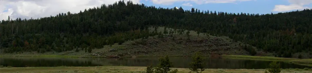
Long Park Reservoir Trail is a short, easy out-and-back hike in the Flaming Gorge Ranger District of Ashley National Forest in Utah, managed by the Forest Service. The trail is about 0.9 miles long, with a total elevation gain of 129 feet, and it starts at roughly 8,656 feet, reaching a high point of about 8,676 feet before returning to the starting level. The most comfortable months for a visit are typically June through September, when typical averages from a nearby weather station run from highs around 75°F in June to about 83°F in July, with lows in the mid-40s to low 50s. That station sits about 1,600 feet lower than the trail, so temperatures on the trail run cooler. The hike takes about half an hour, and Sols Canyon Trail lies just 0.4 miles away. Carter Military Trail is about 1.4 miles off, and Lodgepole Creek offers canoeing about 1.6 miles away. For an overnight stay, Browne Lake campground is about 4.5 miles from the trail.
Local outfitters
- Dutch John Resort At Flaming Gorge25 mi away
Not on Roamze yet. Their page has how to reach them.
- Sols Canyon TrailHiking0.4 mi
- Carter Military TrailHiking1.4 mi
- Lodgepole CreekCanoeing1.6 mi
 Sheep Creek - Windy RidgeRock climbingPhoto: Carpenter, Kenneth, CC BY-SA 4.0 (via Wikimedia Commons)4.3 mi
- Browne LakeCamping4.5 mi
 Browne Lake Group SitesCampingPhoto: Recreation.gov (RIDB) / public domain4.6 mi
- Sheep CreekCanoeing5.1 mi
- ShredderRock climbingPhoto: Carpenter, Kenneth, CC BY-SA 4.0 (via Wikimedia Commons)5.7 mi
Source: Roamze catalog (indexable pages within 10 miles, PostGIS distance)
- Sols Canyon TrailHiking · Next door
- Hickerson Park-Birch Creek RoadHiking · ~3 min drive
- Hickerson ParkHiking · ~6 min drive
- Beaver Creek-Weyman ParkHiking · ~5 min drive
- Hickerson Park-Birch Creek RoadHiking · ~4 min drive
- North Fork Sheep CreekHiking · ~7 min drive
- Ute MountainHiking · ~8 min drive
- Carter Military TrailHiking · ~4 min drive
- Old Carter Military TrailHiking · ~8 min drive
- Lost LakeHiking · ~11 min drive
Best time to visit Long Park Reservoir Trail
Best months: May–September. Best months have typical highs of 55–85 °F, lows of 30 °F or warmer (32 °F where the station doesn't record snow), at most one snowy day and no more than 12 wet days.
Jan
31° / 13°
3 wet
Feb
33° / 13°
3 wet
Mar
43° / 23°
4 wet
Apr
52° / 28°
4 wet
May
63° / 37°
5 wet
Jun
75° / 46°
4 wet
Jul
83° / 54°
3 wet
Aug
81° / 53°
4 wet
Sep
71° / 43°
4 wet
Oct
57° / 31°
4 wet
Nov
41° / 21°
4 wet
Dec
31° / 12°
4 wet
Typical high / low (°F) and days with rain or snow, 1991–2020. Measured at Church Buttes Gas Plt, WY, 35.6 mi away at 7,079 ft. The station sits about 1,600 ft lower than this place, so expect it a little cooler here. This station doesn't record snowfall. Source: NOAA NCEI U.S. Climate Normals 1991–2020.
Map and trail data © OpenStreetMap contributors
