Campsite 5 - Lava Rock Camp
Campground
Campground · < 0.1 mi from the trail
 Photo: Fredlyfish4, CC BY-SA 4.0 (via Wikimedia Commons)
Clear at last check
Weather is good · OpenWeather · checked 13 h ago
Closure in the area
There's a closure order in Zion National Park. It doesn't name Coalpits Wash Trail, so check the source for the area it covers (2 listed).
Narrows are Closed.
Park closure covering Zion National Park · NPS · Zion National Park
Watchman Trail closed
Park closure covering Zion National Park · NPS · Zion National Park
Toxic cyanobacteria in rivers, streams, and pools
Park alert covering Zion National Park · NPS · Zion National Park
Large vehicle restrictions on Zion-Mt. Carmel Highway
Park alert covering Zion National Park · NPS · Zion National Park
As of · Source: NPS · Zion National Park. Agencies don't list every closure — check before you go.
Coalpits Wash Trail is an easy out-and-back hike in Utah's Zion National Park, within the Zion Wilderness. The trail is managed by the National Park Service and runs about 3.6 miles round trip, with a total elevation gain of 760 feet. The route starts at roughly 4,104 feet and reaches a high point of 4,134 feet before returning to the starting elevation. Spring and fall are the most comfortable times to go. Typical averages from a nearby weather station show April highs around 73°F and October highs around 78°F, while July averages about 100°F. The trip takes about 1.5 hours. Scoggins Wash Trail lies about 1.5 miles away, and the Lime With A Twist Trail and Holy Guacamole mountain biking routes are each about 2 miles off. Watchman Campground is about 5 miles away.
Campsite 5 - Lava Rock Camp
Campground
Black Sage
Restaurant
 If it rainsDon Graham from Redlands, CA, USA - God bless it!, CC BY-SA 2.0 · Wikimedia Commons
Places © OpenStreetMap contributors · Photos: Don Graham from Redlands, CA, USA - God bless it!, CC BY-SA 2.0 (commons)
More in HurricaneNot on Roamze yet. Their page has how to reach them.
 Scoggins Wash TrailHikingPhoto: Fredlyfish4, CC BY-SA 4.0 (via Wikimedia Commons)1.5 mi
 Zion BoulderingRock climbingPhoto: Don Graham from Redlands, CA, USA - God bless it!, CC BY-SA 2.0 (via Wikimedia Commons)4.7 mi
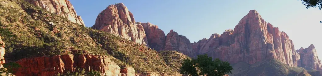 Watchman CampgroundCampingPhoto: Recreation.gov (RIDB) / public domain5.2 mi
 Drilled Pocket BoulderRock climbingPhoto: © Pierre André, CC BY-SA 4.0 (via Wikimedia Commons)5.3 mi
 SentinelRock climbingPhoto: Don Graham from Redlands, CA, USA - God bless it!, CC BY-SA 2.0 (via Wikimedia Commons)5.5 mi
Source: Roamze catalog (indexable pages within 10 miles, PostGIS distance)
Scoggins Wash TrailHiking · ~3 min drivePhoto: Fredlyfish4, CC BY-SA 4.0 (via Wikimedia Commons)Huber Wash TrailHiking · ~4 min drivePhoto: Fredlyfish4, CC BY-SA 4.0 (via Wikimedia Commons) Wire Mesa Loop TrailHiking · ~10 min drivePhoto: Don Graham from Redlands, CA, USA - God bless it!, CC BY-SA 2.0 (via Wikimedia Commons)
 Dry Wash TrailHiking · ~12 min drivePhoto: Ken Lund from Reno, Nevada, USA, CC BY-SA 2.0 (via Wikimedia Commons)
 Nung’wu Poa (Paiute) Trail - Phase 2Hiking · ~8 min drivePhoto: Ken Lund, CC BY-SA 2.0 (via Wikimedia Commons)
Also worth it near here
 The West TempleSummit · ~5 min drivePhoto: Don Graham from Redlands, CA, USA - God bless it!, CC BY-SA 2.0 (via Wikimedia Commons)Zion BoulderingRock climbing · ~8 min drivePhoto: Don Graham from Redlands, CA, USA - God bless it!, CC BY-SA 2.0 (via Wikimedia Commons)
Best months: February–May and October–November. Best months have typical highs of 55–85 °F, lows of 30 °F or warmer (32 °F where the station doesn't record snow), at most one snowy day and no more than 12 wet days.
Jan
54° / 30°
7 wet
Feb
58° / 34°
8 wet
Mar
66° / 39°
8 wet
Apr
73° / 44°
6 wet
May
83° / 53°
4 wet
Jun
95° / 62°
3 wet
Jul
100° / 70°
5 wet
Aug
98° / 69°
6 wet
Sep
91° / 61°
5 wet
Oct
78° / 49°
5 wet
Nov
64° / 37°
5 wet
Dec
53° / 29°
6 wet · 1 snow
Typical high / low (°F) and days with rain or snow, 1991–2020. Measured at Zion Np, UT, 5.3 mi away at 4,038 ft. Source: NOAA NCEI U.S. Climate Normals 1991–2020.
Map and trail data © OpenStreetMap contributors
