Zion Glamping Adventures
Campground
Campground · 3.4 mi from the trail
 Photo: BLMUtah, Public domain (via Wikimedia Commons)
Caution at last check
Weather is marginal · OpenWeather · checked 20 h ago
Canaan Mountain Trail is a 10.5-mile out-and-back hike in Utah's Canaan Mountain Wilderness, managed by the Bureau of Land Management's St. George Field Office. The trail starts at about 7,216 feet and climbs to a high point of 7,224 feet, with a total elevation gain of 1,796 feet over the course of the round trip. The route is rated hard, and the climb is steep enough to make the trip a full-day commitment. The trail's high point is just a few feet above the starting elevation, so the climb is roughly equal in both directions. Plan on about 4.5 hours for the round trip, and expect the trail to be a challenge rather than a short outing. Several other destinations sit within a few miles. Water Canyon Trail is less than a mile away, and Trail to Water Canyon Arch is about 1.2 miles off. Squirrel Canyon Trail is about 1.9 miles away, and the Rock Worship climbing area is about 2.8 miles from the trail.
Zion Glamping Adventures
Campground
 If it rainsDon Graham from Redlands, CA, USA - God bless it!, CC BY-SA 2.0 · Wikimedia Commons
Places © OpenStreetMap contributors · Photos: Don Graham from Redlands, CA, USA - God bless it!, CC BY-SA 2.0 (commons)
More in HurricaneNot on Roamze yet. Their page has how to reach them.
Water Canyon TrailHikingPhoto: BLMUtah, Public domain (via Wikimedia Commons)0.9 mi Trail to Water Canyon ArchHikingPhoto: BLMUtah, Public domain (via Wikimedia Commons)1.2 miSquirrel Canyon TrailHikingPhoto: BLMUtah, Public domain (via Wikimedia Commons)1.9 mi
 Rock WorshipRock climbingPhoto: Ken Lund from Reno, Nevada, USA, CC BY-SA 2.0 (via Wikimedia Commons)2.8 mi
 Colorado City AreaRock climbingPhoto: Rodrigo Paredes from Ciudad Autónoma de Buenos Aires, Argentina, CC BY 2.0 (via Wikimedia Commons)4.4 mi
 The WatchmanRock climbingPhoto: Christopher Michel, CC BY 2.0 (via Wikimedia Commons)8.4 mi
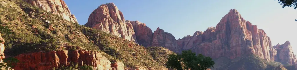 Watchman CampgroundCampingPhoto: Recreation.gov (RIDB) / public domain9.4 mi
Source: Roamze catalog (indexable pages within 10 miles, PostGIS distance)
Water Canyon TrailHiking · ~2 min drivePhoto: BLMUtah, Public domain (via Wikimedia Commons)Trail to Water Canyon ArchHiking · ~2 min drivePhoto: BLMUtah, Public domain (via Wikimedia Commons)Squirrel Canyon TrailHiking · ~3 min drivePhoto: BLMUtah, Public domain (via Wikimedia Commons) Scoggins Wash TrailHiking · ~18 min drivePhoto: Fredlyfish4, CC BY-SA 4.0 (via Wikimedia Commons)
 Nung’wu Poa (Paiute) Trail - Phase 2Hiking · ~13 min drivePhoto: Ken Lund, CC BY-SA 2.0 (via Wikimedia Commons)
 Wire Mesa Loop TrailHiking · ~12 min drivePhoto: Don Graham from Redlands, CA, USA - God bless it!, CC BY-SA 2.0 (via Wikimedia Commons)
Also worth it near here
 South MountainSummit · ~4 min drivePhoto: George A. Grant, Public domain (via Wikimedia Commons)Rock WorshipRock climbing · ~5 min drivePhoto: Ken Lund from Reno, Nevada, USA, CC BY-SA 2.0 (via Wikimedia Commons)
Map and trail data © OpenStreetMap contributors
