Centennial Trail
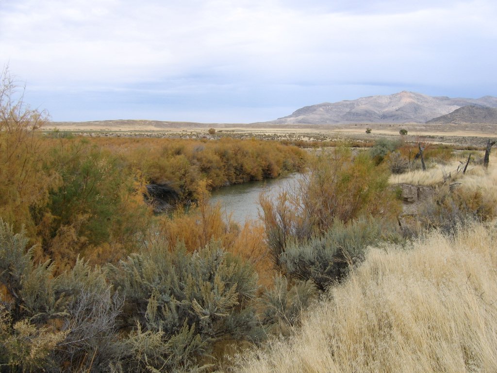
 Photo: The Dye Clan, CC BY-SA 3.0 (via Wikimedia Commons)
- 7.1 mi
- round trip
- 1,585 ft
- climb
- 5,898 ft
- high point
- Out and back
- route
- May–Jun, Sep
- best months
Is Centennial Trail open right now?
Alert in the area
The Forest Service lists 2 alerts for Fishlake National Forest.
PST 66 Rock Canyon Trail Temporarily Closed
Agency alert covering Fishlake National Forest · USFS · Fishlake National Forest
TERMINATION OF STAGE 1 FIRE RESTRICTION ORDER
Agency alert covering Fishlake National Forest · Order 0408-26-10 · USFS · Fishlake National Forest
As of · Source: USFS · Fishlake National Forest. Agencies don't list every closure — check before you go.
The Centennial Trail is a 14.1-mile out-and-back hike in Utah's Fremont Indian State Park, within the Fillmore Ranger District of Fishlake National Forest. The trail starts at about 5,778 feet and climbs to a high point of 5,898 feet, with a total elevation gain of 1,585 feet for the round trip. The route is rated hard, and the steepest stretch comes at about 2.2 miles in, where the grade reaches 14%. Spring and fall are the most comfortable times to go. Typical averages from a nearby weather station at Fremont Indian State Park show May highs around 71°F and October highs around 66°F, while July averages about 90°F and winter brings frequent snow days. The Paiute Side Trail 01 starts just 0.1 mile away, and the Fremont - Sam Stowe Cyn and Alma Christensen hikes are both within about a mile and a half. Castle Rock - Rec Site, a campground, is about 1.9 miles off.
Local outfitters
- Big Rock Candy Mountain5 mi away
- Cedar Mountain RV Resort28 mi away
Not on Roamze yet. Their page has how to reach them.
- Paiute Side Trail 01HikingPhoto: The Dye Clan, CC BY-SA 3.0 (via Wikimedia Commons)0.1 mi
- Fremont - Sam Stowe CynHiking1.1 mi
- Alma ChristensenHiking1.4 mi
 Fremont State ParkHikingPhoto: Ken Lund — CC BY-SA 2.0 (via Flickr)1.6 mi
- Castle Rock - Rec SiteCamping1.9 mi
- Museum to Mud Flat Frontage RdHiking2 mi
- Clear CreekCanoeing2.5 mi
- RichfieldRock climbing6 mi
Source: Roamze catalog (indexable pages within 10 miles, PostGIS distance)
- Paiute Side Trail 01Hiking · Next doorPhoto: The Dye Clan, CC BY-SA 3.0 (via Wikimedia Commons)
- Fremont State ParkHiking · ~3 min drivePhoto: Ken Lund — CC BY-SA 2.0 (via Flickr)
 Big Rock Candy Mountain TrailHiking · ~5 min drivePhoto: Ken Lund from Reno, NV, USA, CC BY-SA 2.0 (via Wikimedia Commons)
- CLEAR CREEK-MILL CREEKHiking · ~14 min drive
- Alma ChristensenHiking · ~2 min drive
- Fremont - Sam Stowe CynHiking · ~2 min drive
 Big Rock Candy Mountain Express Bike TrailHiking · ~5 min drivePhoto: Ken Lund from Reno, NV, USA, CC BY-SA 2.0 (via Wikimedia Commons)
- Joe LottHiking · ~7 min drive
- Pole Creek TieHiking · ~9 min drive
 POWERLINE TRAILHiking · ~7 min drivePhoto: Ken Lund from Reno, NV, USA, CC BY-SA 2.0 (via Wikimedia Commons)
Also worth it near here
Best time to visit Centennial Trail
Best months: May–June and September. Best months have typical highs of 55–85 °F, lows of 30 °F or warmer (32 °F where the station doesn't record snow), at most one snowy day and no more than 12 wet days.
Jan
42° / 12°
6 wet · 4 snow
Feb
46° / 16°
6 wet · 4 snow
Mar
55° / 22°
6 wet · 3 snow
Apr
61° / 27°
7 wet · 2 snow
May
71° / 35°
6 wet
Jun
83° / 43°
4 wet
Jul
90° / 51°
6 wet
Aug
87° / 49°
7 wet
Sep
80° / 40°
5 wet
Oct
66° / 29°
5 wet
Nov
53° / 19°
5 wet · 2 snow
Dec
42° / 12°
5 wet · 4 snow
Typical high / low (°F) and days with rain or snow, 1991–2020. Measured at Fremont Indian Sp, UT, 1 mi away at 5,920 ft. Source: NOAA NCEI U.S. Climate Normals 1991–2020.

Map and trail data © OpenStreetMap contributors
