Emory Peak
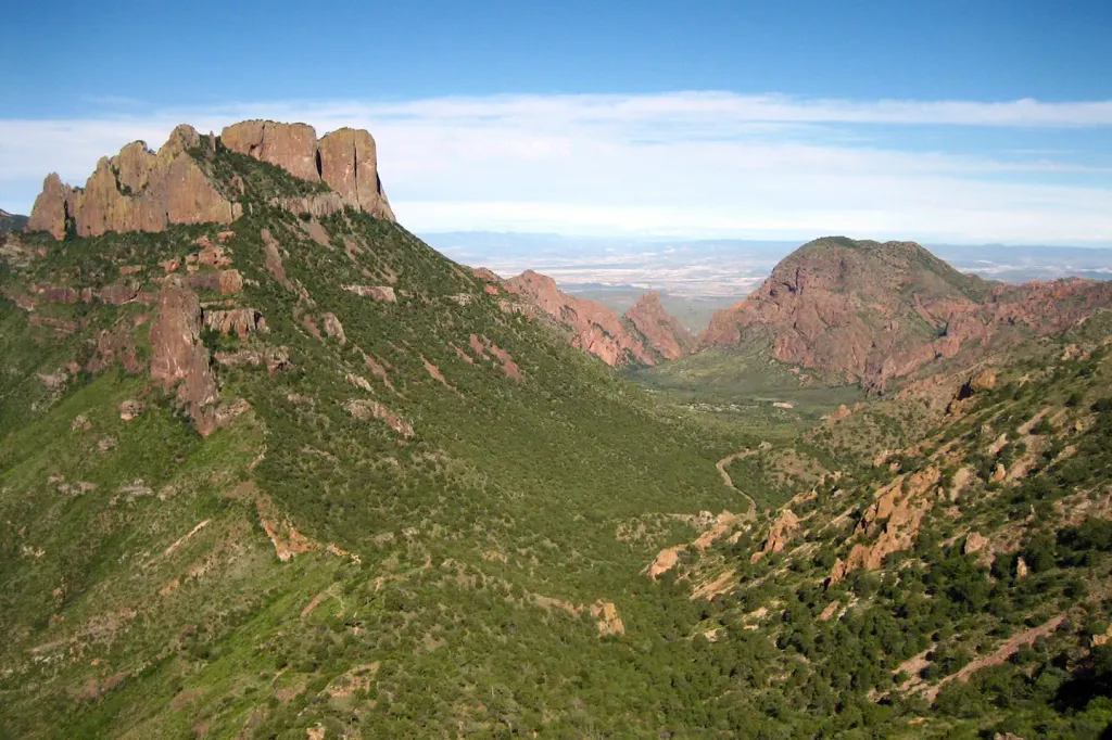
 Photo: Leaflet, Public domain (via Wikimedia Commons)
- 7,810 ft
- summit
- 1
- way up
Is Emory Peak open right now?
No closures listed
The National Park Service lists no closures for Big Bend National Park.
As of · Source: NPS · Big Bend National Park. Agencies don't list every closure — check before you go.
Emory Peak is a summit in Big Bend National Park in Texas. The nearest town is Basin Junction, about 6.8 miles away. Several trails meet within about half a mile of the peak, so a visit here ties in easily with the surrounding trail network. Laguna Meadows, the Laguna Meadows Spur and Blue Creek all sit about 0.4 miles away. Colima lies about 0.5 miles off, and Juniper Canyon and Pinnacles are each about 0.6 miles away. One notes that the park is a no-drone zone. Another covers rules for bringing a pet into the park. For an overnight base, Chisos Basin Campground is about 2 miles away. Hikers who want to round out a trip can pair it with nearby Laguna Meadows, Pinnacles or Juniper Canyon.
Conditions and forecast
Daily highs and lows, wind and the chance of precipitation at the summit and route start for the next 7 days, from the Open-Meteo model.
- Summit elevation
- 7,810 ft
Elevation from USGS 3D Elevation Program terrain data (about 10 m resolution).
Map © Mapbox © OpenStreetMap contributors Questions about Emory Peak
How tall is Emory Peak?
7,810 ft (2,380 m).
How many routes go to the summit of Emory Peak?
One: Emory Peak.
- Laguna Meadows SpurHiking0.4 mi
- Laguna MeadowsHiking0.4 mi
- Blue CreekHiking0.4 mi
- ColimaHiking0.5 mi
- Juniper CanyonHiking0.6 mi
- PinnaclesHiking0.6 mi
 Chisos Basin Group Campground (Big Bend, TX)CampingPhoto: Recreation.gov (RIDB) / public domain2 mi
 Chisos Basin Campground (Big Bend, TX)CampingPhoto: Recreation.gov (RIDB) / public domain2 mi
Source: Roamze catalog (indexable pages within 10 miles, PostGIS distance)
 Casa Grande PeakSummit · ~3 min drivePhoto: Fredlyfish4, CC BY-SA 3.0 (via Wikimedia Commons)
 Mount HuffmanSummit · ~4 min drivePhoto: Clyde Charles Brown, CC BY-SA 4.0 (via Wikimedia Commons)
 Lost Mine PeakSummit · ~6 min drivePhoto: Yinan Chen, Public Domain (via Wikimedia Commons)
 Mule Ear PeaksSummit · ~16 min drivePhoto: National Park Service Digital Image Archives, Public domain (via Wikimedia Commons)
 Cerro CastellanSummit · ~23 min drivePhoto: Fredlyfish4, CC BY-SA 3.0 (via Wikimedia Commons)
 The SolitarioSummit · ~53 min drivePhoto: Kbh3rd, CC BY-SA 3.0 (via Wikimedia Commons)
 Needle PeakSummit · ~57 min drivePhoto: Gary Nored (AnEyeForTexas), CC BY 2.0 (via Wikimedia Commons)
- Sierra San VicenteSummit · ~33 min drive
- La EstufaSummit · ~49 min drive
- Loma AtravesadaSummit · ~52 min drive

