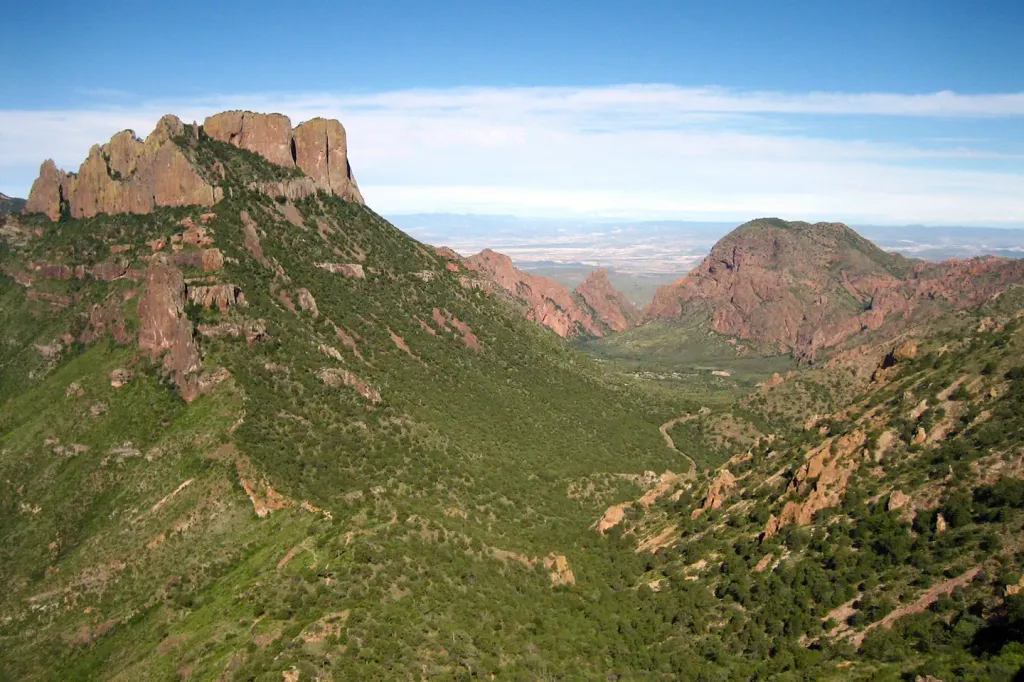
Lost Mine Peak
 Photo: Yinan Chen, Public Domain (via Wikimedia Commons)
- 7,534 ft
- summit
Is Lost Mine Peak open right now?
No closures listed
The National Park Service lists no closures for Big Bend National Park.
As of · Source: NPS · Big Bend National Park. Agencies don't list every closure — check before you go.
Lost Mine Peak is a summit in Brewster County, Texas, inside Big Bend National Park. The nearest town is Study Butte, roughly 17.6 miles away. There are no route length, climbing or difficulty figures to report for the peak. Plan around the rules that cover the whole park. The Lost Mine hike starts 1.7 miles away, and Pine Canyon is 1.9 miles off. Chisos Basin Campground sits about 2.8 miles from the peak, and Emory Peak rises 2.9 miles away.
Conditions and forecast
Daily highs and lows, wind and the chance of precipitation at the summit for the next 7 days, from the Open-Meteo model.
- Summit elevation
- 7,534 ft
Elevation from USGS 3D Elevation Program terrain data (about 10 m resolution).
We don't know of a mapped trail or route to the summit of Lost Mine Peak. Plan the approach with local maps, a guidebook or a local guide, and check conditions before you go.
Questions about Lost Mine Peak
How tall is Lost Mine Peak?
7,534 ft (2,296 m).
Is there a trail to the top of Lost Mine Peak?
We don't know of a mapped trail or route to the summit. Plan the approach with local maps, a guidebook or a local guide.
- Lost MineHiking1.7 mi
- Pine CanyonHiking1.9 mi
 Chisos Basin Group Campground (Big Bend, TX)CampingPhoto: Recreation.gov (RIDB) / public domain2.8 mi
 Chisos Basin Campground (Big Bend, TX)CampingPhoto: Recreation.gov (RIDB) / public domain2.8 mi
- Emory PeakHiking2.9 mi
- Big Bend National ParkRock climbing8.5 mi
- Grapevine HillsRock climbing9.9 mi
- Grapevine NorthRock climbing9.9 mi
Source: Roamze catalog (indexable pages within 10 miles, PostGIS distance)
 Casa Grande PeakSummit · ~3 min drivePhoto: Fredlyfish4, CC BY-SA 3.0 (via Wikimedia Commons)
 Mount HuffmanSummit · ~3 min drivePhoto: Clyde Charles Brown, CC BY-SA 4.0 (via Wikimedia Commons)
 Emory PeakSummit · ~6 min drivePhoto: Leaflet, Public domain (via Wikimedia Commons)
 Mule Ear PeaksSummit · ~22 min drivePhoto: National Park Service Digital Image Archives, Public domain (via Wikimedia Commons)
 Cerro CastellanSummit · ~29 min drivePhoto: Fredlyfish4, CC BY-SA 3.0 (via Wikimedia Commons)
 The SolitarioSummit · ~56 min drivePhoto: Kbh3rd, CC BY-SA 3.0 (via Wikimedia Commons)
 Needle PeakSummit · ~60 min drivePhoto: Gary Nored (AnEyeForTexas), CC BY 2.0 (via Wikimedia Commons)
- Sierra San VicenteSummit · ~32 min drive
- La EstufaSummit · ~55 min drive
- Cerro La PalmaSummit · ~56 min drive
