Cerro Castellan
 Photo: Fredlyfish4, CC BY-SA 3.0 (via Wikimedia Commons)
- 3,290 ft
- summit
- Nov–Mar
- best months
Is Cerro Castellan open right now?
No closures listed
The National Park Service lists no closures for Big Bend National Park.
As of · Source: NPS · Big Bend National Park. Agencies don't list every closure — check before you go.
Cerro Castellan is a summit of 3,290 feet in Big Bend National Park in Texas, about 11 miles from the town of Terlingua. It sits within the park's boundaries, and the closest trail is Tuff Canyon, less than a mile away. Winter and early spring are the most comfortable times to visit. Typical averages from the nearby Castolon weather station show January highs around 69°F with lows near 36°F, while summer highs climb into the mid-100s. That station sits about 1,100 feet lower than the summit, so temperatures on top run cooler. Cottonwood Campground, about 1.6 miles away, is the nearest place to camp. Dorgan Sublett and Mule Ears are hikes roughly 5 to 5.5 miles off, and Santa Elena Canyon is about 7 miles away.
Conditions and forecast
Daily highs and lows, wind and the chance of precipitation at the summit for the next 7 days, from the Open-Meteo model.
- Summit elevation
- 3,290 ft
Elevation from USGS 3D Elevation Program terrain data (about 10 m resolution).
We don't know of a mapped trail or route to the summit of Cerro Castellan. Plan the approach with local maps, a guidebook or a local guide, and check conditions before you go.
Questions about Cerro Castellan
How tall is Cerro Castellan?
3,290 ft (1,003 m).
Is there a trail to the top of Cerro Castellan?
We don't know of a mapped trail or route to the summit. Plan the approach with local maps, a guidebook or a local guide.
- Tuff CanyonHiking0.8 mi
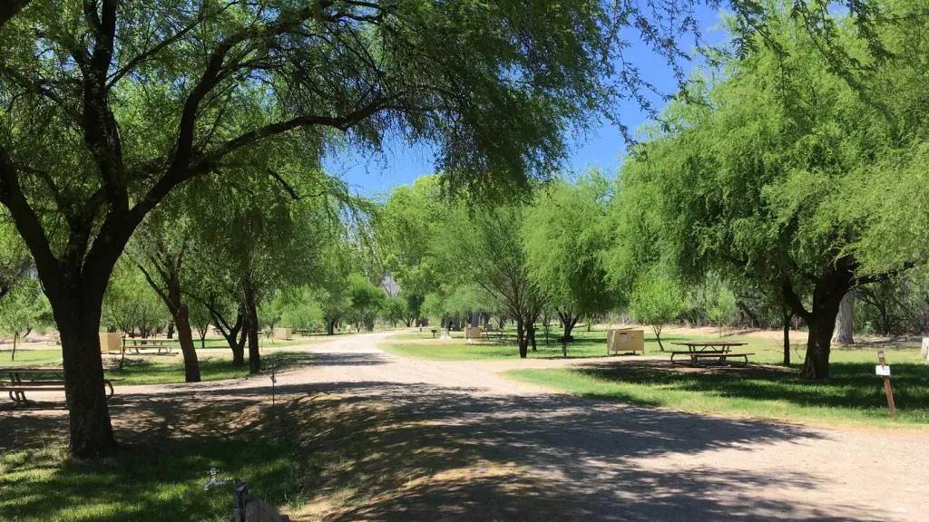 Cottonwood (Big Bend, TX)CampingPhoto: Recreation.gov (RIDB) / public domain1.6 mi
- Dorgan SublettHiking5 mi
- Mule EarsHiking5.5 mi
- ChimneysHiking6.1 mi
- Smoky CreekHiking6.9 mi
- Santa Elena CanyonHiking7 mi
- Burro SpringHiking7.7 mi
Source: Roamze catalog (indexable pages within 10 miles, PostGIS distance)
 Mule Ear PeaksSummit · ~10 min drivePhoto: National Park Service Digital Image Archives, Public domain (via Wikimedia Commons)
 Emory PeakSummit · ~23 min drivePhoto: Leaflet, Public domain (via Wikimedia Commons)
 Casa Grande PeakSummit · ~26 min drivePhoto: Fredlyfish4, CC BY-SA 3.0 (via Wikimedia Commons)
 Mount HuffmanSummit · ~27 min drivePhoto: Clyde Charles Brown, CC BY-SA 4.0 (via Wikimedia Commons)
 Lost Mine PeakSummit · ~29 min drivePhoto: Yinan Chen, Public Domain (via Wikimedia Commons)
 The SolitarioSummit · ~44 min drivePhoto: Kbh3rd, CC BY-SA 3.0 (via Wikimedia Commons)
 Needle PeakSummit · ~47 min drivePhoto: Gary Nored (AnEyeForTexas), CC BY 2.0 (via Wikimedia Commons)
- La EstufaSummit · ~26 min drive
- Loma AtravesadaSummit · ~31 min drive
- Cerro BolaSummit · ~34 min drive
Also worth it near here
Best time to visit Cerro Castellan
Best months: November–March. Best months have typical highs of 55–85 °F, lows of 30 °F or warmer (32 °F where the station doesn't record snow), at most one snowy day and no more than 12 wet days.
Jan
69° / 36°
3 wet
Feb
75° / 42°
2 wet
Mar
83° / 48°
2 wet
Apr
92° / 57°
2 wet
May
100° / 67°
4 wet
Jun
104° / 74°
5 wet
Jul
102° / 75°
6 wet
Aug
102° / 75°
5 wet
Sep
96° / 70°
5 wet
Oct
89° / 59°
3 wet
Nov
78° / 46°
2 wet
Dec
69° / 37°
2 wet
Typical high / low (°F) and days with rain or snow, 1991–2020. Measured at Castolon, TX, 1.3 mi away at 2,169 ft. The station sits about 1,100 ft lower than this place, so expect it a little cooler here. Source: NOAA NCEI U.S. Climate Normals 1991–2020.


