Ibra Lake Loop Trail
- 3.0 mi
- loop
- 753 ft
- climb
- 1,912 ft
- high point
- Loop
- route
- Mar–Jun, Aug–Nov
- best months
Caution today
Agency alerts are in effect for this area; weather is good · USFS, OpenWeather · checked 7 h ago
Is IBRA LAKE LOOP TRAIL open right now?
Closure in the area
There's a closure order in Cherokee National Forest. It doesn't name IBRA LAKE LOOP TRAIL, so check the source for the area it covers (3 listed).
Ocoee River Flooding Damage - Nov 5
Agency closure covering Cherokee National Forest · USFS · Cherokee National Forest
Campsite limitations
Agency closure covering Cherokee National Forest · Order 08-04-00-22-180 · USFS · Cherokee National Forest
Citico Creek Flood Closure
Agency closure covering Tellico Ranger District · USFS · Tellico Ranger District
Emergency road closures due to storm damage
Agency alert covering Cherokee National Forest · USFS · Cherokee National Forest
As of · Source: USFS · Cherokee National Forest. Agencies don't list every closure — check before you go.
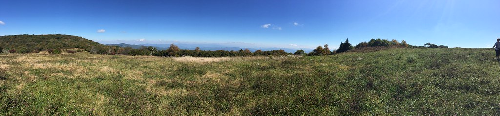
The Ibra Lake Loop Trail is a 3-mile loop in Tennessee's Cherokee National Forest, within the Tellico Ranger District. The Forest Service manages the land, and the trail is rated easy, with a steady climb of about 750 feet over the course of the loop. The route starts at roughly 1,800 feet and reaches a high point of about 1,910 feet, with the steepest stretch around 1.7 miles in at about 9 percent grade. Spring and fall are the most comfortable times to go. Typical averages from a nearby weather station in Tapoco, North Carolina, show October highs around 69°F with lows near 46°F, and April highs around 70°F. That station sits well below the trail, so temperatures on the loop run cooler. Indian Boundary Overflow Campground and Indian Boundary Recreation Area are both about 0.2 miles away, and Indian Boundary Lake is about half a mile off. The South Fork of Citico Trail lies about 1.8 miles away.
Local outfitters
- GSM Outfitters35 mi away
- Hurshel's Outfitters41 mi away
Not on Roamze yet. Their page has how to reach them.
- Indian Boundary Overflow CampgroundCamping0.2 mi
 Indian Boundary Recreation AreaCampingPhoto: Idawriter, CC BY-SA 3.0 (via Wikimedia Commons)0.2 mi
- Indian Boundary LakePier fishing0.5 mi
 SOUTH FORK OF CITICO TRAILHikingPhoto: Chris M Morris, CC BY 2.0 (via Wikimedia Commons)1.8 mi
- PINE RIDGE TRAILHiking1.8 mi
- ROCKY FLATS TRAILHikingPhoto: Chris M Morris, CC BY 2.0 (via Wikimedia Commons)1.9 mi
 Jake Best CgCampingPhoto: Chris M Morris, CC BY 2.0 (via Wikimedia Commons)3.3 mi
- Tellico RiverRiver fishing5.2 mi
Source: Roamze catalog (indexable pages within 10 miles, PostGIS distance)
- SOUTH FORK OF CITICO TRAILHiking · ~3 min drivePhoto: Chris M Morris, CC BY 2.0 (via Wikimedia Commons)
- ROCKY FLATS TRAILHiking · ~3 min drivePhoto: Chris M Morris, CC BY 2.0 (via Wikimedia Commons)
 Benton Mackaye -Cheoah RdHiking · ~11 min drivePhoto: pseabolt, CC BY 3.0 (via Wikimedia Commons)
 HuckleberryHiking · ~15 min drivePhoto: wordjunky, CC BY 2.0 (via Flickr)
 FODDERSTACK MOUNTAINHiking · ~9 min drivePhoto: MichaelGras, CC BY 2.0 (via Flickr)
- NORTH FORK OF CITICO TRAILHiking · ~3 min drivePhoto: Chris M Morris, CC BY 2.0 (via Wikimedia Commons)
- GRASSY BRANCH TRAILHiking · ~5 min drive
- Swan CabinHiking · ~11 min drive
- Snowbird MountainHiking · ~14 min drivePhoto: pseabolt, CC BY 3.0 (via Wikimedia Commons)
- JEFFERY'S HELL TRAILHiking · ~7 min drive
Best time to visit IBRA LAKE LOOP TRAIL
Best months: March–June and August–November. Best months have typical highs of 55–85 °F, lows of 30 °F or warmer (32 °F where the station doesn't record snow), at most one snowy day and no more than 12 wet days.
Jan
48° / 28°
12 wet
Feb
52° / 31°
11 wet
Mar
60° / 37°
12 wet
Apr
70° / 44°
11 wet
May
77° / 52°
12 wet
Jun
83° / 59°
12 wet
Jul
86° / 62°
13 wet
Aug
85° / 61°
10 wet
Sep
79° / 56°
8 wet
Oct
69° / 46°
9 wet
Nov
59° / 36°
10 wet
Dec
50° / 31°
12 wet
Typical high / low (°F) and days with rain or snow, 1991–2020. Measured at Tapoco, NC, 10.3 mi away at 1,110 ft. The station sits about 800 ft lower than this place, so expect it a little cooler here. This station doesn't record snowfall. Source: NOAA NCEI U.S. Climate Normals 1991–2020.
