South Fork of Citico Trail
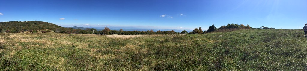
 Photo: Chris M Morris, CC BY 2.0 (via Wikimedia Commons)
- 7.5 mi
- round trip
- 4,726 ft
- climb
- 4,447 ft
- high point
- Out and back
- route
Is SOUTH FORK OF CITICO TRAIL open right now?
Closure in the area
There's a closure order in Cherokee National Forest. It doesn't name SOUTH FORK OF CITICO TRAIL, so check the source for the area it covers (3 listed).
Ocoee River Flooding Damage - Nov 5
Agency closure covering Cherokee National Forest · USFS · Cherokee National Forest
Campsite limitations
Agency closure covering Cherokee National Forest · Order 08-04-00-22-180 · USFS · Cherokee National Forest
Citico Creek Flood Closure
Agency closure covering Tellico Ranger District · USFS · Tellico Ranger District
Emergency road closures due to storm damage
Agency alert covering Cherokee National Forest · USFS · Cherokee National Forest
As of · Source: USFS · Cherokee National Forest. Agencies don't list every closure — check before you go.
South Fork of Citico Trail is a long, steep out-and-back hike in the Tellico Ranger District of Tennessee's Cherokee National Forest. The trail starts at about 1,760 feet and climbs to a high point of 4,447 feet, with a total elevation gain of 4,726 feet for the full round trip. That makes it an expert-level route, and the climb is front-loaded, with the steepest stretch at about 2.9 miles in, where the grade reaches 35 percent. The trail is 14.9 miles long. Plan on about 7.5 hours for the trip. The Pine Ridge Trail and Rocky Flats Trail both start within a tenth of a mile of the route, and the North Fork of Citico Trail is about 0.4 miles away, so it's easy to string together several miles of hiking in this corner of the forest. Indian Boundary Recreation Area, about 1.5 miles from the trail, offers camping. Indian Boundary Lake, roughly 2.3 miles away, is a fishing spot.
Local outfitters
- GSM Outfitters33 mi away
- Hurshel's Outfitters40 mi away
Not on Roamze yet. Their page has how to reach them.
- PINE RIDGE TRAILHiking0.1 mi
- ROCKY FLATS TRAILHikingPhoto: Chris M Morris, CC BY 2.0 (via Wikimedia Commons)0.1 mi
- NORTH FORK OF CITICO TRAILHikingPhoto: Chris M Morris, CC BY 2.0 (via Wikimedia Commons)0.4 mi
 Indian Boundary Recreation AreaCampingPhoto: Idawriter, CC BY-SA 3.0 (via Wikimedia Commons)1.5 mi
- Indian Boundary Overflow CampgroundCamping1.6 mi
- Indian Boundary LakePier fishing2.3 mi
 Jake Best CgCampingPhoto: Chris M Morris, CC BY 2.0 (via Wikimedia Commons)3.3 mi
- Tellico RiverRiver fishing6.3 mi
Source: Roamze catalog (indexable pages within 10 miles, PostGIS distance)
- ROCKY FLATS TRAILHiking · Next doorPhoto: Chris M Morris, CC BY 2.0 (via Wikimedia Commons)
 FODDERSTACK MOUNTAINHiking · ~8 min drivePhoto: MichaelGras, CC BY 2.0 (via Flickr)
 Benton Mackaye -Cheoah RdHiking · ~10 min drivePhoto: pseabolt, CC BY 3.0 (via Wikimedia Commons)
 HuckleberryHiking · ~14 min drivePhoto: wordjunky, CC BY 2.0 (via Flickr)
- NORTH FORK OF CITICO TRAILHiking · Next doorPhoto: Chris M Morris, CC BY 2.0 (via Wikimedia Commons)
- CROWDER PLACE TRAILHiking · ~5 min drive
- Swan CabinHiking · ~9 min drive
- Snowbird MountainHiking · ~13 min drivePhoto: pseabolt, CC BY 3.0 (via Wikimedia Commons)
- GRASSY BRANCH TRAILHiking · ~6 min drive
- Windy GapHiking · ~11 min drive

