Tunnel Falls
About
Tunnel Falls is a waterfall in the Mark O. Hatfield Wilderness, part of the Hood River Ranger District of Mt. Hood National Forest in Oregon. The nearest town is Cascade Locks, about 6.4 miles away. Summer is the driest time to visit. Typical averages from a nearby weather station show July highs around 80°F with only about two wet days, while September averages about 73°F with roughly five wet days. Nearby are the Indian Springs and Eagle Benson hikes, Eagle Creek for canoeing, and Wahtum Lake Campground, about 2.9 miles away.
Waterfall Facts
Elevation
1,213 ft
Elevation from USGS 3D Elevation Program terrain data (about 10 m resolution).
Location
Tunnel Falls
Oregon
Name and location: U.S. Geological Survey, Geographic Names Information System (GNIS). Elevation: USGS 3D Elevation Program. View the GNIS record.
Facts about this place
When to go
Best time to go: May–Oct. The mildest months here, with typical highs of 60–80°F and lows of 36–49°F.
Typical monthly averages (not a forecast) from the Parkdale 1 Nne, OR weather station, 13 mi away. High / low in °F.
- Jan40° high27° low
- Feb44° high28° low
- Mar51° high32° low
- Apr57° high35° low
- May65° high41° low
- Jun71° high45° low
- Jul80° high49° low
- Aug79° high49° low
- Sep73° high43° low
- Oct60° high36° low
- Nov46° high31° low
- Dec38° high27° low
Where it is
- Mark O. Hatfield Wilderness · Wilderness
- Hood River Ranger District · Ranger district
- Mt. Hood National Forest · National forest
- Nearest town
- Cascade Locks, Oregon · 6.4 mi
Source: Wilderness.net boundaries; USFS EDW boundaries; USGS GNIS populated places
Conditions
Active alerts for Mt. Hood National Forest as of Oct 9, 2026:
information · posted Aug 24, 2026
Gordon Creek Watershed Restrictions
information · posted Aug 24, 2026
Crane Creek bridge closed on the Barlow Road
caution · posted Aug 24, 2026
information · posted Aug 24, 2026
FR 4613 road damage- use caution
caution · posted Aug 24, 2026
Eagle Creek Fire Area Closures
caution · posted Aug 24, 2026
Source: USFS forest alerts
Nearby
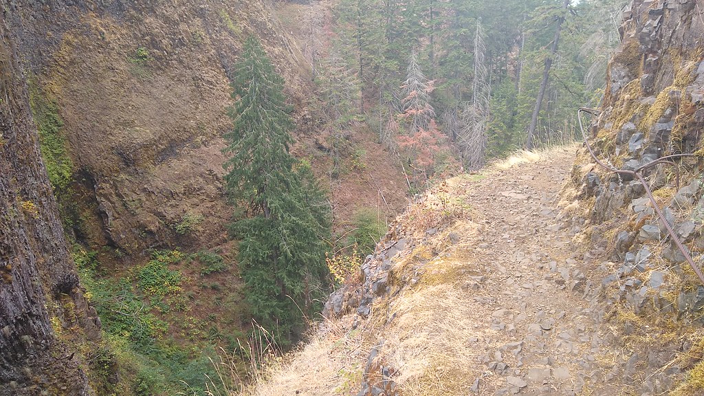 Indian SpringsHikingPhoto: mjfmjfmjf, CC BY 2.0 (via Flickr)0.6 mi
 Eagle BensonHikingPhoto: mjfmjfmjf, CC BY 2.0 (via Flickr)0.7 mi
 Eagle CreekCanoeingPhoto: Werewombat, CC BY-SA 3.0 (via Wikimedia Commons)1.3 mi
- Wahtum Lake CampgroundCamping2.9 mi
- Ottertail LakeCamping3.6 mi
- Herman CreekCanoeing4.6 mi
- Sleepy HollowRock climbing5.9 mi
- Lost Lake BouldersRock climbing5.9 mi
Source: Roamze catalog (indexable pages within 10 miles, PostGIS distance)
Is Tunnel Falls open right now?
Alert in the area
The Forest Service lists 4 alerts for Mt. Hood National Forest.
Bonanza Trail temporarily closed
Agency alert covering Mt. Hood National Forest · USFS · Mt. Hood National Forest
Eagle Creek Fire Area Closures
Agency alert covering Mt. Hood National Forest · Order 06-22-01-26-04 · USFS · Mt. Hood National Forest
FR 4613 road damage- use caution
Agency alert covering Mt. Hood National Forest · USFS · Mt. Hood National Forest
Crane Creek bridge closed on the Barlow Road
Agency alert covering Mt. Hood National Forest · USFS · Mt. Hood National Forest
As of · Source: USFS · Mt. Hood National Forest. Agencies don't list every closure — check before you go.
Best time to visit Tunnel Falls
Best months: May–October. Best months have typical highs of 55–85 °F, lows of 30 °F or warmer (32 °F where the station doesn't record snow), at most one snowy day and no more than 12 wet days.
Jan
40° / 27°
16 wet
Feb
44° / 28°
13 wet
Mar
51° / 32°
14 wet
Apr
57° / 35°
13 wet
May
65° / 41°
10 wet
Jun
71° / 45°
6 wet
Jul
80° / 49°
2 wet
Aug
79° / 49°
3 wet
Sep
73° / 43°
5 wet
Oct
60° / 36°
11 wet
Nov
46° / 31°
17 wet
Dec
38° / 27°
17 wet
Typical high / low (°F) and days with rain or snow, 1991–2020. Measured at Parkdale 1 Nne, OR, 13.2 mi away at 1,520 ft. This station doesn't record snowfall. Source: NOAA NCEI U.S. Climate Normals 1991–2020.
