Punchbowl Falls
- 833 ft
- elevation
- May–Oct
- best months
Punchbowl Falls is a waterfall in Oregon, sitting at about 833 feet in elevation roughly 4.6 miles from the town of Odell. It is a simple destination, a waterfall to visit rather than a route with a set distance or climb. Summer is the most comfortable time to go. Typical averages from a nearby weather station show July and August highs around 82°F with only about two wet days a month, while winter brings highs in the low 40s and rain on most days. Several other outdoor spots lie within a short drive. The Green Point Connector Trail for mountain biking is about 3.2 miles away, and the Rainy-Kingsley hike is about 3.5 miles off. Black Lake campground and the Middle Fork Hood River, a paddling route, are both about 6 miles away.
- Elevation
- 833 ft
Elevation from USGS 3D Elevation Program terrain data (about 10 m resolution).
- Green Point Connector TrailMountain biking3.2 mi
- Rainy-KingsleyHiking3.5 mi
- Black LakeCamping6 mi
- Middle Fork Hood RiverCanoeing6.1 mi
- Rainy LakeCamping6.1 mi
- Viento WallRock climbing6.6 mi
- Windy SlabRock climbing9.1 mi
- Herman CreekCanoeing9.8 mi
Source: Roamze catalog (indexable pages within 10 miles, PostGIS distance)
 Metlako FallsWaterfall · ~22 min drivePhoto: Steve Berardi, CC BY-SA 2.0 (via Wikimedia Commons)
 Ramona FallsWaterfall · ~29 min drivePhoto: Howard Kang, CC BY-SA 2.0 (via Wikimedia Commons)
 Elowah FallsWaterfall · ~30 min drivePhoto: Walter Siegmund (talk), CC BY-SA 3.0 (via Wikimedia Commons)
 Wiesendanger FallsWaterfall · ~39 min drivePhoto: Mattsjc, CC BY-SA 4.0 (via Wikimedia Commons)
 Multnomah FallsWaterfall · ~40 min drivePhoto: John Fowler from Placitas, NM, USA, CC BY 2.0 (via Wikimedia Commons)
 Wahkeena FallsWaterfall · ~41 min drivePhoto: Wahkeenah at English Wikipedia, Public domain (via Wikimedia Commons)
 Coopey FallsWaterfall · ~44 min drivePhoto: Visitor7, CC BY-SA 3.0 (via Wikimedia Commons)
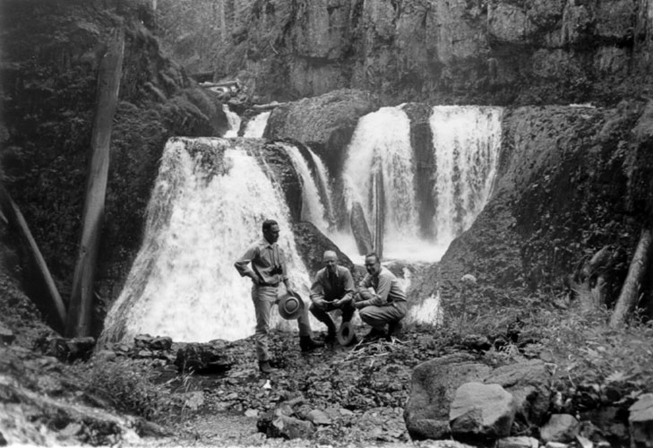 Frustration FallsWaterfall · ~47 min drivePhoto: Unknown authorUnknown author; U.S. Forest Service, Public domain (via Wikimedia Commons)
 Bridal Veil FallsWaterfall · ~46 min drivePhoto: SarahMcD, CC BY 2.0 (via Wikimedia Commons)
- Warren Creek FallsWaterfall · ~11 min drive
Also worth it near here
 Warren Lake Trail #417AHiking · ~8 min drivePhoto: Joe Omundson, CC BY-SA 1.0 (via Wikimedia Commons)
- Tucker County Park and CampgroundCamping · ~9 min drive
 Mount DefianceSummit · ~9 min drivePhoto: Mehmet Emre Yavuz Meyavuz, CC BY-SA 3.0 (via Wikimedia Commons)
- Middle Fork Hood RiverCanoeing · ~10 min drive
Best time to visit Punchbowl Falls
Best months: May–October. Best months have typical highs of 55–85 °F, lows of 30 °F or warmer (32 °F where the station doesn't record snow), at most one snowy day and no more than 12 wet days.
Jan
41° / 30°
18 wet
Feb
46° / 31°
15 wet
Mar
53° / 34°
15 wet
Apr
60° / 39°
13 wet
May
68° / 46°
9 wet
Jun
74° / 51°
5 wet
Jul
82° / 55°
2 wet
Aug
82° / 55°
2 wet
Sep
76° / 47°
5 wet
Oct
63° / 39°
11 wet
Nov
49° / 34°
17 wet
Dec
40° / 31°
20 wet
Typical high / low (°F) and days with rain or snow, 1991–2020. Measured at Hood Rvr Exp Stn, OR, 8.1 mi away at 500 ft. This station doesn't record snowfall. Source: NOAA NCEI U.S. Climate Normals 1991–2020.
