Smith Rock Bivouac Area
Campground
Campground · 1.1 mi from the trail
Southside is a climbing area on Bureau of Land Management land within the Prineville Deschutes Field Office in Oregon, about 2.5 miles from the community of Forest Crossing. The most comfortable months for a visit are typically late spring and early fall. Typical averages from a nearby weather station show May highs around 69°F and September highs around 79°F, while July and August average in the upper 80s. Several climbing areas sit right next to Southside, including Brogan Spire, (a) Dreamland and (b) Dog Wall, each about 0.1 mile away. Canyon Trail and Homestead Trail are both about 0.8 mile off. For an overnight stay, Skull Hollow campground is about 3.5 miles away.
Smith Rock Bivouac Area
Campground
Terrebone Depot Food & Drink
Restaurant
Places © OpenStreetMap contributors
More in Sisters Canyon TrailHikingPhoto: lamblukas, CC BY 2.0 (via Flickr)0.8 mi
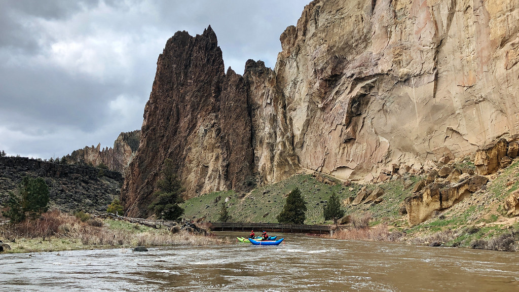 Homestead TrailHikingPhoto: Northwest Rafting Company, CC BY 2.0 (via Flickr)0.8 mi
 Wolf Tree TrailHikingPhoto: Robert Ashworth from Bellingham, WA., USA, CC BY 2.0 (via Wikimedia Commons)0.8 mi
Source: Roamze catalog (indexable pages within 10 miles, PostGIS distance)
 Mud PileRock climbing · Next doorPhoto: Oregon Department of Transportation, CC BY 2.0 (via Wikimedia Commons)
 (3) Hand Job WallRock climbing · Next doorPhoto: Jordan Beard, CC BY-SA 4.0 (via Wikimedia Commons)(2) Windfall WallRock climbing · Next doorPhoto: Oregon Department of Transportation, CC BY 2.0 (via Wikimedia Commons)
 (4) Arrington ColumnsRock climbing · Next doorPhoto: Oregon Department of Transportation, CC BY 2.0 (via Wikimedia Commons)East SideRock climbing · Next doorPhoto: Oregon Department of Transportation, CC BY 2.0 (via Wikimedia Commons)
 (5) Shakespeare CliffRock climbing · Next doorPhoto: Jordan Beard, CC BY-SA 4.0 (via Wikimedia Commons)(2) Wildfire WallRock climbing · Next doorPhoto: Oregon Department of Transportation, CC BY 2.0 (via Wikimedia Commons)(3) Catwalk CliffRock climbing · Next doorPhoto: Oregon Department of Transportation, CC BY 2.0 (via Wikimedia Commons)
 (zz) Upper GorgeRock climbing · Next doorPhoto: Kris Arnold from New York, USA, CC BY-SA 2.0 (via Wikimedia Commons)(1) Parched Cat Cliff (aka Cox Rocks)Rock climbing · Next doorPhoto: Jordan Beard, CC BY-SA 4.0 (via Wikimedia Commons)
Best months: May–June and September–October. Best months have typical highs of 55–85 °F, lows of 30 °F or warmer (32 °F where the station doesn't record snow), at most one snowy day and no more than 12 wet days.
Jan
44° / 25°
9 wet
Feb
48° / 25°
7 wet
Mar
55° / 28°
8 wet
Apr
60° / 31°
8 wet
May
69° / 38°
8 wet
Jun
77° / 43°
5 wet
Jul
88° / 48°
3 wet
Aug
87° / 47°
3 wet
Sep
79° / 41°
4 wet
Oct
65° / 33°
6 wet
Nov
51° / 28°
8 wet
Dec
42° / 23°
9 wet
Typical high / low (°F) and days with rain or snow, 1991–2020. Measured at Redmond Roberts Fld, OR, 7.8 mi away at 3,043 ft. This station doesn't record snowfall. Source: NOAA NCEI U.S. Climate Normals 1991–2020.
