Rowell Creek
- 7.7 mi
- distance
- 1,066 ft
- high point
- Jun–Sep
- best months
Clear today
Weather is good · OpenWeather · checked just now
Rowell Creek is a 7.7-mile paddling stretch in Oregon, about 2.8 miles from Valley Junction and roughly 7 miles from Willamina. The creek flows year-round, with an average flow of about 65 cubic feet per second and a gradient of about 102 feet per mile, based on USGS models. Summer is the most comfortable time to paddle. Typical averages from a nearby weather station show July and August highs around 80 to 81°F, with only about three wet days a month. That station sits a few hundred feet lower than the creek, so temperatures on the water may run a little cooler. Several other paddling routes lie within a short drive. Rock Creek and Gooseneck Creek are each about 5 miles away, and the South Yamhill River is about 6 miles off. For time on land, Valley Of The Giants, a hike, is roughly 9 miles away.
Local outfitters
- Safari Town Surf21 mi away
- Coyote Rock RV Resort & Marina22 mi away
Not on Roamze yet. Their page has how to reach them.
- Rock CreekCanoeing4.8 mi
- Gooseneck CreekCanoeing4.9 mi
- Mill CreekCanoeing5.1 mi
- South Yamhill RiverCanoeing6.3 mi
- Warnicke CreekCanoeing6.9 mi
- Boulder CreekCanoeing7.4 mi
- Agency CreekCanoeing8.3 mi
- Valley Of The GiantsHiking8.8 mi
Source: Roamze catalog (indexable pages within 10 miles, PostGIS distance)
 Salmon RiverCanoeing · ~17 min drivePhoto: Sam Beebe, CC BY 2.0 (via Wikimedia Commons)
 Little Luckiamute RiverCanoeing · ~19 min drivePhoto: Ian Sane, CC BY 2.0 (via Wikimedia Commons)
 Siletz RiverCanoeing · ~21 min drivePhoto: Becherka, Public domain (via Wikimedia Commons)
 Rickreall CreekCanoeing · ~23 min drivePhoto: Valfontis, Public domain (via Wikimedia Commons)
 Luckiamute RiverCanoeing · ~28 min drivePhoto: M.O. Stevens, Public domain (via Wikimedia Commons)
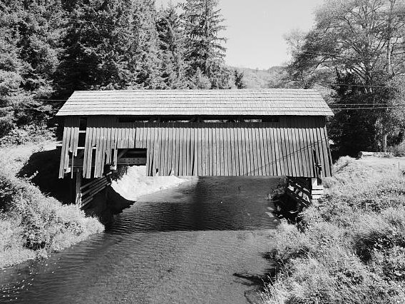 Drift CreekCanoeing · ~30 min drivePhoto: Unknown author, Public domain (via Wikimedia Commons)
- Rock CreekCanoeing · ~8 min drive
- Gooseneck CreekCanoeing · ~8 min drive
- Mill CreekCanoeing · ~9 min drive
- South Yamhill RiverCanoeing · ~11 min drive
Best time to visit Rowell Creek
Best months: June–September. Best months have typical highs of 55–85 °F, lows of 30 °F or warmer (32 °F where the station doesn't record snow), at most one snowy day and no more than 12 wet days.
Jan
45° / 33°
20 wet
Feb
49° / 33°
17 wet
Mar
53° / 35°
20 wet
Apr
58° / 38°
17 wet
May
65° / 43°
13 wet
Jun
70° / 47°
8 wet
Jul
80° / 50°
3 wet
Aug
81° / 50°
3 wet
Sep
75° / 47°
8 wet
Oct
62° / 42°
15 wet
Nov
51° / 37°
19 wet
Dec
45° / 33°
21 wet
Typical high / low (°F) and days with rain or snow, 1991–2020. Measured at Falls City 2 Ssw, OR, 14.2 mi away at 690 ft. This station doesn't record snowfall. Source: NOAA NCEI U.S. Climate Normals 1991–2020.

