Siletz River
 Photo: Becherka, Public domain (via Wikimedia Commons)
- 0.0 mi
- distance
- 700 ft
- high point
- Jun–Sep
- best months
The Siletz River is a paddling stretch managed by the Bureau of Land Management, sitting within its Siletz River land unit about a mile from Falls City, Oregon. It flows year-round, and USGS models an average flow of about 668 cubic feet per second. Summer is the most comfortable time to paddle. Typical averages from a nearby weather station show July and August highs around 80 to 81°F, with only about three wet days a month. Winter months run near 45°F highs and 20 or more wet days. Other paddling lies close by: Gravel Creek is about 2 miles away and Rogers Creek about 3 miles. For hiking, Valley Of The Giants is roughly 4.4 miles off, and the North Fork Siletz River is about 4.8 miles away.
Local outfitters
- Coyote Rock RV Resort & Marina13 mi away
- ZuhG Life Surf Shop15 mi away
Not on Roamze yet. Their page has how to reach them.
- Gravel CreekCanoeing2.2 mi
- Rogers CreekCanoeing3.1 mi
- Valley Of The GiantsHiking4.4 mi
- North Fork Siletz RiverCanoeing4.8 mi
- Sunshine CreekCanoeing4.8 mi
- Boulder CreekCanoeing5.2 mi
 North Loop TrailHikingPhoto: Forest Service Pacific Northwest Region, Public Domain Mark (via Flickr)7.6 mi
- Drift Creek FallsHikingPhoto: Forest Service Pacific Northwest Region, Public Domain Mark (via Flickr)7.7 mi
Source: Roamze catalog (indexable pages within 10 miles, PostGIS distance)
 Luckiamute RiverCanoeing · ~18 min drivePhoto: M.O. Stevens, Public domain (via Wikimedia Commons)
- Twin Bridges Memorial Park Boat LaunchBoat launch · ~20 min drive
 Little Luckiamute RiverCanoeing · ~18 min drivePhoto: Ian Sane, CC BY 2.0 (via Wikimedia Commons)
- Holmes Road Boat RampBoat launch · ~27 min drive
 Salmon RiverCanoeing · ~18 min drivePhoto: Sam Beebe, CC BY 2.0 (via Wikimedia Commons)
- Blue Heron LandingBoat launch · ~27 min drive
 Yaquina RiverCanoeing · ~25 min drivePhoto: Bob Heims, U.S. Army Corps of Engineers, Public domain (via Wikimedia Commons)
 Ritner CreekCanoeing · ~25 min drivePhoto: Steven Fine, CC BY-SA 4.0 (via Wikimedia Commons)
 D RiverCanoeing · ~27 min drivePhoto: Becherka, Public domain (via Wikimedia Commons)
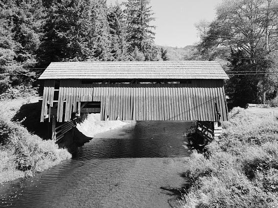 Drift CreekCanoeing · ~15 min drivePhoto: Unknown author, Public domain (via Wikimedia Commons)
Best time to visit Siletz River
Best months: June–September. Best months have typical highs of 55–85 °F, lows of 30 °F or warmer (32 °F where the station doesn't record snow), at most one snowy day and no more than 12 wet days.
Jan
45° / 33°
20 wet
Feb
49° / 33°
17 wet
Mar
53° / 35°
20 wet
Apr
58° / 38°
17 wet
May
65° / 43°
13 wet
Jun
70° / 47°
8 wet
Jul
80° / 50°
3 wet
Aug
81° / 50°
3 wet
Sep
75° / 47°
8 wet
Oct
62° / 42°
15 wet
Nov
51° / 37°
19 wet
Dec
45° / 33°
21 wet
Typical high / low (°F) and days with rain or snow, 1991–2020. Measured at Falls City 2 Ssw, OR, 13.6 mi away at 690 ft. This station doesn't record snowfall. Source: NOAA NCEI U.S. Climate Normals 1991–2020.
