Luckiamute River
 Photo: M.O. Stevens, Public domain (via Wikimedia Commons)
- 13.2 mi
- distance
- 2,164 ft
- high point
- Jun–Sep
- best months
The Luckiamute River is a paddling route in Oregon, on Bureau of Land Management land within the NW Oregon Marys Peak Field Office. It is a canoeing destination, and the surrounding area holds several other paddling spots within a short drive. Summer is the most comfortable time to paddle here. Typical averages from a nearby weather station show July and August highs around 80°F with only about three wet days a month, while winter months bring highs in the mid-40s and rain on most days. That station sits well below the river, so temperatures on the water run cooler. Miller Creek is the closest paddling neighbor, about 2.6 miles away, and North Fork Pedee Creek and Ritner Creek are each about 4.2 miles off. The South Fork Siletz River lies roughly 5.1 miles away.
Local outfitters
- Coyote Rock RV Resort & Marina22 mi away
- Whale Research EcoExcursions25 mi away
Not on Roamze yet. Their page has how to reach them.
- Miller CreekCanoeing2.6 mi
- North Fork Pedee CreekCanoeing4.2 mi
 Ritner CreekCanoeingPhoto: Steven Fine, CC BY-SA 4.0 (via Wikimedia Commons)4.2 mi
- South Fork Siletz RiverCanoeing5.1 mi
- Pedee CreekCanoeing5.9 mi
 Little Luckiamute RiverCanoeingPhoto: Ian Sane, CC BY 2.0 (via Wikimedia Commons)6.2 mi
- Big Rock CreekCanoeing6.4 mi
- Teal CreekCanoeing7.4 mi
Source: Roamze catalog (indexable pages within 10 miles, PostGIS distance)
- Ritner CreekCanoeing · ~7 min drivePhoto: Steven Fine, CC BY-SA 4.0 (via Wikimedia Commons)
- Twin Bridges Memorial Park Boat LaunchBoat launch · ~25 min drive
- Little Luckiamute RiverCanoeing · ~11 min drivePhoto: Ian Sane, CC BY 2.0 (via Wikimedia Commons)
 Yaquina RiverCanoeing · ~17 min drivePhoto: Bob Heims, U.S. Army Corps of Engineers, Public domain (via Wikimedia Commons)
 Siletz RiverCanoeing · ~18 min drivePhoto: Becherka, Public domain (via Wikimedia Commons)
 Marys RiverCanoeing · ~19 min drivePhoto: Finetooth, CC BY-SA 3.0 (via Wikimedia Commons)
 Rickreall CreekCanoeing · ~23 min drivePhoto: Valfontis, Public domain (via Wikimedia Commons)
 Ash CreekCanoeing · ~31 min drivePhoto: Finetooth, CC BY-SA 3.0 (via Wikimedia Commons)
 Salmon RiverCanoeing · ~34 min drivePhoto: Sam Beebe, CC BY 2.0 (via Wikimedia Commons)
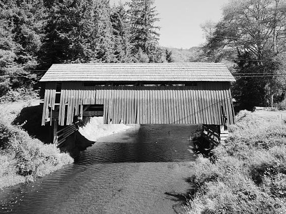 Drift CreekCanoeing · ~32 min drivePhoto: Unknown author, Public domain (via Wikimedia Commons)
Best time to visit Luckiamute River
Best months: June–September. Best months have typical highs of 55–85 °F, lows of 30 °F or warmer (32 °F where the station doesn't record snow), at most one snowy day and no more than 12 wet days.
Jan
45° / 33°
20 wet
Feb
49° / 33°
17 wet
Mar
53° / 35°
20 wet
Apr
58° / 38°
17 wet
May
65° / 43°
13 wet
Jun
70° / 47°
8 wet
Jul
80° / 50°
3 wet
Aug
81° / 50°
3 wet
Sep
75° / 47°
8 wet
Oct
62° / 42°
15 wet
Nov
51° / 37°
19 wet
Dec
45° / 33°
21 wet
Typical high / low (°F) and days with rain or snow, 1991–2020. Measured at Falls City 2 Ssw, OR, 6.4 mi away at 690 ft. The station sits about 1,500 ft lower than this place, so expect it a little cooler here. This station doesn't record snowfall. Source: NOAA NCEI U.S. Climate Normals 1991–2020.
